More From Contributor
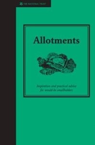
£5.99
Can you think of an animal for every letter of the alphabet? In this delightful ABC book, young children will meet a parade of exotic & familiar creatures & their babies, & learn the upper & lower case letters of the alphabet. With bright & distinctive illustrations done in Stephanie Bauer`s child-friendly style, ” Alligator Alphabet” will be an instant favorite with parents & young readers. This work: features colorful & engaging art from popular children`s illustrator Stephanie Bauer; teaches the upper & lower case letters of the alphabet; & introduces many different baby animals & their parents. ...
Archived Product
£6.95
Topographic coverage of mainland Spain at 1:50, 000 in the MTN50 (Mapa Topográfico Nacional) series from the Centro Nacional de Información Geografica, the country’s civilian survey organization. The maps have contours at 20m intervals, enhanced by relief shading, plus colouring and/or graphics to show different types of terrain, vegetation or land use. Boundaries of national parks & other protected areas are marked. In addition to all the usual information featured on topographic mapping at this scale, detailed presentation of the road & rail networks, rural tracks & paths, etc, the maps also show campsites & mountain refuges. On more recent editions some GRs, the official long-distance hiking routes, are also marked (although not as clearly as on hiking maps from other publishers). Each map covers 29.5x 18.5 km (with adjustments in the border or coastal areas). The maps have a 1-km UTM grid, plus margin ticks for latitude & longitude at 1` intervals. Map legend is in Spanish only.HOW TO CHOOSE THE RIGHT 50K MAP: all the titles in CNIG’s 200K Provincial Road Maps series at 1:200, 000 are overprinted with the grid for the 1:50, 000 maps & can be used to see the area covered by each 50K title. TO SEE THE LIST OF TITLES IN THIS SERIES PLEASE CLICK ON THE SERIES LINK.PLEASE NOTE
- MAP TITLES: the grids shown on our website serve both the civilian & the military 1:50, 000 topographic series. Although the areas covered by maps in both series are identical (apart from some border or coastal sheets), occasionally map titles differ – only one title is shown on the grid, usually the military one. In Galicia, the Basque country & in the Catalan speaking areas the tendency now is to use local place names rather than the often better known Castilian ones. Where possible, both versions are included in our titles. Map titles listed on our website are based on information received by us at the time of publication, but sometimes maps arrive showing a completely different title! As long as the map number is as ordered, the correct map has been supplied.
...
Archived Product
£2.95
Alloa in 1899 in a fascinating series of reproductions of old Ordnance Survey plans in the Alan Godfrey Editions, ideal for anyone interested in the history of their neighbourhood or family. Selected towns in Great Britain & Ireland are covered by maps showing the extent of urban development in the last decades of the 19th & early 20th century. In this title: the main map covers the centre & northern part of the town, with coverage stretching from Bank Street northward to Inglewood & Holton Square. Features include railway with station, engine shed, Devon Valley Section; Alloa Brewery, Springfield Mills, Carsebridge Distillery, Hilton Brick Works, Hallpark area, Carsebridge House, Gaberston area, Gaberston Mill, Kilncraigs Factory, Keilarsbrae Mill, mineral railways & tramways, Fairfield area, Town Green, West End Park, town centre, Cowdenpark, Inglewood, Town Hall, Greenfield, County Hospital, Sunnyside Cemetery, etc. On the reverse is a good section of the adjacent sheet 139.08 extending coverage southward to include Forthbank Pit, Alloa Harbour, Wet Dock, NB Goods Station, CR Goods Station, glass works, part of South Alloa with Ferry Inn, shipbuilding yard, etc. About the Alan Godfrey Editions of the 25 ...
Archived Product
£16.99
This title offers 200 simple recipes using the produce from your plot. The Allotment Cookbook Through the Year is the recipe book for those gardeners that would like to know how to cook delicious seasonal dishes to help make the most of their home-grown produce. Featuring over 200 recipes for popular crops such as apples, berries & herbs, this is packed with imaginative & inspiring ideas to turn your produce into healthy, fresh meals. Including techniques & expert advice to help you harvest, preserve & prepare your crops successfully, this is the perfect veg-grower's kitchen companion. ...
Archived Product
£14.99
The beginners` guide to growing fruit & veg ” Allotment Handbook” has everything you need to leave the supermarket behind in favour of tastier & healthier home-grown fruit & veg. Avoid bl&, pesticide-tainted produce flown in from the other side of the world & start growing your own with this reassuring guide, complete with a glossary of gardening terms & a picture gallery of common weeds. ” Allotment Handbook” takes you through 10 steps to preparing your plot & teaches you need to know techniques such as sowing, plating, feeding, mulching, watering & weeding. Armed with the basics, you`ll learn how to grow over 70 types of fruit & vegetable crops. You`ll also find easy projects such as making a simple compost bin & planting a fruit tree & tips to attract wildlife along with simple, delicious ways to enjoy your produce. A handy troubleshooting section covers identifying & dealing with weeds, pests, & diseases. Whether you prefer to start small with a few herbs & veg staples or you are more ambitious & intend to feed your whole family all year round, ” Allotment Handbook” will show you how. ...
Archived Product
£6.95
Topographic coverage of mainland Spain at 1:50, 000 in the MTN50 (Mapa Topográfico Nacional) series from the Centro Nacional de Información Geografica, the country’s civilian survey organization. The maps have contours at 20m intervals, enhanced by relief shading, plus colouring and/or graphics to show different types of terrain, vegetation or land use. Boundaries of national parks & other protected areas are marked. In addition to all the usual information featured on topographic mapping at this scale, detailed presentation of the road & rail networks, rural tracks & paths, etc, the maps also show campsites & mountain refuges. On more recent editions some GRs, the official long-distance hiking routes, are also marked (although not as clearly as on hiking maps from other publishers). Each map covers 29.5x 18.5 km (with adjustments in the border or coastal areas). The maps have a 1-km UTM grid, plus margin ticks for latitude & longitude at 1` intervals. Map legend is in Spanish only.HOW TO CHOOSE THE RIGHT 50K MAP: all the titles in CNIG’s 200K Provincial Road Maps series at 1:200, 000 are overprinted with the grid for the 1:50, 000 maps & can be used to see the area covered by each 50K title. TO SEE THE LIST OF TITLES IN THIS SERIES PLEASE CLICK ON THE SERIES LINK.PLEASE NOTE
- MAP TITLES: the grids shown on our website serve both the civilian & the military 1:50, 000 topographic series. Although the areas covered by maps in both series are identical (apart from some border or coastal sheets), occasionally map titles differ – only one title is shown on the grid, usually the military one. In Galicia, the Basque country & in the Catalan speaking areas the tendency now is to use local place names rather than the often better known Castilian ones. Where possible, both versions are included in our titles. Map titles listed on our website are based on information received by us at the time of publication, but sometimes maps arrive showing a completely different title! As long as the map number is as ordered, the correct map has been supplied.
...
Archived Product
£6.50
Topographic coverage of mainland Spain at 1:25, 000 published by the Centro Nacional de Información Geograficá, the country’s civilian survey organization. The maps have contours at 10m intervals & colouring and/or graphics to show different types of vegetation or land use. Boundaries of national parks & other protected areas are marked. In addition to all the usual information shown on topographic maps at this scale, detailed presentation of the road & rail networks, rural tracks & paths, etc, the maps also show campsites. The maps have a 1-km UTM grid, with margin ticks for latitude & longitude at 1` intervals. Map legend is in Spanish only.PLEASE NOTE: our grid for the whole of Spain is in preparation
- in the meantime, for areas other than those shown on the attached grid please use CNIG’s topographic survey at 1:50, 000 by searching for ‘SI00000832’. Each 25K map covers one quarter of the corresponding 50K map, with the numbering system: I = NW quarter, II = NE quarter, III = SW quarter & IV = SE quarter. CNIG maps in the Provincial Road Maps series at 1:200, 000 are overprinted with the grid for the 1:50, 000 survey & can be used to see the area covered by each 50K or 25K title in more detail. To see the list of titles in this series please click on the series grid
- for map numbers not yet listed on our website please contact us by email.

...
Archived Product
£6.95
Topographic coverage of mainland Spain at 1:50, 000 in the MTN50 (Mapa Topográfico Nacional) series from the Centro Nacional de Información Geografica, the country’s civilian survey organization. The maps have contours at 20m intervals, enhanced by relief shading, plus colouring and/or graphics to show different types of terrain, vegetation or land use. Boundaries of national parks & other protected areas are marked. In addition to all the usual information featured on topographic mapping at this scale, detailed presentation of the road & rail networks, rural tracks & paths, etc, the maps also show campsites & mountain refuges. On more recent editions some GRs, the official long-distance hiking routes, are also marked (although not as clearly as on hiking maps from other publishers). Each map covers 29.5x 18.5 km (with adjustments in the border or coastal areas). The maps have a 1-km UTM grid, plus margin ticks for latitude & longitude at 1` intervals. Map legend is in Spanish only.HOW TO CHOOSE THE RIGHT 50K MAP: all the titles in CNIG’s 200K Provincial Road Maps series at 1:200, 000 are overprinted with the grid for the 1:50, 000 maps & can be used to see the area covered by each 50K title. TO SEE THE LIST OF TITLES IN THIS SERIES PLEASE CLICK ON THE SERIES LINK.PLEASE NOTE
- MAP TITLES: the grids shown on our website serve both the civilian & the military 1:50, 000 topographic series. Although the areas covered by maps in both series are identical (apart from some border or coastal sheets), occasionally map titles differ – only one title is shown on the grid, usually the military one. In Galicia, the Basque country & in the Catalan speaking areas the tendency now is to use local place names rather than the often better known Castilian ones. Where possible, both versions are included in our titles. Map titles listed on our website are based on information received by us at the time of publication, but sometimes maps arrive showing a completely different title! As long as the map number is as ordered, the correct map has been supplied.
...
Archived Product
£6.50
Topographic coverage of mainland Spain at 1:25, 000 published by the Centro Nacional de Información Geograficá, the country’s civilian survey organization. The maps have contours at 10m intervals & colouring and/or graphics to show different types of vegetation or land use. Boundaries of national parks & other protected areas are marked. In addition to all the usual information shown on topographic maps at this scale, detailed presentation of the road & rail networks, rural tracks & paths, etc, the maps also show campsites. The maps have a 1-km UTM grid, with margin ticks for latitude & longitude at 1` intervals. Map legend is in Spanish only.PLEASE NOTE: our grid for the whole of Spain is in preparation
- in the meantime, for areas other than those shown on the attached grid please use CNIG’s topographic survey at 1:50, 000 by searching for ‘SI00000832’. Each 25K map covers one quarter of the corresponding 50K map, with the numbering system: I = NW quarter, II = NE quarter, III = SW quarter & IV = SE quarter. CNIG maps in the Provincial Road Maps series at 1:200, 000 are overprinted with the grid for the 1:50, 000 survey & can be used to see the area covered by each 50K or 25K title in more detail. To see the list of titles in this series please click on the series grid
- for map numbers not yet listed on our website please contact us by email.

...
Archived Product

Allotments

An allotment is one of the best - and cheapest ways - of getting hold of valuable gardening space to grow you own. Plus it offers one of the most relaxing atmospheres with the chance to mix with fellow gardeners. Your allotment can provide enough fruit, veg and herbs to feed most small families (and cut flowers to adorn the kitchen table) - produce that will taste and look much better than anything shop bought. Jane Eastoe guides you through allotment life, from how to find an allotment, how to plan one out, what to grow, crop rotation, how to store your harvest plus some of the best recipes so you enjoy the fruits of your labour. Great gardening information is given for each crop - the obvious to the not so obvious - from potatoes and carrots to aubergines and chillies. What to grow
when, what to grow where plus a calendar of work for the laziest to the most energetic allotment holder. With all the details on the cost of having an allotment, self-management, and protecting your allotment, this is the easiest guide to getting starting on allotment life.In addition to all the practical gardening techniques, the book has background information on local authority control, self-management options, and how to protect your allotment.
RIP - This product is no longer available on our network. It was last seen on 25.09.2019

This page now acts as a permanent archive for this product. Add more information using the comments box below to ensure it can still be found by future generations.

Use our search facility to see if it is available from an alternative contributor.
  • External links may include paid for promotion
  • Availability: Out Of Stock
  • Supplier: Stanfords
  • SKU: 9781905400768
Availability: In Stock
£7.99

Product Description

An allotment is one of the best
- & cheapest ways
- of getting hold of valuable gardening space to grow you own. Plus it offers one of the most relaxing atmospheres with the chance to mix with fellow gardeners. Your allotment can provide enough fruit, veg & herbs to feed most small families (and cut flowers to adorn the kitchen table)
- produce that will taste & look much better than anything shop bought. Jane Eastoe guides you through allotment life, from how to find an allotment, how to plan one out, what to grow, crop rotation, how to store your harvest plus some of the best recipes so you enjoy the fruits of your labour. Great gardening information is given for each crop
- the obvious to the not so obvious
- from potatoes & carrots to aubergines & chillies. What to grow when, what to grow where plus a calendar of work for the laziest to the most energetic allotment holder. With all the details on the cost of having an allotment, self-management, & protecting your allotment, this is the easiest guide to getting starting on allotment life. In addition to all the practical gardening techniques, the book has background information on local authority control, self-management options, & how to protect your allotment.

Reviews/Comments

Add New

Intelligent Comparison

Oooops!
We couldn't find anything!
Perhaps this product's unique.... Or perhaps we are still looking for comparisons!
Click to bump this page and we'll hurry up.

Price History

Vouchers

No voucher codes found.
Do you know a voucher code for this product or supplier? Add it to Insights for others to use.

Facebook

Jargon Buster

Calendar - A system for organising dates
rotation - A circular motion of an object around a central axis
Small - something that takes up less space than normal.
Energetic - A fast pace.
Practical - Weather a task is easy to carry out and realistically succeed.

Supplier Information

Stanfords
Stanfords was established in 1853 and opened their iconic Covent Garden flagship store in 1901. They have become the top retailer of maps, travel books and accessories in the UK and arguably offer the largest selection of maps and travel books worldwide. Famous names such as Captain Robert Falcon Scott, Ranulph Fiennes and Michael Palin have purchased from Stanfords. They now have a shop in Bristol and both stores together with other venues operate a calendar of events including talks, book signings and exhibitions. As a specialist map retailer, the map selection is comprehensive and includes road maps, street maps and walking maps from worldwide destinations, as well as a selection of world atlases and wall maps. Books include travel guides and travel literature. Stanfords also stock globes, from miniatures made of blue marble to magnificent floor-standing globes. The website features a selection of interesting articles on travel topics.
Page Updated: 2023-11-12 20:15:36

Community Generated Product Tags

Oh No! The productWIKI community hasn't generated any tags for this product yet!
Menu