
 United Kingdom
 France
 Germany
 Netherlands
 Sweden
 USA
USA
 Italy
Italy
 Spain
Spain
More From Contributor


Alloa 1899
Alloa in 1899 in a fascinating series of reproductions of old Ordnance Survey plans in the Alan Godfrey Editions, ideal for anyone interested in the history of their neighbourhood or family. Selected towns in Great Britain and Ireland are covered by maps showing the extent of urban development in the last decades of the 19th and early 20th century.In this title: the main map covers the centre and northern part of the town, with coverage stretching from Bank Street northward to Inglewood and Holton Square. Features include railway with station, engine shed, Devon Valley Section; Alloa Brewery, Springfield Mills, Carsebridge Distillery, Hilton Brick Works, Hallpark area, Carsebridge House, Gaberston area, Gaberston Mill, Kilncraigs Factory, Keilarsbrae Mill, mineral railways
and tramways, Fairfield area, Town Green, West End Park, town centre, Cowdenpark, Inglewood, Town Hall, Greenfield, County Hospital, Sunnyside Cemetery, etc. On the reverse is a good section of the adjacent sheet 139.08 extending coverage southward to include Forthbank Pit, Alloa Harbour, Wet Dock, NB Goods Station, CR Goods Station, glass works, part of South Alloa with Ferry Inn, shipbuilding yard, etc. About the Alan Godfrey Editions of the 25
and tramways, Fairfield area, Town Green, West End Park, town centre, Cowdenpark, Inglewood, Town Hall, Greenfield, County Hospital, Sunnyside Cemetery, etc. On the reverse is a good section of the adjacent sheet 139.08 extending coverage southward to include Forthbank Pit, Alloa Harbour, Wet Dock, NB Goods Station, CR Goods Station, glass works, part of South Alloa with Ferry Inn, shipbuilding yard, etc. About the Alan Godfrey Editions of the 25
Product Description
Reviews/Comments
Add New
Intelligent Comparison
Archived Product
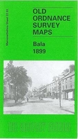
Bala 1899 Stanfords
£3.50
Vouchers
No voucher codes found.
Do you know a voucher code for this product or supplier? Add it to Insights for others to use.
Do you know a voucher code for this product or supplier? Add it to Insights for others to use.
 Denmark