-
Home
-
Contributors
-
International
-
Account
-
Information
More From Contributor
...
Includes:: selected local tracks & winter only routes. Railway lines & ferry connections are included; local airports & seaplane bases are marked. Symbols indicate locations of various recreational activities & facilities. Various locations are annotated with brief historical notes. Each side of the map has a separate index. Latitude & longitude lines are drawn at 2° intervals. To see other regional titles from ITMB covering USA please click on the series link. ...
Includes:: a calendar of events, practical tips on getting by & a summary of Michelin selected star attractions. The ‘ Must See’ section of the guide look at shopping, nightlife & theatre, hotels & dining, parks & gardens, neighbourhoods, landmarks, museums, historic sites, practical information, events, tips & excursions. The ‘ Must Do’ chapter
Includes:: a focus on activities for children, whereas places to eat & places to stay are reviewed in the ‘ Must Eat’ & ‘ Must Stay’ chapters. ...
Includes:: national parks, wildlife refuges, airports, railways, roads, oilfields & pipelines. Latitude & longitude lines are drawn at 3 ...
Includes:: national parks, wildlife refuges, airports, railways, roads, oilfields & pipelines. Latitude & longitude lines are drawn at 3 ...

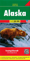
Alaska F&B
grid-referenced for the map index.*Multilingual map legend includes English.*
This page now acts as a permanent archive for this product. Add more information using the comments box below to ensure it can still be found by future generations.
Use our search facility to see if it is available from an alternative contributor.
- External links may include paid for promotion
- Availability: Out Of Stock
- Supplier: Stanfords
- SKU: 9783707916843
Product Description
Detailed, double-sided road map Alaska, ideal for route-planning. Clearly shows the national road network & selected provincial & local roads, with each class of road clearly indicated & road numbers shown. Topography is shown with relief shading & some spot heights, & colour shading is used to indicate land types. International & provincial boundaries are clearly marked, as are National Parks, nature reserves & restricted military areas. Symbols indicate various sights & locations of tourist interest, such as churches, temples, panoramas & viewing points, monuments & historic sites. Some hotels & campsites are marked. Railway lines, airports, oil pipelines & restricted access points are also shown. A grid divides the map at 2° increments, & is also grid-referenced for the map index.* Multilingual map legend
Includes:: English.*
Reviews/Comments
Add New
Intelligent Comparison
We couldn't find anything!
Perhaps this product's unique.... Or perhaps we are still looking for comparisons!
Click to bump this page and we'll hurry up.
Price History
Vouchers
Do you know a voucher code for this product or supplier? Add it to Insights for others to use.


 United Kingdom
 France
 Germany
 Netherlands
 Sweden
 USA
USA
 Italy
Italy
 Spain
Spain


 Denmark