
 United Kingdom
 France
 Germany
 Netherlands
 Sweden
 USA
USA
 Italy
Italy
 Spain
Spain
More From Contributor


Air Apparent
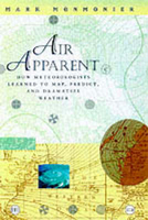
Every night across the country, viewers tune in to their evening news to glimpse the next day`s weather. They are treated to graphic images of invading air masses, colliding fronts, and growing tropical storms. This book is the story of this tool, the weather map, which in its many forms has made the atmosphere visible, understandable, and at least moderately predictable. No other maps are so spontaneously timely, so widely and frequently consulted, and so central to the daily activities of so many. The singular history of the weather map developed around the twin poles of weather`s many facets and the public`s varied needs. Mark Monmonier traces the contentious debates among scientists eager to unravel the enigma of storms and global change, explains the strategies for mapping
the upper atmosphere and forecasting disaster, and exposes the efforts to detect and control air pollution. He introduces Karl Theodor, a Bavarian politician who devised one of the first weather-tracking networks in the late-18th century, and Heinrich Wilhelm Brandes, who drew the first maps of European weather in 1819 - for the year of 1783.Monmonier also explores the interaction between technology - from the telegraph to the Internet - and weather forecasting.
the upper atmosphere and forecasting disaster, and exposes the efforts to detect and control air pollution. He introduces Karl Theodor, a Bavarian politician who devised one of the first weather-tracking networks in the late-18th century, and Heinrich Wilhelm Brandes, who drew the first maps of European weather in 1819 - for the year of 1783.Monmonier also explores the interaction between technology - from the telegraph to the Internet - and weather forecasting.

Product Description
Reviews/Comments
Add New
Vouchers
No voucher codes found.
Do you know a voucher code for this product or supplier? Add it to Insights for others to use.
Do you know a voucher code for this product or supplier? Add it to Insights for others to use.
 Denmark