
 United Kingdom
 France
 Germany
 Netherlands
 Sweden
 USA
USA
 Italy
Italy
 Spain
Spain
More From Contributor


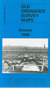
Aintree 1906
Aintree in 1906 in a fascinating series of reproductions of old Ordnance Survey plans in the Alan Godfrey Editions, ideal for anyone interested in the history of their neighbourhood or family. The map covers much of Aintree, north of Liverpool, and is dominated by the famous racecourse. Coverage stretches from Warbreck Moor eastward to Moss Pits Lane, and northward to Aintree House. Features include Aintree Racecourse with Grandstand, Greenwich Park Athletic Ground, much of City Hospital, Kirkdale Cemetery, stretch of Cheshire Lines Railway with Aintree station; stretch of LYR Liverpool-Accrington line with Aintree station, Aintree North Curve, engine shed, Fazakerley & North Mersey Branch, Race Course station, carriage & wagon works, signal works, Liverpool & Bolton line,
Fazakerley station; St Peter`s church, tramways, short stretch of Leeds & Liverpool Canal, Moss Pits, Greenwich House, Stag Farm, Sefton Arms Hotel, Melling Road, etc. On the reverse is a selection of street directory entries, including Aintree Village, Eastbourne Road, Fifth Avenue, Greenwich Road, Helsby Road, Hooton Road, Kingswood Avenue, Longmoor Lane, Melling Avenue, Melling Road, Warbreck Moor and Wyresdale Road. About the Alan Godfrey Editions of the 25” OS Series:Selected towns in Great Britain and Ireland are covered by maps showing the extent of urban development in the last decades of the 19th and early 20th century. The plans have been taken from the Ordnance Survey mapping and reprinted at about 15 inches to one mile (1:4, 340). On the reverse most maps
have historical notes and many also include extracts from contemporary directories. Most maps cover about one mile (1.6kms) north/south, one and a half miles (2.4kms) across; adjoining sheets can be combined to provide wider coverage.FOR MORE INFORMATION AND A COMPLETE LIST OF ALL AVAILABLE TITLES PLEASE CLICK ON THE SERIES LINK.

Product Description
Reviews/Comments
Add New
Vouchers
No voucher codes found.
Do you know a voucher code for this product or supplier? Add it to Insights for others to use.
Do you know a voucher code for this product or supplier? Add it to Insights for others to use.
 Denmark