
 United Kingdom
 France
 Germany
 Netherlands
 Sweden
 USA
USA
 Italy
Italy
 Spain
Spain
More From Contributor


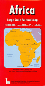
Africa
Brightly and attractively coloured political map, with internal administrative divisions of each country also indicated by colours. Names of administrative provinces and of provincial capitals are shown in some, but not all of the countries. Towns are graded by populations, although the map shows, with some exceptions, relatively few place names. There is some indication of the continents topography with spot heights and names of main mountain ranges, peaks, and deserts. All names, including those of the countries, are in French, as is the map's legend. Coverage includes both Cape Verde and the Azores, and extends, without any colouring, to the whole of the Mediterranean basin, the Black Sea, the Caspian Sea, the Arabian Peninsula and most of Iran. Latitude and longitude
lines are marked at 10
lines are marked at 10
Product Description
Reviews/Comments
Add New
Intelligent Comparison
Archived Product
Africa Stanfords
£8.95
Archived Product
Africa Stanfords
£10.50
Archived Product

Africa Stanfords
£13.50
Archived Product
Africa Stanfords
£10.50
Archived Product
Africa Stanfords
£18.39
Archived Product
Africa Stanfords
£4.99
Archived Product
Africa Stanfords
£25.00
Archived Product
Africa: 0 Stanfords
£11.95
Vouchers
No voucher codes found.
Do you know a voucher code for this product or supplier? Add it to Insights for others to use.
Do you know a voucher code for this product or supplier? Add it to Insights for others to use.
 Denmark