
 United Kingdom
 France
 Germany
 Netherlands
 Sweden
 USA
USA
 Italy
Italy
 Spain
Spain
More From Contributor

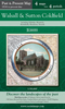


Walsall North East 1913
Walsall North East in 1913 in a fascinating series of reproductions of old Ordnance Survey plans in the Alan Godfrey Editions, ideal for anyone interested in the history of their neighbourhood or family. Selected towns in Great Britain and Ireland are covered by maps showing the extent of urban development in the last decades of the 19th and early 20th century.In this title: the map covers the north-eastern area of Walsall, extending from Duncalfe Street eastward to Calder Fields Farm and from Walhouse Street northward to the Cemetery. Features include LNWR railway with engine shed, Ryecroft Junction and stretch of South Staffordshire line; Midland Railway incl Lichfield Junction, grammar school, Hatherton Lake, Arboretum, Albion Tannery, Oal Tannery, Ryecroft area, tramways,
Moss Closs Farm, Rushall Hall, St Michael's church, short stretch of Daw End Branch canal etc. On the reverse are street directory entries for Borneo Street, Cecil Street, Eastbourne Street, Lichfield Road, Littleton Street, Mellish Road, Persehouse Street and Westbourne Road. About the Alan Godfrey Editions of the 25
Moss Closs Farm, Rushall Hall, St Michael's church, short stretch of Daw End Branch canal etc. On the reverse are street directory entries for Borneo Street, Cecil Street, Eastbourne Street, Lichfield Road, Littleton Street, Mellish Road, Persehouse Street and Westbourne Road. About the Alan Godfrey Editions of the 25
Product Description
Reviews/Comments
Add New
Vouchers
No voucher codes found.
Do you know a voucher code for this product or supplier? Add it to Insights for others to use.
Do you know a voucher code for this product or supplier? Add it to Insights for others to use.
 Denmark