
 United Kingdom
 France
 Germany
 Netherlands
 Sweden
 USA
USA
 Italy
Italy
 Spain
Spain
More From Contributor


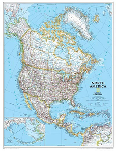
North America NGS Executive Wall Map ENCAPSULATED
North America NGS Executive Style Wall Map, size 61 x 76cm (24” x 30” approx), encapsulated version, published by National Geographic Society in an elegant presentation reminiscent of antique maps. Countries are in muted colours, with surrounding oceans in beige.Coverage includes Central America and the Caribbean, extending from the North Pole to Venezuela. Aleutian Islands and the Bering Sea are shown on an inset. Within USA and Canada internal administrative boundaries are marked, with the names of states/provinces and their capital cities.In addition to the relief shading, the map has names of main geographic features such as mountain ranges, rivers and lakes, etc. Peak heights are given in metres, including in USA. Road network distinguishes between “superhighways”
and other roads, and principal railway lines are also shown. Latitude and longitude lines are drawn at intervals of 10°.* This map is also available on paper without the encapsulation.LAMINATED and ENCAPSULATED WALL MAPS- LAMINATED wall maps have a thin layer of plastic usually applied to the printed side only. They can be written on with suitable marker pens without any damage to the map but, unless laminated on both sides, they are not damp-proof.- ENCAPSULATED wall maps are sealed between two sheets of plastic. They are more rigid and heavier than laminated maps of the same size. They are damp-proof and do not crinkle in humid conditions. Encapsulation gives the map a shiny surface, similar to being displayed behind glass.- PLEASE NOTE: many publishers and retailers often use these
two terms interchangeably. Our map titles and descriptions follow the definitions provided above.
Product Description
Reviews/Comments
Add New
Intelligent Comparison
Archived Product

North America NGS Executive Wall Map PAPER Stanfords
£12.99
Archived Product

China NGS Executive Wall Map ENCAPSULATED Stanfords
£17.99
Archived Product
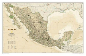
Mexico NGS Executive Wall Map ENCAPSULATED Stanfords
£17.99
Archived Product
North America NGS Classic Wall Map ENCAPSULATED Stanfords
£17.99
Archived Product

Italy NGS Executive Wall Map ENCAPSULATED Stanfords
£17.99
Archived Product
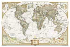
World NGS Executive Wall Map ENCAPSULATED Stanfords
£20.99
Archived Product
North America NGS Executive Style Wall Map PAPER Stanfords
£15.95
Archived Product

Canada NGS Executive Wall Map ENCAPSULATED Stanfords
£20.99
Vouchers
No voucher codes found.
Do you know a voucher code for this product or supplier? Add it to Insights for others to use.
Do you know a voucher code for this product or supplier? Add it to Insights for others to use.
 Denmark