
 United Kingdom
 France
 Germany
 Netherlands
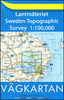
 Sweden
 USA
USA
 Italy
Italy
 Spain
Spain
More From Contributor


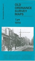
Lye 1914
Lye in 1914 in a fascinating series of reproductions of old Ordnance Survey plans in the Alan Godfrey Editions, ideal for anyone interested in the history of their neighbourhood or family. The map covers the western part of Cradley, Lye, a portion of Wollescote, and the southern part of Quarry Bank UDC. Coverage stretches from Hay Green eastward to Colleygate, and from Forge Lane southward to Star Street in Lye. Features include The Hayes, Hay Green, Anvil Works, Christ Church Lye, Hayes Works, Providential Works, Hayes Colliery, Cradleypark Colliery, Lower Delph Works, Cradley Colliery, Netherend Works, GWR Stourbridge Branch with Lye and Cradley stations, Globe Works, GWR Cradleypark Branch, Netherend, Homerhill Works, Homerhill Colliery, Lyde Green, Cradley Forge,
Cradley Boiler Works, Dunn`s Bank, The Thorns, Bedstead Works, Tintam Abbey Works, Meers Coppice, Fireclay Brick Works, old shafts, etc. On the reverse is a 1914 directory of Lye and Wollescote. About the Alan Godfrey Editions of the 25” OS Series:Selected towns in Great Britain and Ireland are covered by maps showing the extent of urban development in the last decades of the 19th and early 20th century. The plans have been taken from the Ordnance Survey mapping and reprinted at about 15 inches to one mile (1:4, 340). On the reverse most maps have historical notes and many also include extracts from contemporary directories. Most maps cover about one mile (1.6kms) north/south, one and a half miles (2.4kms) across; adjoining sheets can be combined to provide wider coverage.FOR
MORE INFORMATION AND A COMPLETE LIST OF ALL AVAILABLE TITLES PLEASE CLICK ON THE SERIES LINK.

Product Description
Reviews/Comments
Add New
Intelligent Comparison
Archived Product
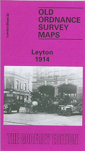
Leyton 1914 Stanfords
£3.50
Vouchers
No voucher codes found.
Do you know a voucher code for this product or supplier? Add it to Insights for others to use.
Do you know a voucher code for this product or supplier? Add it to Insights for others to use.
 Denmark