
 United Kingdom
 France
 Germany
 Netherlands
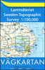
 Sweden
 USA
USA
 Italy
Italy
 Spain
Spain
More From Contributor


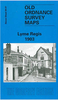
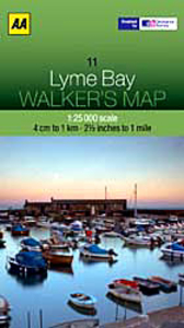
Lyme Bay 25K AA/OS Walker`s Map No. 11
Lyme Bay at 1:25, 000 in a series of Walker’s Maps published by the AA with the cartography from the Ordnance Survey’s Explorer series. Coverage includes Lyme Regis, Axmouth, Seaton, Shute, Axminster, Yarcombe, Chard, Crewkerne, Mosterton, Beaminster, Bridport, West Bay, etc.Maps in the AA Walker’s series are identical to the OS Explorer maps and provide plenty of recreational and tourist information, indicating in England and Wales the traditional public rights of way paths, including bridleways and byways restricted or open to motorized traffic. Also shown are other routes with public access, including permissive footpaths and bridleways. For Scotland, where different access rights apply, the maps provide an additional note explaining the regulations. Special
marking indicates National Trails and Recreational Routes and for cyclists the maps show traffic-free routes and the National Cycle Network. A wide range of symbols highlights locations of special tourist interest: camping and caravanning sites, youth hostels, information offices and visitors’ centres, parking and picnicking places, historic buildings (indicating where appropriate National Trust, English Heritage, Historic Scotland or Cadw), sites for various recreational pursuits, country pubs, public toilets, etc. The maps provide detailed presentation of the topography with contours at 5 or 10m intervals, numerous spot heights and colouring and/or graphics for different types of vegetation. Additional colouring shows access land, including areas managed by the National
Trust, Forestry Commission and Woodland Trust. All the standard information expected of high quality survey mapping at this scale is included: finely graded road network, railway lines with stations, cuttings or embankments, individual isolated buildings, etc.For GPS users the British National Grid is drawn at 1km intervals.

Product Description
Reviews/Comments
Add New
Vouchers
No voucher codes found.
Do you know a voucher code for this product or supplier? Add it to Insights for others to use.
Do you know a voucher code for this product or supplier? Add it to Insights for others to use.
 Denmark