
 United Kingdom
 France
 Germany
 Netherlands
 Sweden
 USA
USA
 Italy
Italy
 Spain
Spain
More From Contributor


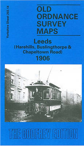
Leeds Harehills 1906
Leeds Harehills in 1906 in a fascinating series of reproductions of old Ordnance Survey plans in the Alan Godfrey Editions, ideal for anyone interested in the history of their neighbourhood or family. The map covers part of northern Leeds, stretching from Woodhouse Street eastward to Harehills Road and northward to Potternewton Lane. Areas covered include Harehills, New Leeds, Potternewton Park, Woodhouse Carr, Buslingthorpe and Scott Hall. Industry features, mostly in the south-western corner, include Buslingthorpe Tannery, Perseverance Mill, Ridge Mill, Springwell Leather Works, Sheepscar Leather & Glue Works, Valley Mills, Buslingthorpe Boot Works and Scott Hall Quarries. The rest of the map is largely residential and features include Potternewton House, Scott Hall Farm,
St Martin`s church, Newton Park, Newton Green Hall, The Mansion (in Potternewton Park), Gledhow Mount, Gledhow Wood, etc. On the reverse are street directory entries for Cowper Street, Francis Street, Grange Avenue, Harehills Avenue, Leopold Street, Louis Street, Sholebroke Avenue and Woodhouse Street.About the Alan Godfrey Editions of the 25” OS Series:Selected towns in Great Britain and Ireland are covered by maps showing the extent of urban development in the last decades of the 19th and early 20th century. The plans have been taken from the Ordnance Survey mapping and reprinted at about 15 inches to one mile (1:4, 340). On the reverse most maps have historical notes and many also include extracts from contemporary directories. Most maps cover about one mile (1.6kms)
north/south, one and a half miles (2.4kms) across; adjoining sheets can be combined to provide wider coverage.FOR MORE INFORMATION AND A COMPLETE LIST OF ALL AVAILABLE TITLES PLEASE CLICK ON THE SERIES LINK.

Product Description
Reviews/Comments
Add New
Intelligent Comparison
Archived Product
Leeds East 1906 Stanfords
£3.50
Vouchers
No voucher codes found.
Do you know a voucher code for this product or supplier? Add it to Insights for others to use.
Do you know a voucher code for this product or supplier? Add it to Insights for others to use.
 Denmark