
 United Kingdom
 France
 Germany
 Netherlands
 Sweden
 USA
USA
 Italy
Italy
 Spain
Spain
More From Contributor

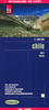

Chile South & Patagonia ITMB
Indexed, double-sided map from ITMB combining coverage of the whole of Patagonia in Argentina and Chile at 1:2, 000, 000 with mapping of the southern half of Chile at 1:1, 750, 000, plus a street plan of Ushuaia.On one side is a map of Patagonia south of Bahia Blanca in Argentina and Temuco in Chile. Altitude colouring shows the topography, with graphics for salt pans and swamps, plus plenty of names of individual mountain ranges, and other topographic features. National parks and protected areas are highlighted. The map shows the road and rail networks, local airports and airfields, as well as ferry routes across the Chilean fjords. Border crossing points across the Andes are clearly marked. Local administrative boundaries are shown with names of the provinces. Symbols highlight
various places of interest. The map has latitude and longitude lines at intervals of 1° and is indexed.On the reverse is a similar map of southern Chile with the whole of Tierra del Fuego, presented on two overlapping panels at 1:1, 750, 000. Coverage extends slightly further north than on the Patagonia side. Each panel has a separate index.Also provided is a street plan of Ushuaia’s town centre, indicating various facilities, please of interest and selected accommodation. Another inset shows the south-western part of the Easter Island at 1:38, 000.
various places of interest. The map has latitude and longitude lines at intervals of 1° and is indexed.On the reverse is a similar map of southern Chile with the whole of Tierra del Fuego, presented on two overlapping panels at 1:1, 750, 000. Coverage extends slightly further north than on the Patagonia side. Each panel has a separate index.Also provided is a street plan of Ushuaia’s town centre, indicating various facilities, please of interest and selected accommodation. Another inset shows the south-western part of the Easter Island at 1:38, 000.

Product Description
Reviews/Comments
Add New
Intelligent Comparison
Archived Product
Chile - Patagonia Stanfords
£7.95
Vouchers
No voucher codes found.
Do you know a voucher code for this product or supplier? Add it to Insights for others to use.
Do you know a voucher code for this product or supplier? Add it to Insights for others to use.
 Denmark