
 United Kingdom
 France
 Germany
 Netherlands
 Sweden
 USA
USA
 Italy
Italy
 Spain
Spain
More From Contributor


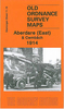


Aberdare 1914
Aberdare in 1914 in a fascinating series of reproductions of old Ordnance Survey plans in the Alan Godfrey Editions, ideal for anyone interested in the history of their neighbourhood or family. The map covers the central area of Aberdare, extending from Nevile Terrace and Oxford Street southward to Dumfries Park, and from Llwynhelig Colliery eastward to Sunnybank Street and Gwar Street. Features include the town centre, Taff Vale Railway with station, GWR Vale of Neath line with station, sidings and goods sheds, Taff Vale Railway`s Dare Valley Branch, GWR Cwmaman Branch, Aberdare & Hirwaun Tramway, street tramways, St Elvan`s church, Foundry Town area, Gadlys area, St John the Baptist church, Blaengwawr Level, Graig Rhiw Mynach, Llwynhelig Colliery with tramway, Glanare
House, remains of old tramways and mine workings, etc. On the reverse is a 1906 Aberdare directory, entries Gr to Ol. About the Alan Godfrey Editions of the 25” OS Series:Selected towns in Great Britain and Ireland are covered by maps showing the extent of urban development in the last decades of the 19th and early 20th century. The plans have been taken from the Ordnance Survey mapping and reprinted at about 15 inches to one mile (1:4, 340). On the reverse most maps have historical notes and many also include extracts from contemporary directories. Most maps cover about one mile (1.6kms) north/south, one and a half miles (2.4kms) across; adjoining sheets can be combined to provide wider coverage.FOR MORE INFORMATION AND A COMPLETE LIST OF ALL AVAILABLE TITLES PLEASE CLICK ON THE
SERIES LINK.

Product Description
Reviews/Comments
Add New
Intelligent Comparison
Archived Product

Aberdare North 1914 Stanfords
£3.50
Archived Product

Aberaeron 1904 Stanfords
£3.50
Vouchers
No voucher codes found.
Do you know a voucher code for this product or supplier? Add it to Insights for others to use.
Do you know a voucher code for this product or supplier? Add it to Insights for others to use.
 Denmark