More From Contributor

£25.00
21 Days to Glory: the Official Team Sky Book of the 2012 Tour de France published by Harper Collins is a lavishly illustrated stage-by-stage story of the Tour, with exclusive contributions of the team members & an introduction from the team’s manager David Brailsford. Stunning photography from Scott Mitchell captures the working life of the team in extreme close-up & Sarah Edworthy’s narrative offers a unique insight into what it takes to win the Tour de France, from the make-or-break stage planning on the team bus each morning down to the meticulous culinary preparations of the team’s chef. The final chapter provides a summary of each stage, including the final result & a detailed route profile showing changes in altitude & the grading of the climbs. ...
Archived Product
£18.99
**FROM THE AUTHOR OF THE MULTI-MILLION COPY BESTSELLER SAPIENS** Sapiens showed us where we came from. Homo Deus looked to the future. 21 Lessons for the 21st Century explores the present. How can we protect ourselves from nuclear war, ecological cataclysms & technological disruptions? What can we do about the epidemic of fake news or the threat of terrorism? What should we teach our children? Yuval Noah Harari takes us on a thrilling journey through today’s most urgent issues. The golden thread running through his exhilarating new book is the challenge of maintaining our collective & individual focus in the face of constant & disorienting change. Are we still capable of understanding the world we have created? ...
Archived Product
£14.99
After a decade of trying to become a mother
- eleven rounds of unsuccessful IVF, multiple miscarriages & a pregnancy which proved
...
Archived Product
£40.00
Official charts for the coast of Greenland produced by the Danish Hydrographic Office. The charts are ordered upon customer dem&, therefore please contact us if you require the charts urgently. For any further information, you can contact maritime@stanfords.co.uk. ...
Archived Product
£45.00
For this February 2018 edition the latest depth surveys have been applied. The latest wind farm information is included where relevant. There has been general updating throughout. The 2018 edition is now wirobound & tidal stream information is included. Individual sheets of this atlas will no longer be sold separately. However, 1st edition charts Y7 & Y14 will be published. These are replicas of charts 2100.1 & 2100.5. Chart included in the atlas are:2100.1 Thames Estuary South 1: 120 000 WGS 842100.2 River Thames Sea Reach 1: 50 000 WGS 842100.3 The River Thames
- Queen Elizabeth Bridge to Canvey Island 1: 35 000 WGS 84 Plans Coalhouse Point to Canvey Isl&, Queen Elizabeth II Bridge to Coalhouse Point 2100.4 The River Thames
- Tower Bridge to Queen Elizabeth Bridge 1: 35 000 WGS 84 Plans Barking Creek to Queen Elizabeth II Bridge, Tower Bridge to Barking Creek 2100.5 River Medway 1: 40 000 WGS 84 Plans Gillingham Marina, Port Werburgh, Whitton Marine, Continuation of River Medway 2100.6 The Swale 1: 40 000 WGS 84 Plans Whitstable Harbour 2100.7 North Foreland to Dover & Calais 1: 115 000 WGS 842100.8 Dover to Dungeness & Cap Gris-Nez 1: 115 000 WGS 842100.9 Beachy Head to Dungeness 1: 115 000 WGS 84 Plans Sovereign Harbour, Rye Harbour 2100.10 Nab Tower to Beachy Head 1: 160 000 WGS 842100.11 Kent Plans
- including plan of Calais 1: various WGS 84 Plans Ramsgate, River Stour Entrance, Dover, Calais, Folkestone 2100.12 Sussex Plans 1: various WGS 84 Plans Newhaven, Brighton Marina, Shoreham Harbour, Littlehampton, The Looe


...
Archived Product
£39.50
Part of Imray’s popular small format chart coverage for the Netherlands, this atlas is a convenient A2 format, wirobound along one edge.

Includes::
download code for more than 140 digital charts covering all of the Netherlands on the Imray Navigator charts app. Coverage is the North Sea coast, from the Belgian-French border, through the Zeel&, South Holland & North Holland coasts up to & including Den Helder. Included in the atlas are all of the navigational charts & tidal data required for coastal passage & approach. Also included is a larger-format passage planning sheet for plotting routes across the North Sea. Charts in the atlas include 1. North Sea Coast – Nieuwpoort to Hoek Van Holland (1:300 000)2. North Sea Coast – Hoek van Holland to Texel (1:300 000)3. Approaches to Nieuwpoort & Oostende (1:100 000)

Includes::
plans Niewpoort (1:30 000) & Oostende (1:20 000)4. Oostende to Westkapelle (1:100 000)

Includes::
plans Blankenberge (1:15 000) & Zeebrugge (1:35 000)5. Entrance to the Westerschelde (1:50 000)

Includes::
plans Breskens (1:15 000), Vlissingen (1:20 000) & Cadz&-Bad (1:10 000)6. Westkapelle to Westhoofd (1:100 000)

Includes::
plan Roompotsluis (1:30 000)7. West Schouwen to Hoek van Holland (1:100 000)

Includes::
plan Stellendam (1:30 000)8. Hoek van Holland to IJmuiden (1:125 000)

Includes::
plans Scheveningen (1:15 000) & IJmuiden (1:35 000)9. IJmuiden to Den Helder (1:125 000)10. Approaches to Den Helder (1:50 000)

Includes::
plan Den Helder (1:20 000)11. Southern North Sea passage planning chart (1:500 000)


...
Archived Product
£40.00
Official charts for the coast of Greenland produced by the Danish Hydrographic Office. The charts are ordered upon customer dem&, therefore please contact us if you require the charts urgently. For any further information, you can contact maritime@stanfords.co.uk. ...
Archived Product
£39.50
Part of Imray’s popular small format chart coverage for the Netherlands, this atlas is a convenient A2 format, wirobound along one edge.

Includes::
download code for more than 140 digital charts covering all of the Netherlands on the Imray Navigator charts app.
Includes: extensive coverage of Westerschelde, Kanaal Gent-Terneuzen, Oosterschelde, Veerse Meer, Zoommeer, plus canal links & North Sea coastal approaches.1. Westerschelde & Oosterschelde Overview Chart (1:225 000)2. Westerschelde
- Oostgat Approaches (1:45 000)

Includes::
plan Cadz&-Bad (1:10 000)3. Entrance to the Westerschelde (1:35 000) 4. Westerschelde
- Breskens to Terneuzen (1:35 000)

Includes::
plan of Breskens (1:15 000) 5. Westerschelde
- Terneuzen to Hoek van Ossenisse (1:35 000)

Includes::
plan of Terneuzen (1:20 000) 6. Westerschelde
- Hoek van Ossenisse to Bath (1:35 000)

Includes::
plan of Walsoorden (1:10 000) 7. Approaches to Antwerpen (1:30 000)

Includes::
Continuation of Schelde-Rijnverbinding to Zoommeer (1:30 000) 8. Antwerpen (1:30 000) 9. Kanaal Gent-Terneuzen (1:30 000) 10. Kanaal door Walcheren
- Vlissingen to Kleverskerke (1:20 000) 11. Veerse Meer West (1:20 000)

Includes::
plans of Oostwatering (1:15 000), Veere (1:10 000), Oranjeplaat (1:15 000) & De Omloop (1:10 000) 12. Veerse Meer East (1:20 000)

Includes::
plans of Kortgene & Wolphaartsdijk (1:10 000) and Zandkreeksluis (1:10 000) 13. Kanaal door Zuid-Beveland (1:17 500)14. Entrance to the Oosterschelde (1:45 000)

Includes::
plan of Roompotsluis (1:30 000) 15. Oosterschelde
- Roompotsluis to Zeelandbrug (1:35 000)

Includes::
plans of Roompot Marina (1:15 000), Colijnsplaat (1:15 000), Zierikzee (1:15 000) & Burghsluis (1:15 000) 16. Oosterschelde
- Zeelandbrug to Yerseke (1:35 000)

Includes::
plans of Goessche Sas (1:10 000) & Stavenisse (1:15 000) 17. Oosterschelde
- Yerseke to Bergsediepsluis (1:35 000)

Includes::
plan of Yerseke (1:12 500) 18. Oosterschelde
- Keeten to Krammer & Krabbenkreek (1:35 000)

Includes::
plans of Bruinisse (1:15 000) & Sint Annaland (1:15 000) 19. Zoommeer (1:15 000)

Includes::
Continuation of Schelde-Rijnverbinding to Volkerak (1:45 000)


...
Archived Product
£14.99
The Tubular Fells Map is a topological map of Alfred Wainwright`s 214 fells, akin to the London Underground map devised by engineering draughtsman, Harry Beck in 1931. The map shows Wainwright’s 214 fells mapped out following the Underground concept, listing fells along route lines like stations, grouped using colours that match the guidebooks they come from. ...
Archived Product
£39.50
Part of Imray’s popular small format chart coverage for the Netherlands, this atlas is a convenient A2 format, wirobound along one edge.

Includes::
download code for more than 140 digital charts covering all of the Netherlands on the Imray Navigator charts app.
Includes: extensive coverage of Nieuwe Waterweg, Nieuwe- & Oude Maas, Brielse Meer, Spui, Noord, Dortsche Kil, Hollandsch Diep, Haringvliet, Volkerak & Grevelingenmeer. Also included are approach charts to the Maas & Haringvliet entrances, & detail of the standing mast routes between Rotterdam & Amsterdam.1. Rijn & Maas Delta Overview Chart (1:250 000)2. Approaches to The Maas (1:45 000)3. Approaches to Haringvliet (1:45 000)4. Europoort & entrance to Nieuwe Waterweg (1:25 000)5. Nieuwe Waterweg
- Hoek van Holland to Maassluis (1:25 000)

Includes::
plans Hoek van Holland (1:10 000) & Maassluis (1:15 000)6. Brielse Meer (1:15 000)

Includes::
plan Brielse Meer
- continuation to Zwartewaal (1:15 000)7. Maassluis to Nieuwe Maas & Oude Maas (1:20 000)8. Rotterdam (1:20 000)9. Rotterdam to Alblasserdam (1:20 000)10. Approaches to Dordrecht (1:20 000)11. Oude Maas
- Hoogvliet to Puttershoek (1:20 000)

Includes::
plan Puttershoek (1:10 000)12. Spui (1:20 000)

Includes::
plans Zuidland & Goudswaard (1:10 000) & Nieuw Beijerland (1:10 000)13. Dortsche Kil to Hollandsch Diep (1:25 000)

Includes::
plans Strijensas (1:10 000), Moerdijk (1:10 000) & Noordschans (1:10 000)14. Haringvliet West (1:30 000)

Includes::
plans Hellevoetsluis (1:15 000) & Middelharnis Entrance (1:10 000)15. Haringvliet East (1:30 000)

Includes::
plans Stad aan’t Haringvliet (1:10 000), Den Bommel (1:10 000) & Hitsertse Kade (1:10 000)16. Hollandsch Diep East & Volkerak (1:30 000)

Includes::
plans Willemstad (1:12 500), Dintelsas (1:20 000) & Benedensas (1:15 000)17. Grevelingenmeer East to Krammersluizen (1:30 000)

Includes::
plans Herkingen (1:10 000) & Bruinisse (1:15 000)18. Grevelingenmeer West (1:30 000)

Includes::
plans Scharendijke (1:20 000), Den Osse (1:20 000), Brouwershaven (1:10 000) & Ouddorp (1:10 000)19. Standing Mast Routes
- Rotterdam to Amsterdam (South sheet) (1:50 000)20. Standing Mast Routes
- Rotterdam to Amsterdam (North sheet) (1:50 000)

Includes::
plan Amsterdam
- Houthaven to Sixhaven (1:22 500)


...
Archived Product

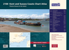
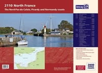
2110 North France Chart Atlas - Nord-Pas-de-Calais, Picardy And
Normandy Coasts - 2017 Edition

The atlas includes:2110.1 Eastern English Channel1: 600 000 WGS 842110.2 Dover Strait1: 200 000 WGS 842110.3 Cap Gris-Nez to Dieppe1: 200 000 WGS 842110.4 Nieuwpoort & Nord-Pas-de-Calais PlansScales: various WGS 84Plans included:Nieuwpoort (1:30 000)Rade de Dunkerque (1:125 000)Dunkerque (1:25 000)Calais (1:20 000)Boulogne-sur-Mer (1:25 000)Étaples (1:75 000)2110.5 Dieppe to Le Havre1: 200 000 WGS 842110.6 Picardy & Upper Normandy PlansScales: various WGS 84Plans included:Baie de Somme (1:75 000)Le Tréport (1:12 500)Dieppe (1:12 500)St-Valéry-en-Caux (1:12 500)Fécamp (1:12 500)2110.7 Approaches to Le Havre & River Seine1: 60 000 WGS 842110.8 River Seine PlansScales: various WGS 84Plans included:Le Havre (1:12 500)River Seine to Tancarville (1:63 000)Honfleur (1:12 500)2110.9 Baie de
Seine (East)1: 155 000 WGS 842110.10 Baie de Seine (West) to Cherbourg1: 155 000 WGS 842110.11 Lower Normandy PlansScales: various WGS 84Plans included:Deauville/Trouville (1:15 000)Dives-sur-Mer (1:30 000)Ouistreham (1:25 000)Courseulles-sur-Mer (1:20 000)Arromanches (1:35 000)Port-en-Bessin (1:10 000)Grandcamp-Maisy (1:6000)Baie du Grand Vey (1:75 000)Saint-Vaast-La-Hougue (1:20 000)Barfleur (1:15 000)Cherbourg (1:40 000)Port Chantereyne (Cherbourg) (1:10 000)Omonville-la-Rogue (1:7000)
RIP - This product is no longer available on our network. It was last seen on 25.09.2019

This page now acts as a permanent archive for this product. Add more information using the comments box below to ensure it can still be found by future generations.

Use our search facility to see if it is available from an alternative contributor.
  • Availability: Out Of Stock
  • Supplier: Stanfords
  • SKU: 9781846238598
Availability: In Stock
£39.50

Product Description

The atlas
Includes::2110.1 Eastern English Channel 1: 600 000 WGS 842110.2 Dover Strait 1: 200 000 WGS 842110.3 Cap Gris-Nez to Dieppe 1: 200 000 WGS 842110.4 Nieuwpoort & Nord-Pas-de-Calais Plans Scales: various WGS 84 Plans included: Nieuwpoort (1:30 000) Rade de Dunkerque (1:125 000) Dunkerque (1:25 000) Calais (1:20 000) Boulogne-sur-Mer (1:25 000)Étaples (1:75 000)2110.5 Dieppe to Le Havre 1: 200 000 WGS 842110.6 Picardy & Upper Normandy Plans Scales: various WGS 84 Plans included: Baie de Somme (1:75 000) Le Tréport (1:12 500) Dieppe (1:12 500) St-Valéry-en-Caux (1:12 500)Fécamp (1:12 500)2110.7 Approaches to Le Havre & River Seine 1: 60 000 WGS 842110.8 River Seine Plans Scales: various WGS 84 Plans included: Le Havre (1:12 500) River Seine to Tancarville (1:63 000) Honfleur (1:12 500)2110.9 Baie de Seine (East)1: 155 000 WGS 842110.10 Baie de Seine (West) to Cherbourg 1: 155 000 WGS 842110.11 Lower Normandy Plans Scales: various WGS 84 Plans included: Deauville/ Trouville (1:15 000) Dives-sur-Mer (1:30 000) Ouistreham (1:25 000) Courseulles-sur-Mer (1:20 000) Arromanches (1:35 000) Port-en-Bessin (1:10 000) Grandcamp-Maisy (1:6000) Baie du Grand Vey (1:75 000) Saint-Vaast-La-Hougue (1:20 000) Barfleur (1:15 000) Cherbourg (1:40 000) Port Chantereyne (Cherbourg) (1:10 000) Omonville-la-Rogue (1:7000)

Reviews/Comments

Add New

Intelligent Comparison

Oooops!
We couldn't find anything!
Perhaps this product's unique.... Or perhaps we are still looking for comparisons!
Click to bump this page and we'll hurry up.

Price History

Vouchers

No voucher codes found.
Do you know a voucher code for this product or supplier? Add it to Insights for others to use.

Facebook

Jargon Buster

France - A state situated in Western Europe with several overseas territories.

Supplier Information

Stanfords
Stanfords was established in 1853 and opened their iconic Covent Garden flagship store in 1901. They have become the top retailer of maps, travel books and accessories in the UK and arguably offer the largest selection of maps and travel books worldwide. Famous names such as Captain Robert Falcon Scott, Ranulph Fiennes and Michael Palin have purchased from Stanfords. They now have a shop in Bristol and both stores together with other venues operate a calendar of events including talks, book signings and exhibitions. As a specialist map retailer, the map selection is comprehensive and includes road maps, street maps and walking maps from worldwide destinations, as well as a selection of world atlases and wall maps. Books include travel guides and travel literature. Stanfords also stock globes, from miniatures made of blue marble to magnificent floor-standing globes. The website features a selection of interesting articles on travel topics.
Page Updated: 2023-11-12 20:15:36

Community Generated Product Tags

Oh No! The productWIKI community hasn't generated any tags for this product yet!
Menu