More From Contributor

£12.99
This collection of walks covers the picturesque area of South Devon, plus the southern part of Dartmoor National Park, an area acclaimed as the last great wilderness in Britain. Each of the 28 walks have full directions, an extract of the map & notes on key features of the area. The area gives a great selection of routes, from coastal walks to inland peaks, with lengths from 2.5 miles to 10 miles. Each walk is also rated for difficulty, & has been tested by experienced walkers. Key places to visit include Bench Tor, Dartmouth Castle, the traditional coastal town of Sidmouth & the Dartmoor railway. ...
Archived Product
£7.99
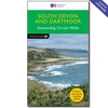
South Devon is famed above all for its magnificent rugged coast, stretching from Plymouth in the west to Seaton in the east, with imposing sandstone cliffs broken by long winding estuaries & traversed throughout by the South West Path. Punctuating this coast are a series of popular seaside towns, both large & small, historic ports & picturesque fishing villages. This Pathfinder Short Walks guidebook contains 20 carefully selected walks for all the family. The walking routes range from 2.4km (1.5 miles) to 9.6km (6 miles), & each

Includes::
information on accessibility, difficulty & parking. Each route comes with full route directions, an extract of the OS map for the area & notes on things to look for on the way. Key places covered by this book include The Dart Valley Trail, Wembury Bay, Budleigh Salterton, Sidmouth & the River Otter. The book itself is designed in a compact size with rucksack friendly toughened cover.

...
Archived Product
£12.99
The Pathfinder walking guidebook for East Sussex & the South Downs National Park has 28 carefully selected walking routes for all abilities. Routes range from 5km (3 miles) to 19km (12 miles) & each is also graded by difficulty. With each route these is a detailed route description, an extract of the OS map of the area & notes of things to look for on the way. Walks in this guidebook include Beachy Head, Battle, Bodiam Castle, Ditchling Beacon, Seven Sisters, & 500 Acre Wood which was the inspiration for Winnie The Pooh. Pathfinder Guides are Britain’s best-loved walking guides. Printed with weather-resistant covers featuring durable rounded corners, they are the perfect companion for country walking throughout Britain. ...
Archived Product
£3.99
Explore Secret Stories South London's Lost River Tour, a self-guided interactive walking tour to enjoy whenever you want. Follow the ghostly trail of the Effra — south London's lost river. Discover how this local landmark disappeared under the ground 150 years ago. & learn what links it to rampaging Vikings, a runaway coffin, & Victorian sewer hunters. On this tour, you'll uncover the truth behind the legends. Is it true that Queen Elizabeth took her barge up the Effra to visit Sir Walter Raleigh? & did King Canute really sail up Brixton Hill in his bid to capture Saxon London? Total length: 3.91 miles; Suggested age range: 7+ Purchase this Tour (and more) in the Secret Stories App, available for free download from Android Play & Apple App store. You'll find more details of the tour & what it contains in the app! ...
Available
£13.99
OS Explorer Map
- Active is a new encapsulated product that is tough, durable & weatherproof. The maps are covered in a protective
...
Archived Product
£12.99
Explore the beautiful south west coast around Dorset, Devon & Cornwall with this collection of 28 of the best coastal walks. From generally leisurely strolls of three miles (4.8km) up to more challenging routes of nine miles (14km) with lots of hills to climb, there's something for all ages & abilities. Routes include Lulworth Cove, Old Harry Rocks, Chesil Beach, Lizard Point & Sidmouth. Each route

Includes::
an extract of the OS Explorer map with routes & waypoints marked, a description of the route, key features to see, & tips on parking, refreshments & more. Pathfinder Guides are Britain’s best-loved walking guides. Printed with weather-resistant covers featuring durable rounded corners, they are the perfect companion for country walking throughout Britain.

...
Archived Product
£8.99
Reproduction map of Southampton from the Revised New Edition, 1896 to 1904 ...
Available
£3.99
Explore Secret Stories Southampton's Stinky Towers Tour, a self-guided interactive walking tour to enjoy whenever you want. Are you ready to step back in time to medieval Southampton? Discover stinky towers; big, bad medieval fortifications; & the hidden story behind Pilgrim Father's journey to America. Total length: 1.2 miles; Suggested age range: 7+ Purchase this Tour (and more) in the Secret Stories App, available for free download from Android Play & Apple App store. You'll find more details of the tour & what it contains in the app! ...
Available
£13.99
OS Explorer Map
- Active is an encapsulated product that is tough, durable & weatherproof. The maps are covered in a protective
...
Archived Product
£32.00
Designed in Japan, the SP Slip Collar acts as a secure training tool or everyday dog collar. Fit the SP Slip Collar gently over the head. Features adjustable buckle, a comfortable neoprene lining, & metal findings. Pair with the SP Rope Lead for a complete set. ...
Archived Product

South Pennines - Pathfinder Walks Guidebook

This book gives details of 28 amazing walks across the Pennines (Lancashire and Yorkshire), including South Pennines’ most famous viewpoint at Stoodley Pike and the parts of the Pennine Way. Each of the routes has information on local amenities, a detailed route description, and extract of the large-scale OS Map for the area and notes and pictures to help you make the most of your time. The routes are all graded for difficulty by experienced walkers and range from 3.5 to 10 miles long. They include Blackstone Edge and reservoirs, several Railway Children locations, the Alcomden Stones and Boulsworth Hill. Pathfinder Guides are Britain’s best-loved walking guides. Printed with weather-resistant covers featuring durable rounded corners, they are the perfect companion for country
walking throughout Britain.
RIP - This product is no longer available on our network. It was last seen on 14.11.2020

This page now acts as a permanent archive for this product. Add more information using the comments box below to ensure it can still be found by future generations.

Use our search facility to see if it is available from an alternative contributor.
Availability: In Stock
£12.99

Product Description

This book gives details of 28 amazing walks across the Pennines (Lancashire & Yorkshire), including South Pennines’ most famous viewpoint at Stoodley Pike & the parts of the Pennine Way. Each of the routes has information on local amenities, a detailed route description, & extract of the large-scale OS Map for the area & notes & pictures to help you make the most of your time. The routes are all graded for difficulty by experienced walkers & range from 3.5 to 10 miles long. They include Blackstone Edge & reservoirs, several Railway Children locations, the Alcomden Stones & Boulsworth Hill. Pathfinder Guides are Britain’s best-loved walking guides. Printed with weather-resistant covers featuring durable rounded corners, they are the perfect companion for country walking throughout Britain.

Reviews/Comments

Add New

Intelligent Comparison

Oooops!
We couldn't find anything!
Perhaps this product's unique.... Or perhaps we are still looking for comparisons!
Click to bump this page and we'll hurry up.

Price History

Vouchers

No voucher codes found.
Do you know a voucher code for this product or supplier? Add it to Insights for others to use.

Facebook

Jargon Buster

edge - Enhanced data rates for GSM evolution also known as enhanced GPRS. A mobile phone technology with improved data transmission rates.
edge - The point at which two surfaces meet
Weather - is the change of an atmospheres conditions.
Large - something that takes up more space than normal.
Resistant - Something that can repel against something.
Children - A young life form within the early stages of physical development,

Supplier Information

Ordnance Survey
Navigate your world with confidence with Ordnance Survey (https://shop.ordnancesurvey.co.uk/)! Explore our extensive range of maps, guides, and outdoor gear designed to help you explore the great outdoors with ease. From detailed maps for hiking and cycling to innovative GPS devices, we've got everything you need to plan your next adventure. With our heritage of accuracy and reliability, Ordnance Survey is your trusted companion for exploring the UK's landscapes, whether you're a seasoned explorer or a weekend wanderer. Gear up and discover new horizons with Ordnance Survey today!
Page Updated: 2024-03-04 13:47:34

Community Generated Product Tags

Oh No! The productWIKI community hasn't generated any tags for this product yet!
Menu