
 United Kingdom
 France
 Germany
 Netherlands
 Sweden
 USA
USA
 Italy
Italy
 Spain
Spain
More From Contributor


Ordnance Survey Map Of York & Selby
York & Selby map - OS Landranger 105 Publication Date: 24/02/2016


Product Description
Reviews/Comments
Add New
Intelligent Comparison
Archived Product

Map Of Peterborough 1896-1904 Ordnance Survey
£8.99
Available
Map Of Flamborough 1896-1904 Ordnance Survey
£5.99
Available

Ordnance Survey Map Of East London Ordnance Survey
£12.99
Available
Traditional Garden Games Badminton, Tennis And Volleyball Set With Net Ordnance Survey
£57.39
Available

Ordnance Survey Map Of Rannoch Moor & Ben Alder Ordnance Survey
£12.99
Archived Product
Map Of Garstang 1896-1904 Ordnance Survey
£8.99
Available
Pathfinder Walks In South West England's Coast - Pathfinder Guidebook 69 Ordnance Survey
£11.04
Available
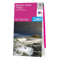
Ordnance Survey Map Of Berwick-upon-Tweed, Holy Island & Wooler Ordnance Survey
£12.99
Vouchers
No voucher codes found.
Do you know a voucher code for this product or supplier? Add it to Insights for others to use.
Do you know a voucher code for this product or supplier? Add it to Insights for others to use.
 Denmark