Explore what the New Forest has on offer. Discover picturesque villages among sprawling heathl&. Witness beautiful ponies grazing — one of the few places in the UK with commoners rights. Take a journey along the coast & stumble upon docks & beaches; experiencing both the waves & trees — there is no doubt the New Forest is a wonderful destination for exploration. Take a walk along Bournemouth beach, a very popular holiday destination. Wonder through the old streets of Ringwood & sample the local beer from the infamous Ringwood Brewery, or why not see Southampton – home of Ordnance Survey. With so much to explore on OL22, it is a must-have map. Our Explorer maps come with a Weatherproof Active option, so you never get caught out in a storm. Publication Date: 01/02/2021 ...
Map of Newark-on-Trent - OS Explorer Map 271 (Retford, Southwell & Saxilby) Format: Folded map Physical Size: ...
Available
Ordnance Survey Map Of Nairn & Cawdor
Map of Nairn & Cawdor - OS Explorer Map 422 (Darnaway Forest, Ardersier & Culloden Muir) Format: Folded map Physical Size: 1270 x 952 mm (133 x 240 mm folded) Publication Date: 16/09/2015
Reviews/Comments
Add New
Intelligent Comparison
Available
Ordnance Survey Map Of Tobermory & North Mull Ordnance Survey
£12.99
Available
Ordnance Survey Map Of Stranraer & Glenluce Ordnance Survey
£16.99
Archived Product
Map Of Ripon 1896-1904 Ordnance Survey
£8.99
Available
Ordnance Survey Map Of Bedford & Huntingdon Ordnance Survey
£16.99
Available
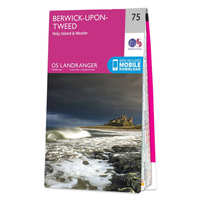
Ordnance Survey Map Of Berwick-upon-Tweed, Holy Island & Wooler Ordnance Survey
£12.99
Available
Ordnance Survey Map Of Colchester Ordnance Survey
£16.99
Available
Ordnance Survey Map Of Durness & Cape Wrath Ordnance Survey
£12.99
Available
Ordnance Survey Map Of Peterhead & Fraserburgh Ordnance Survey
£12.99
Price History
Vouchers
No voucher codes found. Do you know a voucher code for this product or supplier? Add it to Insights for others to use.
Facebook
Jargon Buster
Forest - A area with a high density of trees
Date - A day on a calendar
Date - A social activity whith a current or potential partner
Physical - Used to describe strength or visual properties of an item
Size - is the measurement of how big an object is in space.
Navigate your world with confidence with Ordnance Survey (https://shop.ordnancesurvey.co.uk/)! Explore our extensive range of maps, guides, and outdoor gear designed to help you explore the great outdoors with ease. From detailed maps for hiking and cycling to innovative GPS devices, we've got everything you need to plan your next adventure. With our heritage of accuracy and reliability, Ordnance Survey is your trusted companion for exploring the UK's landscapes, whether you're a seasoned explorer or a weekend wanderer. Gear up and discover new horizons with Ordnance Survey today!
Page Updated: 2024-03-04 13:47:34
Community Generated Product Tags
Oh No! The productWIKI community hasn't generated any tags for this product yet!