The Landranger map of Loch Lomond & Inverary is the perfect companion when planning a trip to the area. Landranger maps are perfect for extensive hikes, cycling, & driving holidays. Ideal for planning days out or holidays to the area nicknamed the 'gateway to the Highlands'. Inverary has a wide range of attractions on offer from Inverary Castle & Gardens, to walking in the nearby Glen Shira & Aray. Other highlights of this map include the West Highland Way, which passes along the banks of Loch Lomond in the Trossachs National Park. (The Loch itself is the largest body of fresh water in mainland Britain.) Our Landranger maps come in standard or Weatherproof Active, you'll also receive a free download for your devices — making for a convenient companion. Publication Date: 03/08/2021 ...
OS Explorer Map 398: Loch Morar & Mallaig. Discover this remote are of the Scottish West coast with our most detailed mapping for walking & climbing. Free UK delivery. Format: Folded map Physical Size: 890 x 1000 mm (134 x 227 mm folded) Publication Date: 16/09/2015 ...
Available
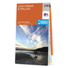
Ordnance Survey Map Of Loch Lomond South
Map of Loch Lomond South - OS Explorer Map OL 38 (Dumbarton & Helensburgh Drymen & Cove) Publication Date: 29/10/2021
Navigate your world with confidence with Ordnance Survey (https://shop.ordnancesurvey.co.uk/)! Explore our extensive range of maps, guides, and outdoor gear designed to help you explore the great outdoors with ease. From detailed maps for hiking and cycling to innovative GPS devices, we've got everything you need to plan your next adventure. With our heritage of accuracy and reliability, Ordnance Survey is your trusted companion for exploring the UK's landscapes, whether you're a seasoned explorer or a weekend wanderer. Gear up and discover new horizons with Ordnance Survey today!
Page Updated: 2024-03-04 13:47:34
Community Generated Product Tags
Oh No! The productWIKI community hasn't generated any tags for this product yet!