-
Home
-
Contributors
-
International
-
Account
-
Information
More From Contributor
£12.99
The Landranger map of Grantown & Aviemore, including the Cairngorm Mountains, is a must-have for your next trip to the area. Landranger maps are perfect for extensive hikes, cycling, & driving holidays. Ideal for planning days out or holidays in Cairngorms National Park, Cairngorm Mountains, Grampian Mountains, & the area around Aviemore. With so much to see packed into this majestic area, we can only list some highlights: Speyside Way, Ben Macdui (Beinn Mac Duibh), Meall a' Bhauchaille, Strathavon, Kinveachy Forest, Dunandhu, Culardoch, Glen Avon, & the Lochs Morlich, Alive, & Einich. Our Landranger maps come in standard or Weatherproof Active, you'll also receive a free download for your devices — making for a convenient companion. Publication June 2021 ...
Available
£12.99
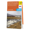
Map of Grantown-on-Spey & Hills of Cromdale
- OS Explorer Map OL 61 (Upper Knockando & Tomnavoulin) Publication Date: 16/07/2021 ...
- OS Explorer Map OL 61 (Upper Knockando & Tomnavoulin) Publication Date: 16/07/2021 ...
Available
£16.99
Map of Grantown-on-Spey & Hills of Cromdale
- OS Explorer Map OL 61 (Upper Knockando & Tomnavoulin) Publication Date: 16/07/2021 ...
- OS Explorer Map OL 61 (Upper Knockando & Tomnavoulin) Publication Date: 16/07/2021 ...
Available
£16.99
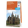
Map of Gravesend & Rochester
- OS Explorer Map 163 (Hoo Peninsula) Publication Date: 16/09/2015 ...
- OS Explorer Map 163 (Hoo Peninsula) Publication Date: 16/09/2015 ...
Available
£12.99
Map of Gravesend & Rochester
- OS Explorer Map 163 (Hoo Peninsula) Publication Date: 16/09/2015 ...
- OS Explorer Map 163 (Hoo Peninsula) Publication Date: 16/09/2015 ...
Available
£12.99
Map of Greenock, Largs & Millport
- OS Explorer Map 341 (Clyde Muirshiel Regional Park) Format: Folded map Physical
...
- OS Explorer Map 341 (Clyde Muirshiel Regional Park) Format: Folded map Physical
...
Available
£16.99
Map of Greenock, Largs & Millport
- OS Explorer Map 341 (Clyde Muirshiel Regional Park) Format: Folded map Physical
...
- OS Explorer Map 341 (Clyde Muirshiel Regional Park) Format: Folded map Physical
...
Available
£16.99
Map of Greenwich & Gravesend
- OS Explorer Map 162 (East End, Docklands, Bromley, Sidcup & Thurrock) Publication Date: 16/09/2015 ...
- OS Explorer Map 162 (East End, Docklands, Bromley, Sidcup & Thurrock) Publication Date: 16/09/2015 ...
Available
£12.99
Map of Greenwich & Gravesend
- OS Explorer Map 162 (East End, Docklands, Bromley, Sidcup & Thurrock) Publication Date: 16/09/2015 ...
- OS Explorer Map 162 (East End, Docklands, Bromley, Sidcup & Thurrock) Publication Date: 16/09/2015 ...
Available
£16.99
Purchase the Grimsby folded map: single, sided (boarded cover) from the OS Landranger Map range Publication Date: 24/02/2016 ...
Available
Ordnance Survey Map Of Great Britain
The OS Route map Great Britain shows all key road, rail and sea connections and is perfect for planning driving holidays and days out, or just to discover all those out of the way places. It's a double-sided map in a card cover. Main map is 1:550 000 scale, with larger scale inserts for key towns and cities. Published May 2022.
- External links may include paid for promotion
- Availability: In Stock
- Supplier: Ordnance Survey
- SKU: 2924
Availability: In Stock
£8.99
Product Description
The OS Route map Great Britain shows all key road, rail & sea connections & is perfect for planning driving holidays & days out, or just to discover all those out of the way places. It's a double-sided map in a card cover. Main map is 1:550 000 scale, with larger scale inserts for key towns & cities. Published May 2022.
Reviews/Comments
Add New
Intelligent Comparison
Price History
Vouchers
No voucher codes found.
Do you know a voucher code for this product or supplier? Add it to Insights for others to use.
Facebook
Do you know a voucher code for this product or supplier? Add it to Insights for others to use.
Jargon Buster
Key - A physical or virtual device or code used for opening something
Road - a manmade lane or a path that is used to speed up travel.
Supplier Information
Ordnance Survey
Navigate your world with confidence with Ordnance Survey (https://shop.ordnancesurvey.co.uk/)! Explore our extensive range of maps, guides, and outdoor gear designed to help you explore the great outdoors with ease. From detailed maps for hiking and cycling to innovative GPS devices, we've got everything you need to plan your next adventure. With our heritage of accuracy and reliability, Ordnance Survey is your trusted companion for exploring the UK's landscapes, whether you're a seasoned explorer or a weekend wanderer. Gear up and discover new horizons with Ordnance Survey today!
Page Updated: 2024-03-04 13:47:34
Community Generated Product Tags
Oh No! The productWIKI community hasn't generated any tags for this product yet!


 United Kingdom
 France
 Germany
 Netherlands
 Sweden
 USA
USA
 Italy
Italy
 Spain
Spain


 Denmark