
 United Kingdom
 France
 Germany
 Netherlands
 Sweden
 USA
USA
 Italy
Italy
 Spain
Spain
More From Contributor


Official Road Atlas Ireland
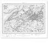
Find your way around Ireland (both Northern Ireland and Eire) with the official map, created by OSNI. The map contains the entire road network at 1: 210 000 scale, plus selected town and city maps. It is 109 pages, and spiral bound to make it easy to keep your place on the move. It includes a distance chart to calculate distances from most towns and information on road tolls.

Product Description
Reviews/Comments
Add New
Vouchers
No voucher codes found.
Do you know a voucher code for this product or supplier? Add it to Insights for others to use.
Do you know a voucher code for this product or supplier? Add it to Insights for others to use.
 Denmark