More From Contributor

£12.99
This walking guidebook contains 28 carefully selected walking routes around the North & mid Devon of three to eleven miles (5 to 18km), each tested by experienced walkers. Each route

Includes::
a full description, an extract of the OS Explorer 1 25 000 scale map, photos & notes of key features & wildlife to look for on the way. The walks Grand Western Canal, Great Torrington, Lundy Island & the ' Valley of Rocks'. Pathfinder Guides are Britain’s best-loved walking guides. Printed with weather-resistant covers featuring durable rounded corners, they are the perfect companion for country walking throughout Britain.

...
Archived Product
£8.99
Reproduction map of North London from the Revised New Edition, 1896 to 1904. Available flat (rolled) or framed. ...
Available
£3.99
Explore Secret Stories North London's Ghost Trains Tour, a self-guided interactive walking tour to enjoy whenever you want. This tour is part of an Ordnance Survey series of bite-sized, tongue-in-cheek stories for you to read out loud. Expect nutty nature, smelly smugglers, raucous royals you get the idea. Take a stroll on an old railway line where only the ghosts of trains run now See some very creative graffiti, miniature paintings on chewing gum & the goatman! Check out parks, adventure playgrounds & one of the greatest, most panoramic views over London. Discover plenty of urban woodl&, greenery, butterflies, & birds (depending on the season!) & maybe even a bat or two in the evening! Total length: 4.73 miles; Suggested age range: 7+ Purchase this Tour (and more) in the Secret Stories App, available for free download from Android Play & Apple App store. You'll find more details of the tour & what it contains in the app! ...
Available
£13.99
OS Explorer Map
- Active is a new encapsulated product that is tough, durable & weatherproof. The maps are covered in a protective
...
Archived Product
£12.99
Discover far more than Wales' highest mountain with the Pathfinder guidebook for North Wales & Snowdonia. Routes include Great Orme, Tal Y Fan, the Clocaenog Forest, as well as Snowdon itself. Each of the 28 circular routes include an OS map, route description, photos & notes on key landscape features & wildlife to look for on your way. The walks ranging from 5km (3 miles) to 14.5 km (9 miles); each has been planned & tested by an experienced walker to help you make the most of the area, whether you are local or visiting. The Pathfinder & Short Walks series of guidebooks covers all the most popular walking areas of the country. ...
Archived Product
£7.99
20 short circular walks all graded by length & ranging from 2 to 6 miles. All routes come with a clear, large-scale OS map, GPS waypoints & highlight where to park, good pubs & places of interest en route. ...
Archived Product
£6.99
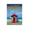
From colourful seaside curiosities & much loved local landmarks to iconic architectural oddities & shops, museums & visitor attractions frozen in time, Anne Ward's illuminating ' Northern Delights' celebrates the unusual & quirky gems of the North of England often overlooked by the less discerning tourist.

Features:
Northumberl&, Durham, Cumbria, Yorkshire, Lancashire. From the best selling author of ' Nothing to See Here'.

...
Available
£13.59
Ben Nevis snood with iconic OS Explorer mapping. A versatile neck tube for everyday & outdoor adventures. ...
Available
£13.59
Helvellyn snood with iconic OS Explorer mapping. A versatile neck tube for everyday & outdoor adventures. ...
Available
£6.99
These attractive & cleverly structured guides will give walkers ten of the best themed short circular walks in Britain's 14 National Parks. With clear information, an overview & introduction for each walk, expertly written numbered directions, large scale Ordnance Survey maps, superb eye-grabbing panoramic photographs, & interpretation of points of interest along the way, these guides set a new standard in clarity & ease-of-use. Featured walks in the Snowdonia National Park include: Aberfalls, Llyn Crafnant & Llyn Geirionydd, Roman Steps, Llyn Padarn & Llanberis, Tal y Fan & Conwy Mountain, Capel Curig, Harlech, Cadair Idris, Snowdon, Llyn Cwellyn & Mynydd Mawr. ...
Available

North York Moors - Pathfinder Walks Guidebook

The Pathfinder guidebook for The North York Moors is designed to help you make the most of your time in the area. It contains 28 walks, each graded by difficulty and ranging from 3.5 miles up to 11 miles in length. All the routes are created by seasoned walkers, and designed to help you make the most of the area. Highlights of The North York Moors available on these walks include Robin Hood's Bay, Rievaulx Abbey, the River Esk valley and the Cook Monument. Routes across wild and remote moorland, such has Ingleby Moor, Westerdale Moor and Ainthorpe Rigg are contrasted with coastal and clifftop walks around Runswick Bay and Staithes, Whitby and Saltwick Bay and Ravenscar. Each walking route has a description, and extract of the OS map to keep you on course and notes with highlights
of the area.
RIP - This product is no longer available on our network. It was last seen on 14.11.2020

This page now acts as a permanent archive for this product. Add more information using the comments box below to ensure it can still be found by future generations.

Use our search facility to see if it is available from an alternative contributor.
Availability: In Stock
£12.99

Product Description

The Pathfinder guidebook for The North York Moors is designed to help you make the most of your time in the area. It contains 28 walks, each graded by difficulty & ranging from 3.5 miles up to 11 miles in length. All the routes are created by seasoned walkers, & designed to help you make the most of the area. Highlights of The North York Moors available on these walks include Robin Hood's Bay, Rievaulx Abbey, the River Esk valley & the Cook Monument. Routes across wild & remote moorl&, such has Ingleby Moor, Westerdale Moor & Ainthorpe Rigg are contrasted with coastal & clifftop walks around Runswick Bay & Staithes, Whitby & Saltwick Bay & Ravenscar. Each walking route has a description, & extract of the OS map to keep you on course & notes with highlights of the area.

Reviews/Comments

Add New

Price History

Vouchers

No voucher codes found.
Do you know a voucher code for this product or supplier? Add it to Insights for others to use.

Facebook

Jargon Buster

Supplier Information

Ordnance Survey
Navigate your world with confidence with Ordnance Survey (https://shop.ordnancesurvey.co.uk/)! Explore our extensive range of maps, guides, and outdoor gear designed to help you explore the great outdoors with ease. From detailed maps for hiking and cycling to innovative GPS devices, we've got everything you need to plan your next adventure. With our heritage of accuracy and reliability, Ordnance Survey is your trusted companion for exploring the UK's landscapes, whether you're a seasoned explorer or a weekend wanderer. Gear up and discover new horizons with Ordnance Survey today!
Page Updated: 2024-03-04 13:47:34

Community Generated Product Tags

Oh No! The productWIKI community hasn't generated any tags for this product yet!
Menu