
 United Kingdom
 France
 Germany
 Netherlands
 Sweden
 USA
USA
 Italy
Italy
 Spain
Spain
More From Contributor
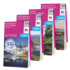


OS Landranger Yorkshire Dales Map Set
Also known simply as ‘The Dales’, the Yorkshire Dales National Park consists of the valleys and peaks of the Pennines. The area offers hill walking, climbing, mountain biking, caving, cycling, horse riding, fell running and water sports, and has Britain’s first National Trail, the Pennine Way. This map bundle contains all 5 OS Landranger Maps for the National Park with a discount of 20% compared to the cost of buying them individually, and is available in both standard and weatherproof 'Active' versions. Whatever activities you plan on your visit, you can make the most of it with Ordnance Survey maps. Official site: www.yorkshiredales.org.uk
Product Description
Reviews/Comments
Add New
Intelligent Comparison
Archived Product
OS Landranger Yorkshire Dales Map Set Ordnance Survey
£31.96
Available

OS Landranger Pembrokeshire Coast Map Set Ordnance Survey
£19.18
Available
OS Landranger Pembrokeshire Coast Map Set Ordnance Survey
£33.58
Archived Product
OS Landranger South Downs Map Set Ordnance Survey
£67.15
Archived Product
OS Landranger South Downs Map Set Ordnance Survey
£38.35
Archived Product
OS Landranger New Forest Map Set Ordnance Survey
£33.58
Archived Product
OS Landranger New Forest Map Set Ordnance Survey
£19.18
Archived Product
OS Landranger Lake District Map Set Ordnance Survey
£19.18
Vouchers
No voucher codes found.
Do you know a voucher code for this product or supplier? Add it to Insights for others to use.
Do you know a voucher code for this product or supplier? Add it to Insights for others to use.
 Denmark