
 United Kingdom
 France
 Germany
 Netherlands
 Sweden
 USA
USA
 Italy
Italy
 Spain
Spain
More From Contributor


OS Landranger North York Moors Map Set
OS Landranger Maps 93, 94, 100 & 101 The North York Moors National Park boasts a beautiful landscape of moorlands, coastline, ancient woodlands and historic sites. As well as walking and cycling, you can visit sites dating from the Iron Age to the Industrial Age. This map bundle contains all 4 OS Landranger Maps for the National Park with a discount of 20% compared to the cost of buying them individually, and is available in both standard and weatherproof 'Active' versions. Whatever activities you plan on your visit, you can make the most of it with Ordnance Survey maps.

Product Description
Reviews/Comments
Add New
Intelligent Comparison
Archived Product

OS Landranger North York Moors Map Set Ordnance Survey
£28.76
Archived Product

OS Explorer North York Moors Map Set Ordnance Survey
£23.98
Archived Product

OS Explorer North York Moors Map Set Ordnance Survey
£14.38
Archived Product

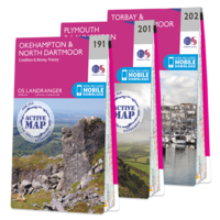
OS Landranger Dartmoor Map Set Ordnance Survey
£21.57
Archived Product
OS Landranger Dartmoor Map Set Ordnance Survey
£35.97
Archived Product

OS Landranger Exmoor Map Set Ordnance Survey
£14.38
Archived Product

OS Landranger Exmoor Map Set Ordnance Survey
£23.38
Archived Product

OS Landranger Northumberland Map Set Ordnance Survey
£55.96
Vouchers
No voucher codes found.
Do you know a voucher code for this product or supplier? Add it to Insights for others to use.
Do you know a voucher code for this product or supplier? Add it to Insights for others to use.
 Denmark