
 United Kingdom
 France
 Germany
 Netherlands
 Sweden
 USA
USA
 Italy
Italy
 Spain
Spain
More From Contributor


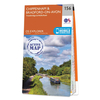


Ordnance Survey Map Of Chiltern Hills West
The OS Explorer map of Chiltern Hills West, including Henley-on-Thames, and Wallingford is a must-have when visiting the Chiltern Hills, or 'The Chilterns' as they are referred to locally.Given the title of AONB in 1965, the Chiltern Hills are a quintessential piece of British countryside. So much to see and do crammed into one map, some notable highlights include: Henley-on-Thames, Wallingford, Purley-on-Thames, Watlington, Caversham, the Chilterns and North Wessex Downs, the Chiltern Way, Thames Path, River Thames, and a section of the Ridgeway.Our OS Explorer maps are perfect for day-tripping, extensive hikes, and cycling. They come in both standard and Weatherproof Active, so you'll never get caught out in a storm. Format: Folded map Physical Size: 952 x 1270 mm (133 x
240 mm folded) Publication Date: 16/09/2015
240 mm folded) Publication Date: 16/09/2015


Product Description
Reviews/Comments
Add New
Intelligent Comparison
Available

Ordnance Survey Map Of Chiltern Hills West Ordnance Survey
£12.99
Available

Ordnance Survey Map Of Chiltern Hills East Ordnance Survey
£12.99
Available

Ordnance Survey Map Of Chiltern Hills East Ordnance Survey
£16.99
Available

Ordnance Survey Map Of Chiltern Hills North Ordnance Survey
£12.99
Available

Ordnance Survey Map Of Chiltern Hills North Ordnance Survey
£16.99
Vouchers
No voucher codes found.
Do you know a voucher code for this product or supplier? Add it to Insights for others to use.
Do you know a voucher code for this product or supplier? Add it to Insights for others to use.
 Denmark