More From Contributor

£8.99
Discover the past with a reproduction of an historical Ordnance Survey map for Taunton. Published from 1896 to 1904, the Revised New Edition for England & Wales maps show contours, latitude & longitude, parish boundaries, railways, roads, waterways & woods in 1 inch to 1 mile scale. These reproductions are printed on high quality, 200 gram sepia toned map paper, & are Approx. 55 x 43 cm (21 x 17 inches), giving an authentic look. They are supplied rolled, so are suitable for mounting or framing & are ideal for display, reference & research. This series of 477 historical maps was created to give accurate overview mapping for Great Britain, & was intended for military, government & leisure use, including touring & cycling. Many of the previous edition had become very out of date so a new survey was commissioned that began in 1893, with the maps being published as they were completed. These maps are the ' Outline' versions that show contour lines & features in h&-drawn black & white, & show many of the map symbols that we are familiar with today. As well as display, they are useful for tracing family history, researching development & understanding how both natural & man-made geography has changed since the end of the Victorian age. We have maps from the 1896 to 1904 editions available for most of Great Britain, however, some are missing as the originals were destroyed when the Ordnance Survey was bombed during the Second World War. This map covers Taunton in the Revised New Edition for England & Wales. Check the ' Area Covered' to determine what towns, cities & features are shown on this map. ...
Available
£12.00
Geological maps illustrate the nature, extent & relative age of rock types to be found in a district. Solid & Drift maps show the 'solid' (bedrock) geology & the 'drift' deposits (such as peat & glacial deposits) with equal emphasis – these map editions give the best impression of the underfoot geology. ...
Archived Product
£8.99
This OS Landranger map 158 of Tenby & Pembroke also

Includes::
Kilgetty, Freystrop, Yerbeston, Milford Haven,

...
Archived Product
£14.99
This OS Landranger map 158 of Tenby & Pembroke also

Includes::
Kilgetty, Freystrop, Yerbeston, Milford Haven,

...
Archived Product
£14.99
OS Explorer map 331 covers the River Teviot, Teviotdale, the Town of Hawick & the surrounding villages. The terrain is varied, with gentle valleys rising to some steep slopes & mid-height peaks. With this map you will receive a code for use on your i OS or Android smartphone or tablet. Find our more at Mobile Download FAQ. The OS Explorer map for Teviotdale South is available in both the standard paper version & weatherproof ' Active' version. ...
Available
£8.99
With 7 miles of seafront, there is a fantastic choice of beaches at Southend-on-Sea, shown on Landranger map 178. Try your hand at water sports at the Southend Marine Activities Centre or explore the longest pleasure Pier in the world. Across the Thames Estuary is the town of Rochester with its Norman castle, cathedral, farmers' markets & festivals. With this map you will receive a code for use on your i OS or Android smartphone or tablet. Find our more at Mobile Download FAQ. The OS Landranger map for Thames Estuary is available in both the standard paper version & weatherproof " Active" version. ...
Archived Product
£14.99
With 7 miles of seafront, there is a fantastic choice of beaches at Southend-on-Sea, shown on Landranger map 178. Try your hand at water sports at the Southend Marine Activities Centre or explore the longest pleasure Pier in the world. Across the Thames Estuary is the town of Rochester with its Norman castle, cathedral, farmers' markets & festivals. With this map you will receive a code for use on your i OS or Android smartphone or tablet. Find our more at Mobile Download FAQ. The OS Landranger map for Thames Estuary is available in both the standard paper version & weatherproof " Active" version. ...
Archived Product
£10.00
This map shows the three principal islands; Inis Oírr, Inis Meáin, & the largest one, Árainn.  A number of small villages are shown here; Cill Mhurbhigh, Cill Rónáin, & An Lorgain. A ferry service operates between the islands, & from the mainland from Galway, Doolin, & Rossaveel. This map displays three airstrips, one on each of the three islands. The Adventure Series is an activity oriented map which shows detailed landscape information in 1:25 000 scale, similar to the OS Explorer maps. It provides detailed mapping in specific locations around Ireland that are popular for outdoor activities. Some of the features included are National Roads, National Secondary Roads, Regional Roads, Waymarked walks, Tracks & Trails, Cycle Routes, Forestry, Land Terrain, Spot Heights, Contours, Named antiquities, Local amenities, National Parks, Lakes, Rivers & Streams. Printed on water resistant paper for greater durability. ...
Archived Product
£8.50
The States of Guernsey map of the Bailiwick is an Ordnance Survey style map with Guernsey at 1:15000 on the front & Alderney, Sark & Herm at 1:10000 on the reverse. It also has a town plan of St Peter Port at 1:3000. ...
Archived Product

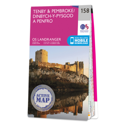
Map Of Tenby & Pembroke

Tenby & Pembroke map - OS Landranger 158 Publication Date: 24/02/2016
Availability: In Stock
£15.99

Product Description

Tenby & Pembroke map
- OS Landranger 158 Publication Date: 24/02/2016

Reviews/Comments

Add New

Price History

Vouchers

No voucher codes found.
Do you know a voucher code for this product or supplier? Add it to Insights for others to use.

Facebook

Jargon Buster

Date - A day on a calendar
Date - A social activity whith a current or potential partner

Supplier Information

Ordnance Survey
Navigate your world with confidence with Ordnance Survey (https://shop.ordnancesurvey.co.uk/)! Explore our extensive range of maps, guides, and outdoor gear designed to help you explore the great outdoors with ease. From detailed maps for hiking and cycling to innovative GPS devices, we've got everything you need to plan your next adventure. With our heritage of accuracy and reliability, Ordnance Survey is your trusted companion for exploring the UK's landscapes, whether you're a seasoned explorer or a weekend wanderer. Gear up and discover new horizons with Ordnance Survey today!
Page Updated: 2024-03-04 13:47:34

Community Generated Product Tags

Oh No! The productWIKI community hasn't generated any tags for this product yet!
Menu