
 United Kingdom
 France
 Germany
 Netherlands
 Sweden
 USA
USA
 Italy
Italy
 Spain
Spain
More From Contributor


Map Of Knoydart, Loch Hourn & Loch Duich
Map of Knoydart, Loch Hourn & Loch Duich - OS Explorer Map 413 (Kyle of Lochalsh) Publication Date: 16/09/2015


Product Description
Reviews/Comments
Add New
Intelligent Comparison
Available
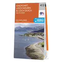
Ordnance Survey Map Of Knoydart, Loch Hourn & Loch Duich Ordnance Survey
£12.99
Vouchers
No voucher codes found.
Do you know a voucher code for this product or supplier? Add it to Insights for others to use.
Do you know a voucher code for this product or supplier? Add it to Insights for others to use.
 Denmark