More From Contributor

£21.99
This is an analogue navigation instrument with a pointer. Choose one of the eight map scales between 1:15.000 & 1:750.000 according to your map, & it measures your planned route. Given a known speed & you can then also calculate how long it will take to cover the rest of the trip ...
Available
£12.00
Geological maps illustrate the nature, extent & relative age of rock types to be found in a district. Bedrock & Superficial Deposits maps show the bedrock geology & the superficial deposits (such as peat & glacial deposits) with equal emphasis – these map editions give the best impression of the underfoot geology. ...
Archived Product
£5.99
Discover the past with a reproduction of an historical Ordnance Survey map for Aberayron. Published from 1896 to 1904, the Revised New Edition for England & Wales maps show contours, latitude & longitude, parish boundaries, railways, roads, waterways & woods in 1 inch to 1 mile scale. These reproductions are printed on high quality, 200 gram sepia toned map paper, & are Approx. 55 x 43 cm (21 x 17 inches), giving an authentic look. They are supplied rolled, so are suitable for mounting or framing & are ideal for display, reference & research. ...
Available
£8.99
Discover the past with a reproduction of an historical Ordnance Survey map for Abergavenny. Published from 1896 to 1904, the Revised New Edition for England & Wales maps show contours, latitude & longitude, parish boundaries, railways, roads, waterways & woods in 1 inch to 1 mile scale. These reproductions are printed on high quality, 200 gram sepia toned map paper, & are Approx. 55 x 43 cm (21 x 17 inches), giving an authentic look. They are supplied rolled, so are suitable for mounting or framing & are ideal for display, reference & research. ...
Available
£12.00
Geological maps illustrate the nature, extent & relative age of rock types to be found in a district. Solid & Drift maps show the 'solid' (bedrock) geology & the 'drift' deposits (such as peat & glacial deposits) with equal emphasis – these map editions give the best impression of the underfoot geology. ...
Archived Product
£14.99
Map sheet number 135 in the OS Landranger map series is the ideal map for planning days out & holidays on the west coast of Wales. From the lower edge of Snowdonia National Park & the nearby Machynlleth to the town of Aberystwyth, this area offers lots of outdoor activities & drives with wonderful scenery. Other areas included in the map area are Ponterwyd, Llanddeiniol & Aberhosan. With this map you will receive a code for use on your i OS or Android smartphone or tablet. Find our more at Mobile Download FAQ. The OS Landranger map for Aberystwyth & Machynlleth is available in both the standard paper version & weatherproof " Active" version. ...
Archived Product
£8.99
Discover the past with a reproduction of an historical Ordnance Survey map for Aberystwyth. Published from 1896 to 1904, the Revised New Edition for England & Wales maps show contours, latitude & longitude, parish boundaries, railways, roads, waterways & woods in 1 inch to 1 mile scale. These reproductions are printed on high quality, 200 gram sepia toned map paper, & are Approx. 55 x 43 cm (21 x 17 inches), giving an authentic look. They are supplied rolled, so are suitable for mounting or framing & are ideal for display, reference & research. ...
Archived Product
£8.99
The eastern side of the Cairngorms National Park, the River don & the eastern Grampians are covered by OS Explorer Map OL 59 There are a number of peaks surrounding Strathdon to explore, including Mona Gowan (749 m) & Carn Mor (578 m). This map replaces the previous OS Explorer map 405 for this area. With this map you will receive a code for use on your i OS or Android smartphone or tablet. Find our more at Mobile Download FAQ. The OS Explorer map for Aboyne, Alford & Strathdon is available in both the standard paper version & weatherproof ' Active' version. ...
Available
£14.99
The eastern side of the Cairngorms National Park, the River don & the eastern Grampians are covered by OS Explorer Map OL 59 There are a number of peaks surrounding Strathdon to explore, including Mona Gowan (749 m) & Carn Mor (578 m). This map replaces the previous OS Explorer map 405 for this area. With this map you will receive a code for use on your i OS or Android smartphone or tablet. Find our more at Mobile Download FAQ. The OS Explorer map for Aboyne, Alford & Strathdon is available in both the standard paper version & weatherproof ' Active' version. ...
Available
£8.99
Map sheet number 186 in the OS Landranger map series is perfect for planning days out in the Aldershot & Guildford area. This are has plenty of things to see & do, such as great shopping in Guildford or walks in the North Downs. Highlights of the area include: The North Downs Way, Guildford, Alton, & King John's Castle. With this map you will receive a code for use on your i OS or Android smartphone or tablet. Find our more at Mobile Download FAQ. The OS Landranger map for Aldershot & Guildford is available in both the standard paper version & weatherproof " Active" version. ...
Archived Product

Map Of Aberystwyth & Machynlleth

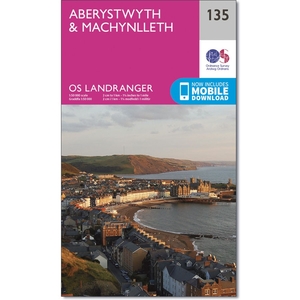
Map sheet number 135 in the OS Landranger map series is the ideal map for planning days out and holidays on the west coast of Wales. From the lower edge of Snowdonia National Park and the nearby Machynlleth to the town of Aberystwyth, this area offers lots of outdoor activities and drives with wonderful scenery. Other areas included in the map area are Ponterwyd, Llanddeiniol and Aberhosan.With this map you will receive a code for use on your iOS or Android smartphone or tablet. Find our more at Mobile Download FAQ.The OS Landranger map for Aberystwyth & Machynlleth is available in both the standard paper version and weatherproof "Active" version.
RIP - This product is no longer available on our network. It was last seen on 14.11.2020

This page now acts as a permanent archive for this product. Add more information using the comments box below to ensure it can still be found by future generations.

Use our search facility to see if it is available from an alternative contributor.
Availability: In Stock
£8.99

Product Description

Map sheet number 135 in the OS Landranger map series is the ideal map for planning days out & holidays on the west coast of Wales. From the lower edge of Snowdonia National Park & the nearby Machynlleth to the town of Aberystwyth, this area offers lots of outdoor activities & drives with wonderful scenery. Other areas included in the map area are Ponterwyd, Llanddeiniol & Aberhosan. With this map you will receive a code for use on your i OS or Android smartphone or tablet. Find our more at Mobile Download FAQ. The OS Landranger map for Aberystwyth & Machynlleth is available in both the standard paper version & weatherproof " Active" version.

Reviews/Comments

Add New

Price History

Vouchers

No voucher codes found.
Do you know a voucher code for this product or supplier? Add it to Insights for others to use.

Facebook

Jargon Buster

Paper - A thin sheet mainly used for writing. Available in a variety of colours. Made mainly from wood pulp.
edge - Enhanced data rates for GSM evolution also known as enhanced GPRS. A mobile phone technology with improved data transmission rates.
edge - The point at which two surfaces meet
Ideal - Something that satisfies a perfect criteria.
Wonderful - Another word for describing something that is extremely good, marvellous.

Supplier Information

Ordnance Survey
Navigate your world with confidence with Ordnance Survey (https://shop.ordnancesurvey.co.uk/)! Explore our extensive range of maps, guides, and outdoor gear designed to help you explore the great outdoors with ease. From detailed maps for hiking and cycling to innovative GPS devices, we've got everything you need to plan your next adventure. With our heritage of accuracy and reliability, Ordnance Survey is your trusted companion for exploring the UK's landscapes, whether you're a seasoned explorer or a weekend wanderer. Gear up and discover new horizons with Ordnance Survey today!
Page Updated: 2024-03-04 13:47:34

Community Generated Product Tags

Oh No! The productWIKI community hasn't generated any tags for this product yet!
Menu