
 United Kingdom
 France
 Germany
 Netherlands
 Sweden
 USA
USA
 Italy
Italy
 Spain
Spain
More From Contributor

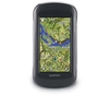

Garmin Montana Auto Friction Mount
Garmin Montana Auto Friction Mount
Your ultimate travel companion, this portable dashboard mount keeps MontanaTM in view as you drive and is a great alternative when windshield mounts are prohibited. The kit includes a mount with an integrated speaker and a portable friction mount for simple installation. It also includes a vehicle power cable.
Compatible with Montana 600, 600 UK, 650, and 650t.

Product Description
Reviews/Comments
Add New
Vouchers
No voucher codes found.
Do you know a voucher code for this product or supplier? Add it to Insights for others to use.
Do you know a voucher code for this product or supplier? Add it to Insights for others to use.
 Denmark