
 United Kingdom
 France
 Germany
 Netherlands
 Sweden
 USA
USA
 Italy
Italy
 Spain
Spain
More From Contributor

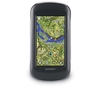
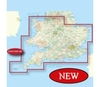
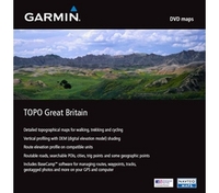
Garmin MapSource TOPO GB Topographic Map With Basecamp
Garmin TOPO GB Topographic Map
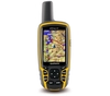
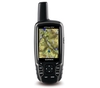
Trek through the highlands and the lowlands with detailed topographic maps. TOPO Great Britain includes terrain contours, topo elevations, summits, routable roads, paths, parks, coastlines, rivers, lakes and geographical points. These detailed maps are ideal for hiking, hunting, cycling and communing with nature. Coverage includes topographic detail throughout Great Britain. Available on DVD. Topographic data is provided by Ordnance Survey of Great Britain road maps are provided by NAVTEQTM.
Features:
*Includes topographic coverage throughout Great Britain.
*Provides detailed digital topographic maps with topographic data from Ordnance Survey of Great Britain.
*Contains summit locations with elevation, detailed contours, and trig
points. *Allows you to search by city, geographic point, summit, lakes and more. *Provides elevation profile on compatible Garmin devices so you can estimate terrain difficulty. *Contains many trails, tracks and paths. *Includes points of interests such as parks, scenic lookouts and picnic sites as well as lodging, food, petrol stations and hopsitals. *(DVD/CD-ROM only) Includes MapSource, computer software that lets you plan trips on your computer and transfer waypoints, routes and tracks between your computer and your Garmin device.
points. *Allows you to search by city, geographic point, summit, lakes and more. *Provides elevation profile on compatible Garmin devices so you can estimate terrain difficulty. *Contains many trails, tracks and paths. *Includes points of interests such as parks, scenic lookouts and picnic sites as well as lodging, food, petrol stations and hopsitals. *(DVD/CD-ROM only) Includes MapSource, computer software that lets you plan trips on your computer and transfer waypoints, routes and tracks between your computer and your Garmin device.

Product Description
Reviews/Comments
Add New
Vouchers
No voucher codes found.
Do you know a voucher code for this product or supplier? Add it to Insights for others to use.
Do you know a voucher code for this product or supplier? Add it to Insights for others to use.
 Denmark