More From Contributor

£10.95
Domodossola
- Val Formazza, map no. 11, in a series contoured hiking maps at 1:50, 000 with local trails, long-distance footpaths,
...
Archived Product
£13.99
Domodossola
- Val Formazza area of the Italian Alps in a series contoured hiking maps at 1:50, 000 with local trails, long-distance
...
Archived Product
£18.99
Domodossola
- Val Grande National Park, map No. 285T, at 1:50, 000 in a special hiking edition of the country’s topographic
...
Archived Product
£7.99
Domodossola area in the Italian Alps on a contoured map at 1:30, 000 in a series from Zanetti Editore highlighting waymarked hiking trails, refuges & places of interest. Maps in this series have contours at 25m with spot heights, shading & colouring for woodlands show the topography. Local footpaths are marked, with an overprint highlighting waymarked routes & indicating difficult sections. A varying range of symbols shows local facilities & places of interest. Some titles have grid lines, presumably of a UTM grid, but without indicating any coordinates. Map legend is in Italian (in some titles also in German). To see the list of titles in this series please click on the series link. ...
Archived Product
£12.99
Domodossola, map No. 285, in the standard topographic survey of Switzerland at 1:50, 000 from Swisstopo, i.e. without the special overprint highlighting walking trails, local bus stops, etc, presented in Swisstopo’s hiking editions of the 50K survey. The map covers the Italian side of the border. Highly regarded for their superb use of graphic relief & hill shading, the maps give an almost 3-D picture of Switzerland`s mountainous terrain. Contours are at 20m intervals. All the maps have a 1-km grid with the Swiss national coordinates. This standard version of the 50K survey covers the whole country on 78 small format sheets, with special larger format maps published for several popular tourist destinations. Small format sheets cover an area of 35 x 24 km (21 x 15 miles approx) & have map legend in the language of the area covered by the map. The special larger sheets cover 50 x 35 km (31 x 22 miles approx) & have no map legend, but a separate leaflet can be provided instead.PLEASE NOTE: the hiking editions of the 1:50, 000 Swisstopo survey are listed on our website in a separate series. ...
Archived Product
£12.99
Topographic survey of France at 1:25, 000 in IGN`s excellent TOP25 / Série Bleue series. All the maps are GPS compatible, with a 1km UTM grid plus latitude & longitude lines at 5’ intervals. Contours are at 5m intervals except for mountainous areas where the maps have contours at 10m intervals, vividly enhanced by hill shading & graphics for rocky terrain. Colouring with graphics indicates different types of vegetation or land use (deciduous or coniferous forests, moors, orchards, vineyards, etc). PLEASE NOTE: coverage of France at this scale is currently being revised – the format & the presentation of each title are indicated by the letters at the end of its Sheet Reference number (e.g. 0416ET, 3531ETR, 1923SB, etc.)MAPS WITH FULL TOURIST OVERPRINT & AN ENGLISH MAP LEGEND: all TOP25 maps & the SB editions of Série Bleue have an overprint highlighting waymarked walking trails including long-distance GR routes &, where appropriate, ski routes. Symbols indicate campsites, gîtes d’etape, refuges, equestrian centres & other recreational facilities or sites, tourist information centres, cultural heritage, etc. Towns & locations of particular interest are highlighted.- ET or OT = single-sided TOP25 map covering approx. 29x 21 km / 18x 13 miles.- ETR or OTR = waterproof & tear resistant TOP25 map covering the same area as the corresponding ET or OT number, but double-sided, printed on a smaller size sheet with a good overlap between the sides.- SB = Série Bleue map with full tourist overprint; these maps, first introduced in summer 2014, each cover approx. 29x 24km / 18x 15 miles.SÉRIE BLEUE maps with numbers ending in E (Est) or O (Ouest): most editions now indicate the GR routes, but do not show any other tourist information. Map legend is in French only. Each map covers approx. 14x 20km / 9x 12 miles. ...
Archived Product
£33.99
The definitive guide from the world`s best-known sailboat maintenance expert Don Casey`s Complete Illustrated Sailboat Maintenance Manual combines six core volumes into a single, utterly dependable resource that answers every frequent question, explains every major system, & helps you keep your boat & its components shipshape. More than 2, 500 clear & detailed illustrations guide you step by step through every procedure. Casey`s technical virtuosity, his user-friendly explanations, & Peter Compton`s diesel engine expertise make even the more complicated repairs & improvements easy to underst&. This must-have guide saves you time, money, & grief as you learn the fastest, easiest, most effective ways to: Evaluate the condition of your boat or one you`re about to purchase Repair structural damage to your fiberglass sailboat Improve or repair your sailboat`s electrical system Troubleshoot, maintain, & repair your boat`s diesel engine Put a professional-looking finish on your boat`s hull, deck, spars, wood, & trim Make & repair sails, sail covers, dodgers, awnings, sailbags, & bimini tops ...
Archived Product
£8.99
Considered by Graham Greene to be Maugham`s best work, ” Don Fernando” is a paean to a golden age of enormous creative energy. It discusses the writings of St. Teresa & the paintings of El Greco, & comments with sagacity & wit on such illustrious figures as Cervantes, Velazquez & the creator of Don Juan. This vibrant assessment of a great people at their greatest hour is full of happy surprises, curious facts & stimulating opinions that reflect Maugham`s lifelong enchantment with the landscape & people of Spain. ...
Archived Product
£35.00
Don Mc Cullin`s reputation stands as one of the greatest war photographers of our times. In recent years he has photographed the landscape surrounding his home in Somerset, but his later travels have taken him to some of the most remote regions in the world. His skill in photographing people in extreme situations has enabled him to mix with tribes on the edges of civilisation. His work among the people of Irian Jaya, including cannibals, appeared in his last book, Don Mc Cullin. Mc Cullin`s new work in Africa reaches one of the last corners of the earth where signs of outside influence are few, though they appear ominously significant. Over the last two years Don Mc Cullin has travelled south from Addis Ababa in Ethiopia to the valley of the Omo River leading down to the border with Sudan. There he has entered the tribal lands of the Surma, the Gheleb, the Bume, the Erbore, the Bene, the Bodi, the Karo, the Hamar & the Mursi. Extraordinary body paints decorate many of their bodies. Metalwork adorns their limbs, &, in the case of the Mursi, huge circular plates extend their lower lips & piercings open up large holes in their ear lobes. Ritualistic stick battles are enacted with ferocity. Rifles & machine guns are often cradled in the hands of warriors. The violence Mc Cullin witnessed was staged but real dangers were close. African tribespeople can present another face of the exotic to those of us in modern, developed cultures, especially if the photography recognises nothing of their dignity but all of their exoticism. Mc Cullin knows too much to fall into that trap. Mc Cullin`s subjects retain their dignity & also become heroic. We, the viewers, can be amazed by their strength & beauty, & all the more so because Mc Cullin`s compassionate photography enables us to understand their vulnerability. Mc Cullin`s photographs will be prefaced by extracts from his diaries. ...
Archived Product
£18.99
Don Mc Cullin is one of the greatest photographers of conflict in our time. This book was conceived on a grand scale that does justice to his extraordinary life & the events he has witnessed. It forms one of the great documents of the latter part of the last century. The book begins & ends in the Somerset landscape that surrounds Mc Cullin's home, but the whole sequence of more than two hundred photographs encompasses a ravaged northern Engl&, war in Cyprus, Biafra, Vietnam, Cambodia, Beirut & riots in Derry. The climax of the book is among the cannibals & tribespeople deep in the jungles of Irian Jaya, where Mc Cullin focuses on humanity in an almost Stone Age condition. The introduction by Harold Evans, the acclaimed newspaper editor & authority on photojournalism, is drawn from his long experience of working with Mc Cullin. The distinguished novelist & essayist, Susan Sontag, has contributed an essay on Mc Cullin & the role of witness to conflict
- a subject of timely pertinence.
...
Archived Product

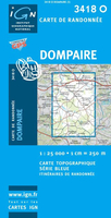
Dompaire

Topographic survey of France at 1:25, 000 in IGN`s excellent TOP25 / Série Bleue series. All the maps are GPS compatible, with a 1km UTM grid plus latitude and longitude lines at 5’ intervals. Contours are at 5m intervals except for mountainous areas where the maps have contours at 10m intervals, vividly enhanced by hill shading and graphics for rocky terrain. Colouring with graphics indicates different types of vegetation or land use (deciduous or coniferous forests, moors, orchards, vineyards, etc). PLEASE NOTE: coverage of France at this scale is currently being revised – the format and the presentation of each title are indicated by the letters at the end of its Sheet Reference number (e.g. 0416ET, 3531ETR, 1923SB, etc.)MAPS WITH FULL TOURIST OVERPRINT & AN ENGLISH MAP
LEGEND: all TOP25 maps and the SB editions of Série Bleue have an overprint highlighting waymarked walking trails including long-distance GR routes and, where appropriate, ski routes. Symbols indicate campsites, gîtes d’etape, refuges, equestrian centres and other recreational facilities or sites, tourist information centres, cultural heritage, etc. Towns and locations of particular interest are highlighted.- ET or OT = single-sided TOP25 map covering approx. 29x21 km / 18x13 miles.- ETR or OTR = waterproof and tear resistant TOP25 map covering the same area as the corresponding ET or OT number, but double-sided, printed on a smaller size sheet with a good overlap between the sides.- SB = Série Bleue map with full tourist overprint; these maps, first introduced in summer
2014, each cover approx. 29x24km / 18x15 miles.SÉRIE BLEUE maps with numbers ending in E (Est) or O (Ouest): most editions now indicate the GR routes, but do not show any other tourist information. Map legend is in French only. Each map covers approx. 14x20km / 9x12 miles.
RIP - This product is no longer available on our network. It was last seen on 25.09.2019

This page now acts as a permanent archive for this product. Add more information using the comments box below to ensure it can still be found by future generations.

Use our search facility to see if it is available from an alternative contributor.
  • Availability: Out Of Stock
  • Supplier: Stanfords
  • SKU: 9782758509929
Availability: In Stock
£11.50

Product Description

Topographic survey of France at 1:25, 000 in IGN`s excellent TOP25 / Série Bleue series. All the maps are GPS compatible, with a 1km UTM grid plus latitude & longitude lines at 5’ intervals. Contours are at 5m intervals except for mountainous areas where the maps have contours at 10m intervals, vividly enhanced by hill shading & graphics for rocky terrain. Colouring with graphics indicates different types of vegetation or land use (deciduous or coniferous forests, moors, orchards, vineyards, etc). PLEASE NOTE: coverage of France at this scale is currently being revised – the format & the presentation of each title are indicated by the letters at the end of its Sheet Reference number (e.g. 0416ET, 3531ETR, 1923SB, etc.)MAPS WITH FULL TOURIST OVERPRINT & AN ENGLISH MAP LEGEND: all TOP25 maps & the SB editions of Série Bleue have an overprint highlighting waymarked walking trails including long-distance GR routes &, where appropriate, ski routes. Symbols indicate campsites, gîtes d’etape, refuges, equestrian centres & other recreational facilities or sites, tourist information centres, cultural heritage, etc. Towns & locations of particular interest are highlighted.- ET or OT = single-sided TOP25 map covering approx. 29x 21 km / 18x 13 miles.- ETR or OTR = waterproof & tear resistant TOP25 map covering the same area as the corresponding ET or OT number, but double-sided, printed on a smaller size sheet with a good overlap between the sides.- SB = Série Bleue map with full tourist overprint; these maps, first introduced in summer 2014, each cover approx. 29x 24km / 18x 15 miles.SÉRIE BLEUE maps with numbers ending in E (Est) or O (Ouest): most editions now indicate the GR routes, but do not show any other tourist information. Map legend is in French only. Each map covers approx. 14x 20km / 9x 12 miles.

Reviews/Comments

Add New

Intelligent Comparison

Oooops!
We couldn't find anything!
Perhaps this product's unique.... Or perhaps we are still looking for comparisons!
Click to bump this page and we'll hurry up.

Price History

Vouchers

No voucher codes found.
Do you know a voucher code for this product or supplier? Add it to Insights for others to use.

Facebook

Jargon Buster

GPS - Global Positioning System - Global position using satellites
Summer - The season between Spring and Autumn. Usually the hottest season of the year
France - A state situated in Western Europe with several overseas territories.
Graphics - A general term for visual aspects of an item/display
Waterproof - Resistant to water, usualy specified by depth in metres
Size - is the measurement of how big an object is in space.
Km - Kilometre. A unit of measurement equal to 1000 metres.
Resistant - Something that can repel against something.
Reference - To prove evidence with a back up source.

Supplier Information

Stanfords
Stanfords was established in 1853 and opened their iconic Covent Garden flagship store in 1901. They have become the top retailer of maps, travel books and accessories in the UK and arguably offer the largest selection of maps and travel books worldwide. Famous names such as Captain Robert Falcon Scott, Ranulph Fiennes and Michael Palin have purchased from Stanfords. They now have a shop in Bristol and both stores together with other venues operate a calendar of events including talks, book signings and exhibitions. As a specialist map retailer, the map selection is comprehensive and includes road maps, street maps and walking maps from worldwide destinations, as well as a selection of world atlases and wall maps. Books include travel guides and travel literature. Stanfords also stock globes, from miniatures made of blue marble to magnificent floor-standing globes. The website features a selection of interesting articles on travel topics.
Page Updated: 2023-11-12 20:15:36

Community Generated Product Tags

Oh No! The productWIKI community hasn't generated any tags for this product yet!
Menu