
 United Kingdom
 France
 Germany
 Netherlands
 Sweden
 USA
USA
 Italy
Italy
 Spain
Spain
More From Contributor


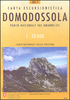


Domodossola 30K Zanetti Map No. 64
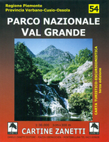
Domodossola area in the Italian Alps on a contoured map at 1:30, 000 in a series from Zanetti Editore highlighting waymarked hiking trails, refuges and places of interest. Maps in this series have contours at 25m with spot heights, shading and colouring for woodlands show the topography. Local footpaths are marked, with an overprint highlighting waymarked routes and indicating difficult sections. A varying range of symbols shows local facilities and places of interest. Some titles have grid lines, presumably of a UTM grid, but without indicating any coordinates. Map legend is in Italian (in some titles also in German).To see the list of titles in this series please click on the series link.

Product Description
Reviews/Comments
Add New
Vouchers
No voucher codes found.
Do you know a voucher code for this product or supplier? Add it to Insights for others to use.
Do you know a voucher code for this product or supplier? Add it to Insights for others to use.
 Denmark