
 United Kingdom
 France
 Germany
 Netherlands
 Sweden
 USA
USA
 Italy
Italy
 Spain
Spain
More From Contributor


Dominican Republic And Haiti
Description of the previous edition: Dominican Republic and Haiti at 1:600, 000 from Nelles Verlag, with an enlargement for the Punta Cana area, plus street plans of Santo Domingo, Puerto Plata, Santiago de los Caballeros and Port-au-Prince. Each country is covered on one side of the map, accompanied by the relevant street plans.Relief shading with spot heights and names of mountain ranges presents the topography. Road network distinguishes between highways in good and poor condition and shows distances on main routes. Local airports are shown and in the Dominican Republic railway lines are included. The map also shows internal administrative boundaries in each country with names of the provinces.Various places of interest are prominently marked, including national parks or other
protected areas and beaches. Latitude and longitude margin ticks are at 1
protected areas and beaches. Latitude and longitude margin ticks are at 1
Product Description
Reviews/Comments
Add New
Intelligent Comparison
Archived Product
Dominican Republic And Haiti Stanfords
£10.39
Archived Product
Dominican Republic - Haiti Stanfords
£9.50
Archived Product
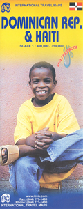
Dominican Republic & Haiti ITMB Stanfords
£9.99
Archived Product
Dominican Republic And Haiti SUPERCEDED Stanfords
£12.99
Archived Product
Dominican Republic Stanfords
£11.19
Archived Product
Dominican Republic (ed. 3) Stanfords
£10.39
Archived Product
Birds Of The Dominican Republic & Haiti Stanfords
£24.99
Archived Product
Dominican Republic Borch Stanfords
£9.99
Vouchers
No voucher codes found.
Do you know a voucher code for this product or supplier? Add it to Insights for others to use.
Do you know a voucher code for this product or supplier? Add it to Insights for others to use.
 Denmark