More From Contributor
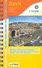
£12.99
Zurich Then & Now map from Swisstopo, Switzerland’s national survey organization, with an excellent combination of two detailed topographic maps & two aerial photos, comparing presentation of the city at different stages in its development. One side shows the city & its environs on two topographic maps at 1:25, 000: a beautiful colour reproduction of Swiss Survey’s famous “ Dufourkarte” series drawn between 1846 & 1851, contrasting it with a map of the same area from 2007. On the reverse there are two aerial images at 1:16, 000: a black & white photo from 1931 with the same area photographed in colour in 2007. The accompanying text about the two topographic series & the two aerial imagery series is in French & German only. For the list of other titles in this series please click on the series link. ...
Archived Product
£10.99
Zurich on a beautifully h&-drawn panorama map from Gecko Maps offering a 3-D bird`s-eye view of the city, with on the reverse a more detailed enlargement of its historic centre. Every building is drawn to scale with full architectural details. Drawn by the renowned artist Ruben Atoyan who specializes in this kind of mapping, this title presents on one side a view of the city looking south-east, with the mountains across Lake Zurich framing the top of the map. Coverage to the west extends to the Sihl & a panel at the bottom presents a selection of the city’s best know buildings, including the central railway station, the town hall, university buildings & several churches. On the reverse the city’s historic centre is presented in greater detail, highlighting recommended sightseeing routes to view its most interesting buildings. Map legend

Includes::
English.

...
Archived Product
£8.99
Pocket street plan of Zurich at 1:17, 500 from Orell Füssli’s range of street plans of Swiss cities, providing coverage of the central section across the city & its suburbs, from Wollishofen on Lake Zurich across to the international airport at Kloten, but with only limited coverage of the western & eastern districts. Tram & bus routes are shown with line numbers & stops, & on an enlargement for the city centre at 1:10, 000 one way streets are also marked. On some longer streets selected house numbers are indicated. The map is indexed &

Includes::
brief notes & a list of useful phone numbers. Map legend & the text include English. Unfortunately some of the street names are difficult to read, particularly on the enlargement for the city centre, almost obliterated by symbols highlighting various places of interest. Better know for its gnomes & bankers, Zurich is apparently full of night clubs!

...
Archived Product
£21.99
Zurich Pocket Street Atlas from the locally based cartographic publishers Orell Füssli, presenting the city with its outer suburbs at 1:17, 500. Bus, tram & S-Bahn routes are shown with line numbers & stops/stations. For drivers the atlas shows main traffic arteries, one way streets, car & coach parks, & park+ride facilities. Longer streets are annotated with selected house numbers for easier identification of addresses. Important buildings are highlighted & named, & a range of symbols indicates various places of interest. In addition to the street index the atlas has a directory of useful addresses. Map legend

Includes::
English.

...
Archived Product
£4.99
Handy, pocket-size, pop-up Zurich map. Ideal to pop in a pocket or handbag for quick reference while exploring the city. Explore Zurich with ease with the help of this genuinely pocket-sized, pop-up map. Small in size yet big on detail, this compact, dependable, city map will ensure you don`t miss a thing.

Includes::
2 Pop Out maps: an overview of the greater city area & a detailed street map of central Zurich Additional maps of the area surrounding Zurich & the transport system are also included Handy, self-folding, tourist map is small enough to fit in your pocket yet offers extensive coverage of the city in an easy-to-use format Thorough street index is also featured & cross-referenced to the map so you can easily find your destination Hotels, restaurants, stores & attractions are all included on the map Fold

Size:
95mm x 130mm Sheet

Size:
215mm x 250mm (per sheet; 2 sheets) Approx scale: 1:8, 000 (central map) 1:28, 000 (greater map). Scale to be used as a guideline only.


...
Archived Product
£3.99
The ultimate pocket map of Zurich! Explore Zurich with ease with the help of this genuinely pocket-sized, pop-up map. Small in size yet big on detail, this compact, dependable, city map will ensure you don't miss a thing.

Includes::
2 Pop Out maps: an overview of the greater city area & a detailed street map of central Zurich Additional maps of the area surrounding Zurich & the transport system are also included Handy, self-folding, tourist map is small enough to fit in your pocket yet offers extensive coverage of the city in an easy-to-use format Thorough street index is also featured & cross-referenced to the map so you can easily find your destination Hotels, restaurants, stores & attractions are all included on the maps

...
Archived Product
£23.99
Zurich Street Atlas from Orell Füsli with an excellent street index, plus extensive lists of main sights, cultural establishments, restaurants, shops, & other useful practical information for the residents & tourists alike. The atlas covers Zurich with its outer suburbs at 1:15, 000 with the city centre, from the central railway station to the Opera House, shown at 1:10, 000. Bus, tram & S-bahn routes are shown with stops & line numbers. One way streets are shown only on the enlargement for the central part, but parking facilities are marked throughout the whole area. A range of symbols highlight various places of interest, including monuments, museums, shopping centres, etc. Map legend

Includes::
English. Extensive street index lists each commune separately & within Zurich’s municipal area gives the beginning & end point for each street as well as its district & postcode, e.g. Abeggweg: starts at Laubiweg 12, ends at Fürstweg 11, district 6, postcode 8057. The atlas has a 43-page guide to the city with list of restaurants by cuisine, main sights, museum & galleries, shops
- each section showing photos of selected establishments with brief descriptions (in German only), opening times & access by public transport. Also included are extensive lists of other useful facilities & public offices.


...
Archived Product
£12.99
Map No. 1091, Zurich, in the topographic survey of Switzerland at 1:25, 000 from Bundesamt für Landestopographie (swisstopo), covering the whole country on 247 small format sheets, with special larger maps published for popular regions including some titles now available in hiking versions. Highly regarded for their superb use of graphic relief & hill shading, the maps give an almost 3-D picture of Switzerland`s mountainous terrain. Contours are at 10 m intervals, with 20m intervals in the mountainous areas. All the maps have a 1-km grid for Swiss national coordinates (datum CH 1903). * Small format sheets (Nos. 1011
- 1374)* Map legend in the language of the area covered by the map. Additional margin ticks show latitude & longitude in steps of 2`. The area covered by each map is 17 x 12 km (11 x 7 miles approx). * Special larger sheets (Nos. from 2501 onwards) – STANDARD editions:* No map legend is included but a separate leaflet can be provided instead. The area covered by each map is 25 x 17 km (15 x 11 miles approx).* Special larger sheets (Nos. from 2501 onwards) – HIKING editions:* An overprint highlights hiking, mountain & alpine paths, including regional & national long-distance trails. The maps also show bus routes with bus stops, plus inns in remote locations. The area covered by each map is 25 x 17 km (15 x 11 miles approx).
...
Archived Product
£12.99
Zurich, map No. 225, in the standard topographic survey of Switzerland at 1:50, 000 from Swisstopo, i.e. without the special overprint highlighting walking trails, local bus stops, etc, presented in Swisstopo’s hiking editions of the 50K survey. Highly regarded for their superb use of graphic relief & hill shading, the maps give an almost 3-D picture of Switzerland`s mountainous terrain. Contours are at 20m intervals. All the maps have a 1-km grid with the Swiss national coordinates. This standard version of the 50K survey covers the whole country on 78 small format sheets, with special larger format maps published for several popular tourist destinations. Small format sheets cover an area of 35 x 24 km (21 x 15 miles approx) & have map legend in the language of the area covered by the map. The special larger sheets cover 50 x 35 km (31 x 22 miles approx) & have no map legend, but a separate leaflet can be provided instead.PLEASE NOTE: the hiking editions of the 1:50, 000 Swisstopo survey are listed on our website in a separate series. ...
Archived Product
£18.99
Zürich area, map No. 225T, at 1:50, 000 in a special hiking edition of the country’s topographic survey, published by Swisstopo in cooperation with the Swiss Hiking Federation. Cartography, identical to the standard version of the survey, is highly regarded for its superb use of graphic relief & hill shading to provide an almost 3-D picture of Switzerland`s mountainous terrain. Contours are at 20m intervals. An overprint highlights routes maintained by the SHF, distinguishing between hiking routes, mountain routes requiring proper footwear, & alpine routes where equipment is needed. Paths which are part of the national or regional network of long-distance hiking routes are specially marked & in the more recent editions are annotated with their official numbers. The maps show mountain huts, refuges & in remote areas also inns, plus roads with bus service & the positions of bus stops. All the maps have a 1-km grid of the Swiss national coordinates. For a list of all the titles in this series, please click on the series link. ...
Archived Product

Zurich PopOut Map

Zurich Pop-Out Map from Compass Maps in a series designed to provide two street plans, the city centre plus a wider area around it, in a handy format to fit neatly all but the smallest pockets, with, as appropriate, transport network diagrams, additional useful maps, etc. Each title
RIP - This product is no longer available on our network. It was last seen on 25.09.2019

This page now acts as a permanent archive for this product. Add more information using the comments box below to ensure it can still be found by future generations.

Use our search facility to see if it is available from an alternative contributor.
  • Availability: Out Of Stock
  • Supplier: Stanfords
  • SKU: 9781845877156
Availability: In Stock
£2.99

Product Description

Zurich Pop-Out Map from Compass Maps in a series designed to provide two street plans, the city centre plus a wider area around it, in a handy format to fit neatly all but the smallest pockets, with, as appropriate, transport network diagrams, additional useful maps, etc. Each title

Reviews/Comments

Add New

Price History

Vouchers

No voucher codes found.
Do you know a voucher code for this product or supplier? Add it to Insights for others to use.

Facebook

Jargon Buster

Pockets - A small bag to carry items usually sewn on the side of garments
Network - A link and communication between things. Often computers or people.
Transport - Something that carries people or goods.

Supplier Information

Stanfords
Stanfords was established in 1853 and opened their iconic Covent Garden flagship store in 1901. They have become the top retailer of maps, travel books and accessories in the UK and arguably offer the largest selection of maps and travel books worldwide. Famous names such as Captain Robert Falcon Scott, Ranulph Fiennes and Michael Palin have purchased from Stanfords. They now have a shop in Bristol and both stores together with other venues operate a calendar of events including talks, book signings and exhibitions. As a specialist map retailer, the map selection is comprehensive and includes road maps, street maps and walking maps from worldwide destinations, as well as a selection of world atlases and wall maps. Books include travel guides and travel literature. Stanfords also stock globes, from miniatures made of blue marble to magnificent floor-standing globes. The website features a selection of interesting articles on travel topics.
Page Updated: 2023-11-12 20:15:36

Community Generated Product Tags

Oh No! The productWIKI community hasn't generated any tags for this product yet!
Menu