More From Contributor
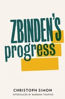
£8.50
Zaragoza/ Saragossa on an indexed street plan at 1:13, 300 from Telstar Distrimapas, Spain’s leading publisher of city maps, with a detailed enlargement of the city centre & English language descriptions of its main sights. On one side is an indexed street plan of the city indicating locations of car parks, taxi ranks, petrol stations, etc. Main public buildings & places interest are named. On the reverse the city centre is shown in greater detail at 1:10, 400. Street index is in a separate booklet which

Includes::
lists of various offices, services & facilities, including several hotels, restaurants, clubs, etc. Also provided is a list of bus lines, plus multilingual descriptions of 13 main sights. The text

Includes::
English.


...
Archived Product
£5.99
The once-mighty region of Aragon is now one of the peninsula's less known areas. From lively Zaragoza to the rugged extremes of the Pyrenees, Aragon remains sparsely populated yet there is much for visitors to enjoy. Footprint Focus provides invaluable information on transport, accommodation, eating & entertainment to ensure that your trip

Includes::
the best of this remote region of Spain. Essentials section with useful advice on getting to & around Aragon. Comprehensive, up-to-date listings of where to eat, sleep & play.

Includes::
information on tour operators & activities, from visiting Roman ruins in Zaragoza to hiking in the Pyrenees. Detailed maps for Aragon's key destinations. Slim enough to fit in your pocket. With detailed information on all the main sights, plus many lesser-known attractions, Footprint Focus Zaragoza & Aragon provides concise & comprehensive coverage of one of Spain's most far-flung regions. The content of the Footprintfocus Zaragoza & Aragon guide has been extracted from Footprint's Spain Guide.


...
Archived Product
£9.99
Contoured, GPS-compatible, indexed road map at 1:200, 000 from CNIG
- Spain’s civilian survey organization, with exceptionally
...
Archived Product
£12.99
Zurich’s central districts on an indexed street plan from Swiss publishers Orell Füssli, excellent for exploring the city by public transport & highlighting locations of 40 best sights, illustrated on the reverse with photos. Coverage extends north to the In Klösterli district, east just beyond the Zürichhorn & the China Garten, south to Alt-Wiedikon & west to the Schiffbau theatres. Tram & bus routes are shown with stops & line numbers. Interesting buildings are highlighted by small drawings & the map indicates locations of the city’s best sights which are illustrated on the reverse by colour photos. The index is next to the map. Also included are notes on the city’s history & its places of interest, plus a small panorama map showing Lake Zurich with the Alps in the background & highlighting sights outside the street plan. Map legend & the text include English. ...
Archived Product
£19.99
Züricher Oberland at 1:50, 000 in a series of waterproof & tear-resistant, contoured mountain biking maps from Hallwag, each highlighting several circuits & providing route profiles, guidance on the difficulty & overall experience, etc. PLEASE NOTE: the map covers an area east of the city, between the south-eastern part of Lake Zurich & Gossau. Zurich itself & its immediate environs are not on the map. Each map in this series is printed on sturdy, waterproof & tear-resistant plastic, & uses the same detailed base as other hiking & cycling map series from the Hallwag – Kümmerly + Frey publishing house. Contours are at 25m intervals, enhanced by shading & excellent graphic relief to provide a very clear picture of the topography. An overprint highlights several mountain bike circuits from main towns & holiday resorts on the map, indicating the direction of the route. The routes are graded by colour-coding into five degrees of difficulty. Additional information provided on the map

Includes::
youth hostels, Friends of Nature houses or isolated countryside hotels, viewpoints, interesting sites, etc. The maps have a 1-km gird, although no Swiss national survey coordinates are provided for it. On the reverse each of the highlighted circuits is presented on a route-profile which also indicates “beauty & experience value” (changes in landscape, viewpoints, etc); difficulty; overall severity (length + difference in elevation + difficulty); distance; difference in altitude; time required; & the highest point. The legend for the main map & for the route profiles

Includes::
English. Brief descriptions of each circuit are in German only.


...
Archived Product
£6.95
Map No. 141, Zdarske Vrchy, in a series of GPS compatible topographic maps of the Czech Republic at 1:75.000 from Shocart highlighting both signposted cycling routes & other local cycling paths, with route profiles & additional tourist information. Relief is shown by contour lines, spot heights, & subtle hill-shading. The maps show roads, tracks, railways, cable cars, chairlifts, & a range of natural landscape features & landmarks. Coloured symbols depict plenty of additional tourist features e.g. information centres, places of interest, antiquities, shelters, campsites, accommodation, bicycle services etc. An overprint highlights both signposted routes & other recommended routes which have no terrain markers. For all bike routes intermediate distances are shown. Hiking paths are also highlighted. Latitude & longitude margin ticks are at 5' intervals. Each map is accompanied by a booklet containing general information on the Czech cycle route network, elevation profile diagram for selected routes, plus an index for locations of historical & geographical interest, bicycle service workshops, information centres, & tourist attractions. Map legend & text are in English, German & Czech. ...
Archived Product
£11.99
An embarrassment of pandas, a galaxy of starfish, a shiver of sharks...these are all collective nouns
- terms used to describe
...
Archived Product
£13.95
One of the regional road maps derived from data provided by the Danish national survey organization, Kort og- Matrikelstyrelsen. Communications network

Includes::
secondary roads, motorway filling stations & services, scenic routes, etc., as well as railways & vehicle & passenger ferries. Symbols show various facilities & places of interest, including campsites, tourist offices, various landmarks, antiquities, amusement parks, zoos, viewpoints, etc. County boundaries are marked & forests, nature reserves, heaths, marshes, etc. are distinguished, although there is no relief detail. Latitude & longitude lines are drawn at 10' & 20' intervals respectively. Map legend in English, Danish & German. The maps have no index.

...
Archived Product
£9.50
Topographical survey of Belgium at 1:20, 000 from Nationaal Geografisch Instituut / Institut Géographique National, the country’s national survey organization. Each 20K map covers one quarter of the corresponding 1:50, 000 map (with adjustments in the border & coastal areas). The maps provide all the information expected of topographic mapping at this scale & in addition have an unusually large amount of vegetation and/or land use information (different types of woodlands, gardens, orchards, heath, etc). The maps have a 1-km UTM grid, with margin ticks for latitude & longitude at intervals of 1`. Map legend & a glossary of terms used on the maps include English. Stanfords keeps as regular stock 20K maps for the World War I battlefields around the Ypres, Messines & Passchendaele, & for the area of the Battle of Waterloo. The 1:20, 000 survey covers the whole of Belgium & maps for other regions can be supplied as special orders. To see the list of titles in this series please click on the series link.PLEASE NOTE: the Long-Distance Footpaths Map of Belgium at 1:300, 000 which shows the division of Belgium into the 50K survey sheets can also be used to see in more detail coverage by the 20K maps. ...
Archived Product
£14.99
This handy ANWB map full of great cycling routes, spread across the province & neighboring regions. Each guide contains 14 separate routes, printed on a card in A4 format. The route map contains clear route descriptions, sights, current cycling junctions long-distance routes, street names & all ANWB Hospitable Points. There is also a sheet with ANWB Node Cards & a brochure with the user manual & tips for each route map. With a scale of 1: 100, 000 (1 cm = 1 km) the cards are very readable. The ANWB Fietsgids is available in a series of 11 parts, in which all provinces are described in detail. ...
Archived Product

Zbinden`s Progress

Lukas Zbinden leans on the arm of Kazim, as they walk slowly down the stairway towards the door of his old people`s home. Step by step, the irrepressible Lukas recounts the life he shared with his wife Emilie and his son. She loved to walk in the countryside; he loved towns and meeting strangers. Different in so many ways, what was the secret of their life-long love? And why is it now so hard for him to talk to his son? Gradually we get to know a man with a twinkle in his eye and learn the captivating story of this man, his late wife, their son and the many people he has met along the way. Zbinden`s Progress is heart-rending, heart-warming and hilarious. --- Winner of the Bern Literature Prize 2010
RIP - This product is no longer available on our network. It was last seen on 25.09.2019

This page now acts as a permanent archive for this product. Add more information using the comments box below to ensure it can still be found by future generations.

Use our search facility to see if it is available from an alternative contributor.
  • External links may include paid for promotion
  • Availability: Out Of Stock
  • Supplier: Stanfords
  • SKU: 9781908276100
Availability: In Stock
£10.00

Product Description

Lukas Zbinden leans on the arm of Kazim, as they walk slowly down the stairway towards the door of his old people`s home. Step by step, the irrepressible Lukas recounts the life he shared with his wife Emilie & his son. She loved to walk in the countryside; he loved towns & meeting strangers. Different in so many ways, what was the secret of their life-long love? & why is it now so hard for him to talk to his son? Gradually we get to know a man with a twinkle in his eye & learn the captivating story of this man, his late wife, their son & the many people he has met along the way. Zbinden`s Progress is heart-rending, heart-warming & hilarious. --- Winner of the Bern Literature Prize 2010

Reviews/Comments

Add New

Intelligent Comparison

Oooops!
We couldn't find anything!
Perhaps this product's unique.... Or perhaps we are still looking for comparisons!
Click to bump this page and we'll hurry up.

Price History

Vouchers

No voucher codes found.
Do you know a voucher code for this product or supplier? Add it to Insights for others to use.

Facebook

Jargon Buster

Eye - An organ which detects light
Heart - An organ that pumps blood around the body. Usually related to love.
Love - Someone who shows deep affection for someone else.
Home - A place of permanent residence for families.

Supplier Information

Stanfords
Stanfords was established in 1853 and opened their iconic Covent Garden flagship store in 1901. They have become the top retailer of maps, travel books and accessories in the UK and arguably offer the largest selection of maps and travel books worldwide. Famous names such as Captain Robert Falcon Scott, Ranulph Fiennes and Michael Palin have purchased from Stanfords. They now have a shop in Bristol and both stores together with other venues operate a calendar of events including talks, book signings and exhibitions. As a specialist map retailer, the map selection is comprehensive and includes road maps, street maps and walking maps from worldwide destinations, as well as a selection of world atlases and wall maps. Books include travel guides and travel literature. Stanfords also stock globes, from miniatures made of blue marble to magnificent floor-standing globes. The website features a selection of interesting articles on travel topics.
Page Updated: 2023-11-12 20:15:36

Community Generated Product Tags

Oh No! The productWIKI community hasn't generated any tags for this product yet!
Menu