
 United Kingdom
 France
 Germany
 Netherlands
 Sweden
 USA
USA
 Italy
Italy
 Spain
Spain
More From Contributor


Zakinthos
Lesbos at 1:50, 000 from Freytag and Berndt with all place names shown in both Greek and Latin alphabet. The map is clear and easy to read, with large icons highlighting places of interest and larger size print than found on most similar maps.Relief shading shows the topography. Road network indicates unsurfaced roads. Driving distances are given on main routes and locations of petrol stations are marked. Large icons highlight various places of interest including campsites. The map has latitude and longitude lines at intervals of 5
Product Description
Reviews/Comments
Add New
Intelligent Comparison
Archived Product
Zakynthos Stanfords
£14.99
Archived Product

Zakynthos Stanfords
£14.99
Archived Product
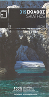
Skiathos Stanfords
£9.95
Vouchers
No voucher codes found.
Do you know a voucher code for this product or supplier? Add it to Insights for others to use.
Do you know a voucher code for this product or supplier? Add it to Insights for others to use.
 Denmark