
 United Kingdom
 France
 Germany
 Netherlands
 Sweden
 USA
USA
 Italy
Italy
 Spain
Spain
More From Contributor


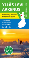
Ylläs Levi
Ylläs - Levi area at 1:50, 000 on a double-sided map in a series of beautiful and informative maps covering Finland’s most popular outdoor leisure areas with cartography from Karttakeskus, the country’s topographic survey. Maps in this series have excellent use of colours, shading and symbols to provide a very detailed picture of the terrain and vegetation. Extensive overprint highlights routes for hiking, and/or other outdoor pursuits, a wide variety of accommodation, from hotels and holiday villages to Lapland tepees, food and fuel supplies, etc. The maps have a UTM grid and margin ticks for latitude and longitude. Map legends include English. IN THIS TITLE: hiking and skiing map of the Lapland fell region of popular winter resort towns and Sami villages in the north-west of
Finland, close to the border with Sweden, including the towns of Sirkka, Äkäslompolo, Ylläsjärvi and Kittilä. Contours are at 5m intervals, with relief shading and colouring/symbols indicating different types of terrain and vegetation. An overprint highlights hiking trails, ski routes and canoe routes, as well as various types of accommodation (hotels, holiday camps, campsites, huts, etc.), restaurants and shopping facilities, petrol stations, etc. The map has a UTM grid and margin ticks for latitude and longitude in steps of 20`. Map legend includes English.Also provided three enlargements at 1:30, 000 showing hiking and ski trails, including the illuminated routes, in the immediate environs of Sirkka, Äkäslompolo and Ylläsjärvi.
Finland, close to the border with Sweden, including the towns of Sirkka, Äkäslompolo, Ylläsjärvi and Kittilä. Contours are at 5m intervals, with relief shading and colouring/symbols indicating different types of terrain and vegetation. An overprint highlights hiking trails, ski routes and canoe routes, as well as various types of accommodation (hotels, holiday camps, campsites, huts, etc.), restaurants and shopping facilities, petrol stations, etc. The map has a UTM grid and margin ticks for latitude and longitude in steps of 20`. Map legend includes English.Also provided three enlargements at 1:30, 000 showing hiking and ski trails, including the illuminated routes, in the immediate environs of Sirkka, Äkäslompolo and Ylläsjärvi.

Product Description
Reviews/Comments
Add New
Vouchers
No voucher codes found.
Do you know a voucher code for this product or supplier? Add it to Insights for others to use.
Do you know a voucher code for this product or supplier? Add it to Insights for others to use.
 Denmark