More From Contributor

£10.00
Already an online phenomenon, East Meets West is the first volume in designer Yang Liu`s successful infographic series. Conceived & designed with perceptive wit & her signature graphic simplicity, Yang Liu`s pictograms convey the obvious & sometimes not so obvious discrepancies in life on opposite sides of the globe. Drawing on her own experiences of China & Europe, Yang Liu explores a rich range of differences between Eastern & Western experience, from sleeping patterns to the role of senior citizens, from leisure activities to attitudes towards beauty, property & public space. With their clarity, insight & fundamental fondness towards both cultures. Yang Liu`s work has become not only a social media & magazine darling, but also a favorite with professional training programms around the world. ...
Archived Product
£10.00
Time travel: A pictogram journey through now & then In this third installment in her pictogram series for TASCHEN, leading graphic designer Yang Liu brings the way we were face to face with the way we are. Hot on the heels of the bestselling predecessors, Today meets Yesterday deploys the same vivid pictogram pairings to explore the transformations, & the challenges, of our ever-evolving world. Liu has made her name with a combination of graphic precision & incisive observation of behavior patterns. In Today meets Yesterday, her eye for tastes & trends takes ambitious scope, juxtaposing past with present to explore fundamental shifts in society. Along the way, we encounter the tussle between competing ideologies, historic & current global dangers, our interaction with the environment, & the wholesale impact of technology on our ways of ways of living, learning, & loving, from online retail to the rise of the smombie. With an eye on everything from geopolitics to concentration spans, Liu s panorama incorporates the details of daily experience as much as the momentous happenings in history. Through Facebook, food waste, collectivism, & much more, Today meets Yesterday casts the familiar situation in a crisp & discerning light, bringing fresh awareness, as well as some ironies, to who we are & where we came from.” ...
Archived Product
£8.95
Yangon (Rangoon) street plan at 1:24, 000 from Odyssey Books with on the reverse a road map of Burma/ Myanmar at 1:2, 150, 000, both with informative descriptions & colour photos of places of interest highlighted on them & various aspects of the country. On one side is a street plan of Yangon showing locations of numerous hotels, as well as museums, pagodas or zedis, & other places of interest. Surrounding the plan are descriptions of 37 various sites, illustrated with colour photos & cross-referenced to the plan. The districts immediately south of the city’s central railway station are also sown in greater detail on an enlargement. On the reverse is a road map of Burma at 1:2, 150, 000. Road & rail networks are shown on a base map with satellite-based relief shading & altitude colouring. Symbols indicate major historical or scenic sites, national parks & nature/wildlife reserves, international & domestic airports, & border crossings. The map has no geographical coordinates. Neither the street plan nor the road map is indexed. Like the plan of Yangon, the road map is also surrounded by informative descriptions & photos. ...
Archived Product
£19.95
Yangon Echoes is a popular history of buildings used as homes in Burma`s bustling, former capital, charting social space & urban folklore & linking past to present via living memories. This anthology records everyday life through domestic connections to old places & explores the present day significance of Yangon`s rich inheritance of built form. Our storytellers speak of joy & tragedy, simple pleasures & aching issues. They share thoughts & feelings of living through Yangon`s emergence from decades of stagnation to engagement with a rapidly spinning world. Told with courage & charm, these informal stories of home offer insight into what has happened & is happening to the city. ...
Archived Product
£32.00
Architectural Guide Yangon presents around one hundred memorable buildings from Myanmar`s historical capital. Following decades of international isolation, the city`s vast heritage remains largely, surprisingly & spectacularly intact. Rangoon_- as it was known under the British
- was a melting pot of British India. Vivid traces of this legacy are everywhere, especially in the city`s Buddhist, Christian, Hindu, Jewish & Muslim houses of worship that often stand side by side, down town, in Yangon`s tightly-gridded streets. Since the country`s independence from the British in 1948, successive authoritarian regimes have also stamped the cityscape with their legacies. Today Yangon is a bustling & busy city in flux, at the frontier of Myanmar`s rapid opening to the wider world. Yangon`s urban fabric deserves a systematic guide that nourishes every visitor & resident`s shared fascination for the city & its history, offering countless anecdotes & notes on architectural detail.
...
Archived Product
£20.00
Flowing over 6275 km (3900 miles) from one end of China to the other, the Yangtze is vast, varied, & mysterious, like China itself. It rises in the highlands of Tibet, where glaciers drip & ooze to create a network of icy channels that join to form what the Chinese call simply Chang Jiang, the Long River. From here it snakes & cascades its way through some of the worlds most spectacular scenery precipitous mountains, narrow gorges, & lush lowlands of eastern China, made fertile by the mud spread by the rivers frequent flooding. Yangtze follows the river on this fascinating & varied course. As it does so it explores many aspects of the river that have intrigued Chinese & westerners alike. It looks at the rivers unique wildlife, from the dazzling colours of rhododendrons & camellias on its banks to the endangered creatures, such as the baiji river dolphin, that dwell in or on the banks of its waters. It describes the teeming human activity along the river the fishing, farming, & trade that make it a lifeline & a livelihood for millions. And it looks at the rivers role in some of the turning points in Chinese history, such as the wars of the Three Kingdoms Period, the culture of the Tang dynasty, the Taiping Rebellion, & the Long March of Mao & his communist allies. Finally, Yangtze looks at the changes & challenges affecting the river today. For the Yangtze stands at a turning point. The worlds biggest civil engineering project, the construction of the Three Gorges dam across the river, is nearing completion. Chinas government hopes that the enormous dam will control the rivers floods, open up further reaches to big ships, & generate hydro-electricity. Opponents of the scheme point to the damage to the environment, the human costs, & the enormous risks involved. Beautifully illustrated with outstanding photographs & specially created maps, Yangtze pictures the river at a crucial time in its long & absorbing history. ...
Archived Product
£9.95
The Yangzi River, including its Three Gorges region, on a new updated 2014 map from Odyssey Books, presenting the river & the surrounding area in a series of panels with maps at various scales, street plans & satellite images annotated with notes for visitors & spread across both sides of this title. An overview map of the whole of China with main cities & roads indicates coverage by three special panels: the upper Yangzi from its source to Luzhou, the lower Yangzi between Luzhou & Shanghai, plus within the river’s lower section two more detailed panels covering the most visited stretch between Chongqing & Yichang & a more detailed still close-up of just the Three Gorges. All the panels show road & rail networks & are annotated with numerous boxes with historical comments, notes on places of interest etc. Also provided are three city maps showing main streets & sights in Chongqing, Wuhan & Shanghai. Additional satellite maps explain problems connected with The Gorges Dam Project. ...
Archived Product
£6.99
An unflinching & heartfelt story about racism & finding the strength to stand up for what`s right. Set in the Deep South in the 1960s, Yankee Girl still has strong resonances today. Synopsis It`s 1964 & Alice Anne Moxley has moved to Mississippi from Chicago with her family. The ` Yankee Girl` is taunted by the other girls at school, although she soon discovers the other new girl
- the school`s first black student
- suffers much worse. Alice is disturbed by what goes on, but knows she will remain an outsider if she defends Valerie. It takes a tragedy for her to realise what is really important & find the courage to act.

...
Archived Product
£9.99
Yamna, sheet no. 2787-04, in the topographic survey of Nepal at 1:50, 000 published by the Nepali Government in the late 1990s & early 2000s & produced from remote sensing data by Finnish cartographers as part of that country’s international aid program. The maps cover 15’ x 15’ quadrangles.IMPORTANT – PLEASE NOTE BEFORE ORDERING: AVAILABILITY: although, theoretically at least, still in print, these maps are very difficult to get locally in Nepal and/or from various suppliers elsewhere specializing in obtaining such maps. DELIVERIES MAY TAKE SEVERAL WEEKS OR EVEN MONTHS.PROBLEMS WITH PLACE NAMES: reports from previous users indicate that transliteration of place names differs from that used widely not only on other maps & in guide books but also on the ground itself, in road signs & in the tourist & trekking industry in general. Whilst most names are similar enough to be easily recognizable, e.g. Namche Bajar for Namche Bazar or Lantan for Langtang, we have been told of confusion & difficulties arising from different spellings appearing on these maps.TREKKING ROUTES & TOURIST INFORMATION: whilst the maps show foot trails & mark locations of temples, etc, they carry no specific trekking information. Major trekking routes & places of interest are not highlighted. There is no marking for base camps & other tourist facilities. Map specifications: Contours are at 40m intervals, with graphics and/or coloring to show various features of the terrain (glaciers with moraines & crevasses, quarries, gravel or clay pits, etc.) & vegetation (forests, bush, grass, orchards & plantations, etc). Additional comments such as “open mixed forest mainly bajh & pine” annotate many area. The maps have numerous spot heights, but relatively few peaks are named. Areas outside the country’s borders are left blank. Settlements in remote areas are indicated by markings for individual buildings & the placing of names does not always make it clear which group of buildings they refer to. Road network distinguishes between major & minor foot trails. Symbols mark features such as temples, schools & hospitals, police stations, etc. Also shown are the country’s administrative divisions. The maps have a 1-km UTM grid, plus latitude & longitude lines at intervals of 5’. Map legend & all the text is in English. Coverage: the whole country is now covered, with the north at 1:50, 000, plus central & southern Nepal at 1:25, 000. The two series are complementary, do not overlap & use the same grid & numbering system (apart from the Lumbini Zone, where a different grid & numbering are used). For areas not shown on our grid & titles not listed here, please contact us by e-mail, but please do bear in mind the problems with availability & the likely very long delivery time. ...
Archived Product
£8.99
Yaraana is an exploration of the gay identity in South Asia. From Ashok Row Kavi's autobiographical piece on growing up gay in Bombay to Vikram Seth's brilliantly etched account of a homosexual relationship in The Golden Gate, the stories, poems, plays & prose extracts in this collection cover a range of literary styles, themes & sensibilities. Mahesh Dattani's play Night Queen is significant as one of the first serious attempts at dramatizing homosexuality on the Indian stage; the poems by R. Raj Rao included here are part of a series that formed the basis for the Bollywood film Bomgay; &, the poetry of Dinyar Godrej, Adil Jussawalla & Sultan Padamsee is searing in its intensity. All the pieces speak of the agony & the joy of being a man in love with other men. Extracts from the work of well-known writers including Bhupen Khakkar, Kamleshwar & Vishnu Khandekar provide a rare insight into the lives of homosexual men in India's small towns & villages. An extract from Shyam Selvadurai's Funny Boy details an account of growing up gay in war-torn Sri Lanka, while K.C. Ajay, an illiterate taxi driver, gives us an alternate glimpse of love & friendship in Nepal. Pieces such as these along with the poetry of Agha Shahid Ali & Iftikhar Naseem expand the scope of this collection to include writers from South Asia. With wit, passion & courage, these writings bring to the fore the true meaning of yaraana or male friendship & bonding, an often ignored facet of South Asian life & sexuality. ...
Archived Product

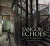
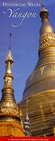
Yangon: Historical Walks Map

Historical Walks in Yangon (Rangoon), a waterproof and tear-resistant folded map from the Myanmar Heritage Trust published by Silkworm Books, with street plans and detailed descriptions of three walks around the city’s best preserved districts.On one side is a generalized street plan of Yangon naming main streets and districts. Three areas of particular historical and architectural interest are highlighted on the plan and shown in greater detail on separate insets, each with a route for a recommended walk and important buildings cross-referenced to the accompanying list.On the reverse each walk is given a very detailed description illustrated by old photos from late 19th and early 20th century. Further notes provide more information about the city in its colonial days.Also provided is
a Heritage Building List of the city’s 187 buildings identified by the Yangon City Development Committee as the first step towards promoting heritage awareness.
RIP - This product is no longer available on our network. It was last seen on 25.09.2019

This page now acts as a permanent archive for this product. Add more information using the comments box below to ensure it can still be found by future generations.

Use our search facility to see if it is available from an alternative contributor.
  • External links may include paid for promotion
  • Availability: Out Of Stock
  • Supplier: Stanfords
  • SKU: 9789749511442
Availability: In Stock
£11.99

Product Description

Historical Walks in Yangon (Rangoon), a waterproof & tear-resistant folded map from the Myanmar Heritage Trust published by Silkworm Books, with street plans & detailed descriptions of three walks around the city’s best preserved districts. On one side is a generalized street plan of Yangon naming main streets & districts. Three areas of particular historical & architectural interest are highlighted on the plan & shown in greater detail on separate insets, each with a route for a recommended walk & important buildings cross-referenced to the accompanying list. On the reverse each walk is given a very detailed description illustrated by old photos from late 19th & early 20th century. Further notes provide more information about the city in its colonial days. Also provided is a Heritage Building List of the city’s 187 buildings identified by the Yangon City Development Committee as the first step towards promoting heritage awareness.

Reviews/Comments

Add New

Intelligent Comparison

Oooops!
We couldn't find anything!
Perhaps this product's unique.... Or perhaps we are still looking for comparisons!
Click to bump this page and we'll hurry up.

Price History

Vouchers

No voucher codes found.
Do you know a voucher code for this product or supplier? Add it to Insights for others to use.

Facebook

Jargon Buster

Waterproof - Resistant to water, usualy specified by depth in metres
Resistant - Something that can repel against something.

Supplier Information

Stanfords
Stanfords was established in 1853 and opened their iconic Covent Garden flagship store in 1901. They have become the top retailer of maps, travel books and accessories in the UK and arguably offer the largest selection of maps and travel books worldwide. Famous names such as Captain Robert Falcon Scott, Ranulph Fiennes and Michael Palin have purchased from Stanfords. They now have a shop in Bristol and both stores together with other venues operate a calendar of events including talks, book signings and exhibitions. As a specialist map retailer, the map selection is comprehensive and includes road maps, street maps and walking maps from worldwide destinations, as well as a selection of world atlases and wall maps. Books include travel guides and travel literature. Stanfords also stock globes, from miniatures made of blue marble to magnificent floor-standing globes. The website features a selection of interesting articles on travel topics.
Page Updated: 2023-11-12 20:15:36

Community Generated Product Tags

Oh No! The productWIKI community hasn't generated any tags for this product yet!
Menu