More From Contributor

£18.95
Publishing the results of the most recent annual World Press Photo Contest, this exceptional book contains the very best press photographs from the year 2017 – pictures submitted by photojournalists, picture agencies, newspapers & magazines throughout the world. Selected from thousands of images, these prizewinning photos capture the most powerful, moving & sometimes disturbing images of the year. ...
Archived Product
£18.95
Publishing the results of the most recent annual World Press Photo Contest, this exceptional book contains the very best press photographs from the year 2015
- pictures submitted by photojournalists, picture agencies, newspapers & magazines throughout the world. Selected from thousands of images, these prizewinning photos capture the most powerful, moving & sometimes disturbing images of the year.
...
Archived Product
£10.99
A world map in a jigsaw format: Extra Goods introduces the pleasure of learning geography by play with a new series of magnetic puzzles reproducing the world & the world`s major cites. This 100 pieces puzzle is presented in a beautiful tin box, decorated with the world map which is the reproduced on the jigsaw. The perfect gift for travelers & armchair travelers. The tin

Features:
- 100 pieces magnetic puzzle- dimensions: a puzzle surface of 33cm x 23 cm-

Dimensions of the box: height 9 cm; diameter 7 cm- up-to-date cartography To see the list of other titles in this series please click on the series link.


...
Archived Product
£25.00
100 major horse racing venues with detail of each one`s history & heritage from BBC journalist, Cornelius Lysaght. Text is accompanied by contemporary photography & detailed diagrams created by Collins, the world-leading publisher of maps & atlases, making it an essential purchase or gift for any horse racing fan. The book features each track in regional order, starting with the famous Epsom Downs course in England then taking in renowned locations such as Churchill Downs, Royal Ascot & Flemington Racecourse, all the way up to the state-of-the-art Meydan Racecourse in Dubai. More unusual & lesser known courses are also featured including the Pardubicka in Czech Republic, St Moritz in Switzerland & Ngong in Kenya. Each course is accompanied by an array of statistics & the latest photographs from these scenic venues. It also features alphabetical & `by country` indices for ease of reference. ...
Archived Product
£25.99
The ” World Rail Atlas & historical summary of the Middle East & Caucasus” is the first such publication in an emerging series that will cover all parts of Europe, Africa, Asia, Australasia & the Americas. This volume is the eighth in a series of 20, released as such due to the availability of material. It covers the following countries: Armenia, Azerbaijan, Bahrain, Cyprus, Georgia, Iran, Iraq, Israel, Jordan, Kuwait, Lebanon, Oman, Palestine, Qatar, Saudi Arabia, Syria, Turkey, United Arab Emirates, & Yemen. This is the first time that a rail atlas is published for most of these countries. The ” World Rail Atlas” presents several countries` railway networks diagrammatically represented in print for the first time ever, save for minimal & obscure diagrams produced through the years, & together with all distances shown to the nearest tenth of a kilometre, where known, gives as complete a picture as is possible at this stage. ...
Archived Product
£14.99
Discover the fascinating histories & routes of 50 of the world`s most scenic railways. Railway expert Julian Holland takes you on a journey around the world. Take a journey around the world by rail, from the American Rockies to the Australian outback, covering 50 routes from 35 countries. Detailed commentary on the geography & history of each line, from leading railways expert Julian Holl&, is complemented by prestigious Times mapping & beautiful photography. Railway journeys include; * Le Petit Train Jaune in the Pyrenees featuring France`s highest railway station. * Cape Town to Kimberley in South Africa a feat of late Victorian engineering through the Hex River Mountains & across the Karoo Desert. * Qinghai-Tibet Railway in China contains the highest railway, tunnel & station in the world. * Trans-Australian Railway in Australia contains the world`s longest stretch of dead straight track. * Cumbres & Toltec Railroad in USA takes passengers on an awe-inspiring scenic 64-mile journey through the Rocky Mountains along the Colorado-New Mexico border.* La Trochita in Argentina where original oil-fired steam locomotives travel along a narrow gauge railway in the shadow of the Andes Mountains. ...
Archived Product
£19.99
Medium size, 129 x 83cm (51”x 32.5” approx) political map of the world from Rand Mc Nally in their Classic edition
- ENCAPSULATED
...
Archived Product
£14.99
Medium size, 127 x 81cm (50”x 32”) political map of the world from Rand Mc Nally in their Classic edition
- PAPER version
-

...
Archived Product
£19.99
Medium size, 129 x 83cm (51” x 32.5” approx.), political map of the world from Rand Mc Nally in their Signature edition
- ENCAPSULATED
...
Archived Product
£14.99
Medium size, 127 x 81.5cm (50” x 32” approx), political map of the world from Rand Mc Nally in their Signature edition
- PAPER
...
Archived Product

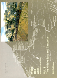
World Rail Atlas And Historical Summary: Vol. 8 The Middle East And
Caucasus

The ”World Rail Atlas and historical summary of the Middle East and Caucasus” is the first such publication in an emerging series that will cover all parts of Europe, Africa, Asia, Australasia and the Americas. This volume is the eighth in a series of 20, released as such due to the availability of material. It covers the following countries: Armenia, Azerbaijan, Bahrain, Cyprus, Georgia, Iran, Iraq, Israel, Jordan, Kuwait, Lebanon, Oman, Palestine, Qatar, Saudi Arabia, Syria, Turkey, United Arab Emirates, and Yemen. This is the first time that a rail atlas is published for most of these countries.The ”World Rail Atlas” presents several countries` railway networks diagrammatically represented in print for the first time ever, save for minimal and obscure
diagrams produced through the years, and together with all distances shown to the nearest tenth of a kilometre, where known, gives as complete a picture as is possible at this stage.
RIP - This product is no longer available on our network. It was last seen on 25.09.2019

This page now acts as a permanent archive for this product. Add more information using the comments box below to ensure it can still be found by future generations.

Use our search facility to see if it is available from an alternative contributor.
  • Availability: Out Of Stock
  • Supplier: Stanfords
  • SKU: 9789541201282
Availability: In Stock
£19.99

Product Description

The ” World Rail Atlas & historical summary of the Middle East & Caucasus” is the first such publication in an emerging series that will cover all parts of Europe, Africa, Asia, Australasia & the Americas. This volume is the eighth in a series of 20, released as such due to the availability of material. It covers the following countries: Armenia, Azerbaijan, Bahrain, Cyprus, Georgia, Iran, Iraq, Israel, Jordan, Kuwait, Lebanon, Oman, Palestine, Qatar, Saudi Arabia, Syria, Turkey, United Arab Emirates, & Yemen. This is the first time that a rail atlas is published for most of these countries. The ” World Rail Atlas” presents several countries` railway networks diagrammatically represented in print for the first time ever, save for minimal & obscure diagrams produced through the years, & together with all distances shown to the nearest tenth of a kilometre, where known, gives as complete a picture as is possible at this stage.

Reviews/Comments

Add New

Price History

Vouchers

No voucher codes found.
Do you know a voucher code for this product or supplier? Add it to Insights for others to use.

Facebook

Jargon Buster

World - A physical grouping, commonly used to describe earth and everything associated with ti
Print - A mechanical process of putting text onto paper. It can also relate to a pattern on an item.

Supplier Information

Stanfords
Stanfords was established in 1853 and opened their iconic Covent Garden flagship store in 1901. They have become the top retailer of maps, travel books and accessories in the UK and arguably offer the largest selection of maps and travel books worldwide. Famous names such as Captain Robert Falcon Scott, Ranulph Fiennes and Michael Palin have purchased from Stanfords. They now have a shop in Bristol and both stores together with other venues operate a calendar of events including talks, book signings and exhibitions. As a specialist map retailer, the map selection is comprehensive and includes road maps, street maps and walking maps from worldwide destinations, as well as a selection of world atlases and wall maps. Books include travel guides and travel literature. Stanfords also stock globes, from miniatures made of blue marble to magnificent floor-standing globes. The website features a selection of interesting articles on travel topics.
Page Updated: 2023-11-12 20:15:36

Community Generated Product Tags

Oh No! The productWIKI community hasn't generated any tags for this product yet!
Menu