More From Contributor
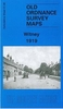
£9.99
[ Previously published as ` Went The Day Well`] ` Of all the books marking the bicentenary Waterloo, this has to be the best` Spectator `A book to die for` Evening Standard From Samuel Johnson Prize shortlisted author David Crane, this is a breathtaking portrait of the Britain that fought the battle of Waterloo. As Wellington`s rain-sodden army retreated towards an obscure valley called Waterloo, the men & women of Britain were still going to the theatre & science lectures, working in the fields & the factories, reading & writing books & sermons, painting their pictures & sitting in front of Lord Elgin`s marbles. David Crane`s stunning freeze-frame of Britain on this day of momentous change shifts hour by hour between Britain & Belgium. The Britain that fought Waterloo
- its radicals & patriots, artisans & aristocrats, prisoners & poets
- appears through the smoke of battle & the mythology of Waterloo in this magnificent & original tracing of the endless, overlapping connections between people`s lives.

...
Archived Product
£3.50
Whitney in 1919 in a fascinating series of reproductions of old Ordnance Survey plans in the Alan Godfrey Editions, ideal for anyone interested in the history of their neighbourhood or family. The map of Witney covers the centre of the town, extending from the River Windrush westward to Witney Park Farm `on site of Bishop`s Palace`, & from St Mary`s church northward to Holy Trinity church. Features include Church Green, High Street, Mount Mills, Langel Common, The Crofts, Market Square, Corn Street, Workhouse, cemetery, Bridge Street, Mill Street, Witney Mills, West End, etc. On the reverse is a commercial directory from 1899. About the Alan Godfrey Editions of the 25” OS Series: Selected towns in Great Britain & Ireland are covered by maps showing the extent of urban development in the last decades of the 19th & early 20th century. The plans have been taken from the Ordnance Survey mapping & reprinted at about 15 inches to one mile (1:4, 340). On the reverse most maps have historical notes & many also include extracts from contemporary directories. Most maps cover about one mile (1.6kms) north/south, one & a half miles (2.4kms) across; adjoining sheets can be combined to provide wider coverage.FOR MORE INFORMATION & A COMPLETE LIST OF ALL AVAILABLE TITLES PLEASE CLICK ON THE SERIES LINK. ...
Archived Product
£4.50
Witten & Langendreer in 1944 in the Alan Godfrey series of reproductions of British War Office survey first published in 1945 prior to the Allied occupation of the area. The map is in colour & covers the area from Langendreer in the north southward to Witten. Features include railways, roundhouses, marshalling yards, collieries, tramways, Witten town centre, Laer, Annen, Kley, -spel, Düren, etc To see other titles in this series please click on the series link. This series of reproductions from Alan Godfrey covers the major industrial area east of the Rhine that

Includes::
Bochum, Cologne, Dortmund, Duisburg, Düsseldorf, Essen, Gelsenkirchen, Oberhausen & other towns, with their great network of railways & industries. The maps are taken from the British War Office 1:12, 500 plans & reduced at Approx. 1:19, 000. Published in 1945, prior to the Allied occupation of the area, the maps are especially good at showing industry, collieries & transport. They are not bombing maps
- indeed, they make clear that allowance is not made for bomb damage
- but show the areas with all their industrial sites & railways largely as they were before the bombing raids of 1943-44. The maps have additional information added by British intelligence. This is normally accurate but allowance must be made for the `fog of war` & occasional spelling mistakes, etc. Each title has on the reverse a specially written introduction to the area in English, with a shorter text in German. Map legend is in English only.


...
Archived Product
£8.99
Wittenberge on a topographic map at 1:200, 000 from the Bundesamt für Kartographie und Geodäsie, Germany’s federal mapping agency. The map covers an area of Approx. 100 x 90km. This map is belongs to a series of 58 topographic maps from Bundesamt für Kartographie und Geodäsie, the federal cartographic agency of Germany responsible for topographic mapping at 1:200, 000 & maps at smaller scales (the more detailed topographic & leisure maps are prepared & published by the survey organizations of the individual states). Cartography is from the 200K topographic survey & the maps have very elegant, modern look whilst retaining the traditional German presentation of names of smaller towns & villages in italics. Contours are at 12, 5m intervals, enhanced by relief shading, with colouring for woodlands, moors, marches, vineyards & hop plantations. Waterways & rivers are also described in detail, with currents, waterfalls, dams, & jetties clearly marked. Road network, graded into five types, highlights in colour national & regional roads; no driving distances are marked Railway network is also shown in detail, with stations, goods only lines, etc. The maps show administrative boundaries of states & counties, & have a UTM grid plus margin ticks for latitude & longitude at 2’ intervals. Map legend is in German only.PLEASE NOTE: maps in this series provide an excellent presentation of the areas covered by them, with plenty of place names & detailed representation of the road network, & will appeal to anyone who likes quality cartography, but they are not necessarily the best option for holiday & business travel. To see other titles in this series please click on the series link. ...
Archived Product
£3.50
Witton Gilbert & Langley Park in 1895 in a fascinating series of reproductions of old Ordnance Survey plans in the Alan Godfrey Editions, ideal for anyone interested in the history of their neighbourhood or family. The map is double-sided for maximum coverage. The main map has the village of Witton Gilbert in the north-easten corner, & the centre of Langley Park in the south west corner; it extends south as far as Quebec Street & Cooperative Terrace. Features include Langley Park Hotel, Wall Nook, Stobbilee, Bleach Green, Witton Gilbert station, Kaysburn Pumping Station, Kaysburn brickworks, St John`s Green, Witton Hall, St Michael`s church, Glendinning Arms, Travellers Rest pub, etc. On the reverse is part of the adjacent sheet 19.10 extending coverage westward to include Langley Park Colliery, coke ovens, waggonway to pit & drift, Park House, All Saints church, Quebec Street, etc. About the Alan Godfrey Editions of the 25” OS Series: Selected towns in Great Britain & Ireland are covered by maps showing the extent of urban development in the last decades of the 19th & early 20th century. The plans have been taken from the Ordnance Survey mapping & reprinted at about 15 inches to one mile (1:4, 340). On the reverse most maps have historical notes & many also include extracts from contemporary directories. Most maps cover about one mile (1.6kms) north/south, one & a half miles (2.4kms) across; adjoining sheets can be combined to provide wider coverage.FOR MORE INFORMATION & A COMPLETE LIST OF ALL AVAILABLE TITLES PLEASE CLICK ON THE SERIES LINK. ...
Archived Product
£10.99
Like ” Star Wars” before it, ” The Wizard of Oz” is a marriage of phenomenal Scanimation
- four books, four instant ” New York
...
Archived Product
£9.99
“ Wizard of the Crow” is Ngugi wa Thiong`o’s magisterial comic novel that is certain to take its place as a landmark of postcolonial African Literature from the exiled Kenyan novelist, playwright, poet, & literary critic. His aim in “ Wizard of the Crow” is, in his own words, nothing less than `to sum up Africa of the twentieth century in the context of 2, 000 years of world history.` Commencing in `our times` & set in the ` Free Republic of Aburiria`, the novel dramatises with corrosive humour & keenness of observation a battle for control of the souls of the Aburirian people. Fashioning the stories of the powerful & the ordinary into a dazzling mosaic, Ngugi reveals humanity in all its ceaselessly surprising complexity. Informed by traditional African storytelling, “ Wizard of the Crow” is one of the greatest achievements in Ngugi wa Thiong`o`s career thus far. ...
Archived Product
£10.99
To honour the Ruler`s birthday, the Free Republic of Aburiria set out to build a tower; a modern wonder of the world that will reach the gates of Heaven. But behind this pillar of unity a battle for control of the Aburirian people rages. Among the contenders: the eponymous Wizard, an avatar of folklore & wisdom; the corrupt Christian Ministry; & the nefarious Global Bank. Informed by traditional African storytelling, Wizard of the Crow is widely considered Ngugi wa Thiong`o`s masterpiece. ...
Archived Product
£6.99
Wizzil the witch is bored stiff & out to cause trouble at Frimp Farm. Little does she know that she will meet her match in Mr De Witt Frimp. As the two compete in the battle of revenge, they soon realise that there`s more to life.. . Two masters of picture books, William Steig & Quentin Blake, have collaborated to create a brilliantly funny tale about an unlikely friendship. You will not be disappointed. ...
Archived Product
£8.99
Crushed by a devastating scandal, university professor Oscar Amalfitano flees Barcelona for Santa Teresa
- a Mexican city close
...
Archived Product

Wivenhoe 1896

Wivenhoe in 1896 in a fascinating series of reproductions of old Ordnance Survey plans in the Alan Godfrey Editions, ideal for anyone interested in the history of their neighbourhood or family. SThe map covers most of this small, compact town, including its railway station, St Mary`s church, Wivenhoe Hall, shipbuilding yards, Station Hotel, wharf. Across the River Colne are gravel pits and Fingringhoe Quay. To the north is Wivenhoe Mill and cemetery. A directory of Wivenhoe is included, plus a railway timetable for the local lines in 1915.About the Alan Godfrey Editions of the 25” OS SeriesSelected towns in Great Britain and Ireland are covered by maps showing the extent of urban development in the last decades of the 19th and early 20th century. The plans have been taken from
the Ordnance Survey mapping and reprinted at about 15 inches to one mile (1:4, 340). On the reverse most maps have historical notes and many also include extracts from contemporary directories. Most maps cover about one mile (1.6kms) north/south, one and a half miles (2.4kms) across; adjoining sheets can be combined to provide wider coverage.FOR MORE INFORMATION AND A COMPLETE LIST OF ALL AVAILABLE TITLES PLEASE CLICK ON THE SERIES LINK.
RIP - This product is no longer available on our network. It was last seen on 25.09.2019

This page now acts as a permanent archive for this product. Add more information using the comments box below to ensure it can still be found by future generations.

Use our search facility to see if it is available from an alternative contributor.
  • External links may include paid for promotion
  • Availability: Out Of Stock
  • Supplier: Stanfords
  • SKU: 9781841517322
Availability: In Stock
£3.50

Product Description

Wivenhoe in 1896 in a fascinating series of reproductions of old Ordnance Survey plans in the Alan Godfrey Editions, ideal for anyone interested in the history of their neighbourhood or family. SThe map covers most of this small, compact town, including its railway station, St Mary`s church, Wivenhoe Hall, shipbuilding yards, Station Hotel, wharf. Across the River Colne are gravel pits & Fingringhoe Quay. To the north is Wivenhoe Mill & cemetery. A directory of Wivenhoe is included, plus a railway timetable for the local lines in 1915. About the Alan Godfrey Editions of the 25” OS Series Selected towns in Great Britain & Ireland are covered by maps showing the extent of urban development in the last decades of the 19th & early 20th century. The plans have been taken from the Ordnance Survey mapping & reprinted at about 15 inches to one mile (1:4, 340). On the reverse most maps have historical notes & many also include extracts from contemporary directories. Most maps cover about one mile (1.6kms) north/south, one & a half miles (2.4kms) across; adjoining sheets can be combined to provide wider coverage.FOR MORE INFORMATION & A COMPLETE LIST OF ALL AVAILABLE TITLES PLEASE CLICK ON THE SERIES LINK.

Reviews/Comments

Add New

Intelligent Comparison

Oooops!
We couldn't find anything!
Perhaps this product's unique.... Or perhaps we are still looking for comparisons!
Click to bump this page and we'll hurry up.

Price History

Vouchers

No voucher codes found.
Do you know a voucher code for this product or supplier? Add it to Insights for others to use.

Facebook

Jargon Buster

Contemporary - Modern era design
Contemporary - A design reference to indicate post war modern design
Hotel - An establishment which provides lodging for a fee
compact - Carefuly designed to ensure an item has a minimal physical size
History - Anything that happens in the past. An acedemic subject.
Gravel - A size of rock between 2mm and 64mm
Small - something that takes up less space than normal.
Compact - something that has a lot combined within a small space.
Contemporary - An object that is living in the same time.
Mill - A building which can grind grain into flour.
Hall - A room at the inside of an entrance of a house.
Ideal - Something that satisfies a perfect criteria.
Family - A group of people that live together made up from parents and children.

Supplier Information

Stanfords
Stanfords was established in 1853 and opened their iconic Covent Garden flagship store in 1901. They have become the top retailer of maps, travel books and accessories in the UK and arguably offer the largest selection of maps and travel books worldwide. Famous names such as Captain Robert Falcon Scott, Ranulph Fiennes and Michael Palin have purchased from Stanfords. They now have a shop in Bristol and both stores together with other venues operate a calendar of events including talks, book signings and exhibitions. As a specialist map retailer, the map selection is comprehensive and includes road maps, street maps and walking maps from worldwide destinations, as well as a selection of world atlases and wall maps. Books include travel guides and travel literature. Stanfords also stock globes, from miniatures made of blue marble to magnificent floor-standing globes. The website features a selection of interesting articles on travel topics.
Page Updated: 2023-11-12 20:15:36

Community Generated Product Tags

Oh No! The productWIKI community hasn't generated any tags for this product yet!
Menu