More From Contributor

£8.50
Wisconsin in a series of US state maps from the National Geographic with cartography from Mapquest, including city maps of Milwaukee with an enlargement of the downtown area, Madison, Appleton, Superior, Eau Claire, Green Bay, Oshkosh & Racine
- Kenosha, plus a scenic drive route down the Great River Road along the Mississippi. The map is printed on lightweight, waterproof & tear-resistant plastic paper. Maps in the NGS State Series clearly show each state
...
Archived Product
£9.99
Wisconsin on a laminated & waterproof Easy-to-Fold map from Rand Mc Nally, the country’s leading publisher of road maps & street plans. For clarity of road information Rand Mc Nally state maps present the road network on a plain background, with no or little topographic detail. Driving distances are indicated on all principal highways & on many local routes. National or state parks & other protected areas, Indian Reservations & restricted entry military zones are highlighted & symbols indicate campsites, rest areas, various places of interest, etc. Each map shows local administrative boundaries with names of the counties, is indexed & gives geographical coordinates as margin ticks usually at 1° intervals. Rand Mc Nally state maps are available in two formats: double-sided Easy-to-Read maps with numerous enlargements for cities and/or most visited areas, & laminated Easy-to-Fold maps in a more handy format but with smaller print. TO SEE THE LIST OF RAND Mc NALLY STATE MAPS PLEASE CLICK ON THE SERIES LINK. ...
Archived Product
£6.99
Wisconsin Easy-to-Read map from Rand Mc Nally, US leading publisher of road maps & street plans, in their extensive series of state maps. Additional panels provide enlargements for Milwaukee & vicinity with a street plan of the downtown area, Appleton, Eau Claire, Green Bay, Janesville
- Beloit area, Kenosha
- Racine area, La Crosse, Madison, Oshkosh, Sheboygan & Superior. For clarity of road information Rand Mc Nally state maps present the road network on a plain background, with no or little topographic detail. Driving distances are indicated on all principal highways & on many local routes. National or state parks & other protected areas, Indian Reservations & restricted entry military zones are highlighted & symbols indicate campsites, rest areas, various places of interest, etc. Each map shows local administrative boundaries with names of the counties, is indexed & gives geographical coordinates as margin ticks usually at 1° intervals. Rand Mc Nally state maps are available in two formats: double-sided Easy-to-Read maps with numerous enlargements for cities and/or most visited areas, & laminated Easy-to-Fold maps in a more handy format but with smaller print. TO SEE THE LIST OF RAND Mc NALLY STATE MAPS PLEASE CLICK ON THE SERIES LINK.

...
Archived Product
£11.99
Born-&-bred Cheesehead Thomas Huhti offers an insider's view of Wisconsin, from the bars & pubs of Madison to the beaches & water parks of the Wisconsin Dells. Thomas is a perfect tour guide, providing unique trip ideas such as a Wisconsin Outdoors Adventure & a Frank Lloyd Wright Tour. Packed with information on dining, transportation, & accommodations, Moon Wisconsin has lots of options for a range of travel budgets. Every Moon guidebook

Includes::
recommendations for must-see sights & many regional, area & city-centered maps. With advice on dining in Milwaukee & exploring the scenic lakeside towns of Door County, Moon Wisconsin gives travellers the tools they need to create a more personal & memorable experience. With expert writers, first-rate strategic advice, & an essential dose of humour, Moon Handbooks are the cure for the common trip.

...
Archived Product
£19.95
Wisconsin Recreational Atlas & Gazetteer at 1:160, 000 approx. in a series of large format paperback state atlases from De Lorme, with detailed, contoured, GPS compatible topographic mapping plus extensive recreational information, with lists of sites & facilities, etc. Each title covers one state & presents it on impressively detailed mapping at scales much more detailed than used on most state road maps. Particularly popular areas are often also presented on enlargements. The maps are contoured, show variation of terrain (deserts, glaciers, wetlands, woodlands, etc) & have latitude & longitude and/or UTM grid lines for GPS use. Various types of protected areas are distinguished by the colouring of their boundaries, e.g. national or state parks, forests, etc. Also marked are Indian Reservations & restricted entry military zones. Road network is shown in much more detail than on other state mapping, with local roads, unsurfaced back roads & tracks, forest trails, etc. Where appropriate, old historical routes are marked. Railway lines & local airports or landing strips are included & the maps also indicate administrative boundaries. Symbols highlight various recreational areas & facilities such as campgrounds, unique natural features, etc. Each title contains extensive lists of outdoor adventure sites (grouped into activities such as hiking, biking, paddling, fishing, skiing, etc.), diverse family outing sites, campgrounds, & tables showing what facilities can be found in the state ...
Archived Product
£24.99
Wisconsin Recreational Atlas & Gazetteer at 1:160, 000 approx. in a series of large format paperback state atlases from De Lorme, with detailed, contoured, GPS compatible topographic mapping. Recreational information

Includes::
lists of recommended family outings, unique natural features, outdoor adventure areas for hiking/biking/paddling. Tables present facilities in recreational areas & campgrounds, plus fishing & hunting areas with lists of species. Each title in this De Lorme series covers one state & presents it at a scale much more detailed than used on most state road maps. Particularly popular areas are often also presented on enlargements. The maps are contoured, show variation of terrain (deserts, glaciers, wetlands, woodlands, etc) & have latitude & longitude and/or UTM grid lines for GPS use. Various types of protected areas are distinguished by the colouring of their boundaries, e.g. national or state parks, forests, etc. Also marked are Indian Reservations & restricted entry military zones. Road network is shown in much more detail than on other state mapping, with local roads, unsurfaced back roads & tracks, forest trails, etc. Where appropriate, old historical routes are marked. Railway lines & local airports or landing strips are included & the maps also indicate administrative boundaries. Symbols highlight various recreational areas & facilities such as campgrounds, unique natural features, etc. Each title contains extensive lists of outdoor adventure sites (grouped into activities such as hiking, biking, paddling, fishing, skiing, etc.), diverse family outing sites, campgrounds, & tables showing what facilities can be found in the state’s recreational areas. Each atlas also has an index of localities. To see the list of titles in this series please click on the series link.

...
Archived Product
£30.00
Detailed physical wall map of Wisconsin State at a scale of 1:500, 000. The cartography shows relief through a stunning, ...
Archived Product
£5.99
Wisconsin's Door County in the Moon Spotlight guide series; covering a range of specific local cities, districts, areas & regions in North, Central & South America & targeted at those seeking to travel to a specific area within a country. Each of the guides has been extracted in full from the relevant country Moon Handbook & individual titles focus on a particular city, region or notable area of the destination. Many of the guides in the series are unique in their coverage, although are limited in putting the destination into its wider geographical context that a more comprehensive guide would provide. Stylistically, Moon ...
Archived Product

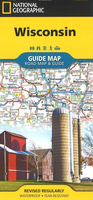
Wisconsin NGS Guide Map

National Geographic`s Wisconsin Guide Map provides travelers with the perfect combination of detail and perspective in a highly functional travel tool. Cities and towns are clearly indicated and easy to find in the user-friendly index. A complete road network of highways, tollways, and other roads, along with distances noted in miles for major highways, will help you find the route that`s right for you. National and state parks, public campsites, visitor information centers, airports, ski areas, hospitals, and more are noted as well.A chart of park service sites and climate information will be particularly helpful to travelers taking in the many outdoor activities in Wisconsin. Inset maps of the cities of Madison, Milwaukee, Superior, Appleton, Oshkosh, Racine-Kenosha,
Milwaukee, Green Bay, and Eau Claire provide greater detail of these urban centers. A handy combination of map and guidebook, this map is also loaded with information on varied points of interest including St. Croix National Scenic Riverway, Apostle Islands National Lakeshore, and Great River Road, a scenic byway along Route 35 between La Crosse and Prairie du Chien.
RIP - This product is no longer available on our network. It was last seen on 25.09.2019

This page now acts as a permanent archive for this product. Add more information using the comments box below to ensure it can still be found by future generations.

Use our search facility to see if it is available from an alternative contributor.
  • Availability: Out Of Stock
  • Supplier: Stanfords
  • SKU: 9781566957328
Availability: In Stock
£8.99

Product Description

National Geographic`s Wisconsin Guide Map provides travelers with the perfect combination of detail & perspective in a highly functional travel tool. Cities & towns are clearly indicated & easy to find in the user-friendly index. A complete road network of highways, tollways, & other roads, along with distances noted in miles for major highways, will help you find the route that`s right for you. National & state parks, public campsites, visitor information centers, airports, ski areas, hospitals, & more are noted as well.A chart of park service sites & climate information will be particularly helpful to travelers taking in the many outdoor activities in Wisconsin. Inset maps of the cities of Madison, Milwaukee, Superior, Appleton, Oshkosh, Racine-Kenosha, Milwaukee, Green Bay, & Eau Claire provide greater detail of these urban centers. A handy combination of map & guidebook, this map is also loaded with information on varied points of interest including St. Croix National Scenic Riverway, Apostle Islands National Lakeshore, & Great River Road, a scenic byway along Route 35 between La Crosse & Prairie du Chien.

Reviews/Comments

Add New

Intelligent Comparison

Oooops!
We couldn't find anything!
Perhaps this product's unique.... Or perhaps we are still looking for comparisons!
Click to bump this page and we'll hurry up.

Price History

Vouchers

No voucher codes found.
Do you know a voucher code for this product or supplier? Add it to Insights for others to use.

Facebook

Jargon Buster

Network - A link and communication between things. Often computers or people.
Road - a manmade lane or a path that is used to speed up travel.
Combination - The process of two of more things being mixed or combined together.

Supplier Information

Stanfords
Stanfords was established in 1853 and opened their iconic Covent Garden flagship store in 1901. They have become the top retailer of maps, travel books and accessories in the UK and arguably offer the largest selection of maps and travel books worldwide. Famous names such as Captain Robert Falcon Scott, Ranulph Fiennes and Michael Palin have purchased from Stanfords. They now have a shop in Bristol and both stores together with other venues operate a calendar of events including talks, book signings and exhibitions. As a specialist map retailer, the map selection is comprehensive and includes road maps, street maps and walking maps from worldwide destinations, as well as a selection of world atlases and wall maps. Books include travel guides and travel literature. Stanfords also stock globes, from miniatures made of blue marble to magnificent floor-standing globes. The website features a selection of interesting articles on travel topics.
Page Updated: 2023-11-12 20:15:36

Community Generated Product Tags

Oh No! The productWIKI community hasn't generated any tags for this product yet!
Menu