
 United Kingdom
 France
 Germany
 Netherlands
 Sweden
 USA
USA
 Italy
Italy
 Spain
Spain
More From Contributor


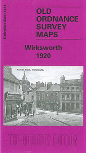
Wirksworth 1920
Wirksworth in 1920 in a fascinating series of reproductions of old Ordnance Survey plans in the Alan Godfrey Editions, ideal for anyone interested in the history of their neighbourhood or family. The map covers the small town of Wirksworth, extending northward to Bolehill and Middlepeak. Features include Midland Railway`s Wirksworth Branch with station, section of LNWR Cromford & High Peak line, quarries with rail connections, Stoneycroft Quarry, Coal Hills Quarry, Redhill Quarry, Middlepeak Quarries, Greymare Mine (disused), Malsters Venture Mine (disused), other disused mines, St Mary`s church, Wirksworth Hall, Gate House, Waltham House, Yokecliffe House, Market Place, Baileycroft Quarry (disused), Washgreen area, schools and chapels, Bolehill area, Yokecliffe Rake
Mines (disused), old shafts, etc. An 1891 directory of Wirksworth is on the reverse.About the Alan Godfrey Editions of the 25” OS Series:Selected towns in Great Britain and Ireland are covered by maps showing the extent of urban development in the last decades of the 19th and early 20th century. The plans have been taken from the Ordnance Survey mapping and reprinted at about 15 inches to one mile (1:4, 340). On the reverse most maps have historical notes and many also include extracts from contemporary directories. Most maps cover about one mile (1.6kms) north/south, one and a half miles (2.4kms) across; adjoining sheets can be combined to provide wider coverage.FOR MORE INFORMATION AND A COMPLETE LIST OF ALL AVAILABLE TITLES PLEASE CLICK ON THE SERIES LINK.
Mines (disused), old shafts, etc. An 1891 directory of Wirksworth is on the reverse.About the Alan Godfrey Editions of the 25” OS Series:Selected towns in Great Britain and Ireland are covered by maps showing the extent of urban development in the last decades of the 19th and early 20th century. The plans have been taken from the Ordnance Survey mapping and reprinted at about 15 inches to one mile (1:4, 340). On the reverse most maps have historical notes and many also include extracts from contemporary directories. Most maps cover about one mile (1.6kms) north/south, one and a half miles (2.4kms) across; adjoining sheets can be combined to provide wider coverage.FOR MORE INFORMATION AND A COMPLETE LIST OF ALL AVAILABLE TITLES PLEASE CLICK ON THE SERIES LINK.

Product Description
Reviews/Comments
Add New
Intelligent Comparison
Archived Product
Ainsworth 1908 Stanfords
£2.95
Archived Product
Ainsworth 1908 Stanfords
£3.50
Vouchers
No voucher codes found.
Do you know a voucher code for this product or supplier? Add it to Insights for others to use.
Do you know a voucher code for this product or supplier? Add it to Insights for others to use.
 Denmark