More From Contributor
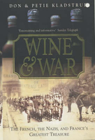
£6.39
A detailed topographic map from the Ordnance Survey Explorer series, covering Windsor, Weybridge, Bracknell & Wokingham (showing part of the Thames Path). Edition A4: Publication date March 2012 About this series: These highly detailed maps show all the administrative boundaries, settlements as small as isolated farms, the road network down to unfenced roads & country tracks, & field boundaries (hedges & drystone walls) which make navigation across the countryside much easier. Steep gradients on roads are indicated. Various landmarks, e.g. powerlines, archaeological sites, windmills, churches & lighthouses are shown & additional graphics indicate natural terrain features such as cliffs, scree, mud & vegetation variations. The contour interval is 5 metres in the lower parts of the country & 10 metres in the uplands, & spot heights are marked. Each map covers an area of 30 x 20km (i.e. approx. 19 x 12 miles), with some double-sided maps covering more, as indicated in the individual descriptions. The maps are fully GPS compatible, with the National Grid shown at 1km intervals & latitude & longitude indicated by margin ticks at 1'. The Explorer series has replaced the earlier, green-cover Pathfinder maps. The Explorer series is now complete & covers all of Engl&, Wales & Scotl&. Some sheets for popular areas like the National Parks are still branded as Outdoor Leisure (OL) maps, but are now included in this series as the cartography is the same as that in the Explorer Maps. The Explorer maps offer a substantial improvement on the Pathfinder series, with greater use of colour, larger area per map, & stronger emphasis on information for ramblers & tourists. This series is ideal for walking & other outdoor pursuits & each map shows a large amount of information for ramblers & tourists. Public rights of way are shown (except in Scotland), together with other routes with public access: National Trails & Recreational Paths, permitted paths & bridleways, & selected cycle routes. Open access land created under the Countryside & Rights of Way Act 2000 is marked. Tourist information

Includes::
caravan & camp sites, Park & Ride locations, recreation/leisure/sport centres, museums, historic buildings, English Heritage & National Trust sites, rural pubs, etc. The map legend is in English only, except for the tourist information content which is also in French & German.

...
Archived Product
£13.99
Laminated waterproof edition of a detailed topographic map from the Ordnance Survey Explorer series, covering Windsor, Weybridge & Bracknell (showing part of the Thames Path). Edition A4; Publication date May 2012 About this series: These highly detailed maps show all the administrative boundaries, settlements as small as isolated farms, the road network down to unfenced roads & country tracks, & field boundaries (hedges & drystone walls) which make navigation across the countryside much easier. Steep gradients on roads are indicated. Various landmarks, e.g. powerlines, archaeological sites, windmills, churches & lighthouses are shown & additional graphics indicate natural terrain features such as cliffs, scree, mud & vegetation variations. The contour interval is 5 metres in the lower parts of the country & 10 metres in the uplands, & spot heights are marked. Each map covers an area of 30 x 20km (i.e. approx. 19 x 12 miles), with some double-sided maps covering more, as indicated in the individual descriptions. The maps are fully GPS compatible, with the National Grid shown at 1km intervals & latitude & longitude indicated by margin ticks at 1'. The Explorer series has replaced the earlier, green-cover Pathfinder maps. The Explorer series is now complete & covers all of Engl&, Wales & Scotl&. Some sheets for popular areas like the National Parks are still branded as Outdoor Leisure (OL) maps, but are now included in this series as the cartography is the same as that in the Explorer Maps. The Explorer maps offer a substantial improvement on the Pathfinder series, with greater use of colour, larger area per map, & stronger emphasis on information for ramblers & tourists. This series is ideal for walking & other outdoor pursuits & each map shows a large amount of information for ramblers & tourists. Public rights of way are shown (except in Scotland), together with other routes with public access: National Trails & Recreational Paths, permitted paths & bridleways, & selected cycle routes. Open access land created under the Countryside & Rights of Way Act 2000 is marked. Tourist information

Includes::
caravan & camp sites, Park & Ride locations, recreation/leisure/sport centres, museums, historic buildings, English Heritage & National Trust sites, rural pubs, etc. The map legend is in English only, except for the tourist information content which is also in French & German.

...
Archived Product
£14.99
Windsor, Weybridge & Bracknell area on a detailed topographic & GPS compatible map No. 160, waterproof version, from the Ordnance Survey’s 1:25, 000 Explorer series. MOBILE DOWNLOADS: this title & all the other OS Explorer maps include a code for downloading after purchase the digital version onto your smartphone or tablet for viewing on the OS smartphone app.OS EXPLORER SERIES: to see the list of all the titles in the OS Explorer series, both paper & waterproof versions, please click on the series link. The Explorer series, Ordnance Survey’s most detailed maps recommended for anyone enjoying outdoor activities, provides topographic coverage of Great Britain at 1:25, 000 on GPS compatible maps with hiking trails, cycling routes & extensive tourist information. Each printed map is available either on paper or as a waterproof & tear-resistant OS Active Map, as indicated in its title. Britain’s National Parks & other areas of particular tourist interest are presented on often double-sided OL (Outdoor Leisure) maps, whilst most standard format Explorers cover an area of 30 x 20km (approx. 19 x 12 miles). All three versions (paper, waterproof & digital) are the same & provide plenty of recreational & tourist information, indicating the traditional public right of way paths (except in Scotland where different laws apply), including bridleways & byways. National Trails & other long-distance paths are marked, as well as permissive footpaths or bridleways & on-road or traffic-free cycle routes with, where appropriate, their National/ Regional Cycle Network numbers. Boundaries of access land are clearly marked. A wide range of symbols provides additional tourist information, highlighting camping & caravanning sites, information offices & visitors’ centres, parking & picnicking places, country pubs, sport & recreational facilities including cycle hire locations & mountain biking trails, historic buildings & museums, etc. Exceptionally clear presentation of the landscape is provided by contours at 5m or in the uplands at 10m intervals, with additional spot heights plus colouring and/or graphics for different types of woodlands, orchards, heath, marshl&, scree or boulders, & other topographic features. For GPS users the maps have British National Grid lines at 1km intervals, with latitude & longitude given by margin ticks at 1`. Clearly laid out map legend

Includes::
French & German translations for the tourist information symbols.

...
Archived Product
£16.99
This book shows how to choose, buy, build, install, maintain, repair, & use a windvane self-steerer. When you're cruising shorthanded, you can't always be at the helm. A windvane self-steering system is the most reliable means of steering your small vessel on long ocean passages--and it doesn't use one amp of your precious electrical power. The Windvane Self-Steering Handbook is the definitive guide to every aspect of sailing & working with the long-distance sailor's best friend. Veteran sailor Bill Morris points out the mechanical & navigational advantages of vane steering systems; provides an overview of available products, complete with sizes, prices, & contact information; & shows you how to install, maintain, repair, & modify vane gears for best performance. In this practical guide you'll find: lucid explanations of how vane gears work; an easy-to-implement discussion of how to match a vane design with your boat; invaluable instructions for how to sail with a windvane
- settings, sail trim, etc.; a look at ten commercially available vane gear systems; diagrams & instructions for a home-built unit; &, instructions for customizing vane gears for optimum performance.
...
Archived Product
£19.99
A chatty & informative guide that gives you the lowdown on wine & how to make the most of it. Wine & Food offers a fresh look at the global wine scene with detailed information on more than 20 grapes & styles. Understanding storing & pouring wine, & what food to serve it with teaches you exactly how to pick the right wine every time. The way we buy wine, serve it, enjoy it & match it with food has changed enormously in the last decade, so start with the basics at The Bar where you`ll find all the latest information on glasses, equipment, storage, temperature & trends on the current scene. Head to The Cellar for taste & flavour notes on reds, whites, rose, fizz, fortified & dessert wines, from Pinot Noir, Cabernet Sauvignon & Port to Chardonnay, Sherry & Champagne help you to decide which style is best for you & what to drink it with. Once you`ve discovered all the detail you need on your wine, head to The Store Cupboard for an exploration of how to pair it with food. With sections on meat, fish (you really can pair red wine with fish!), veg, spice, sauce & cheese, including four cheese flights for entertaining, you`ll be prepared to enhance your dish with no more than a pour. Also included are nine myth-breaker experiments, including a Same Wine Different Glass Test, The Truth About Tannin & Sensory Sake Tasting, that really bring the enjoyment of drinking wine to life. ...
Archived Product
£30.00
This visually stunning atlas provides the most comprehensive overview of the wine industry in New Zealand & is the only Wine ...
Archived Product
£18.99
Red or white? Cabernet or merlot? Drinking great wine isn`t hard, but finding great wine is much easier with an understanding of the fundamentals. In Wine Folly, Puckette & Hammack use sleek & modern graphics to simplify complex wine topics. From tips on which glasses to use & easy-to-grasp flavour wheels for each wine type, to simple tasting & food-pairing notes, this colourful & accessible guide will equip you with knowledge & confidence to enjoy great wines. ...
Archived Product
£25.00
Want to pick the perfect wine for dinner? Red, white or Rose? Dry or Fruity? Spanish or Portuguese? Become the expert with Wine Folly`s Magnum Edition: The Master Guide. It will take your appreciation & understanding of wine to the next level. Wine Folly introduced a whole new audience to the world of wine, making it easy for complete beginners to understand the fundamentals thanks to their straightforward advice, simple explanatory graphics & practical wine-tasting tips. Now they are back with plenty more eye-catching visuals & easy-to-grasp advice that the brand has become known for. Wine Folly Deluxe comes complete with a fresh look, twice as much information on regions, & a profusion of new & alternative wine styles. With its simple & practical answers to all your wine questions & curiosities
- red or white? Light or bold? Spanish or Portuguese?
- it`s the perfect guide for anyone looking to expand their expertise & an ideal gift for the oenophile in your life.

...
Archived Product
£120.00
This is an indispensable book for every wine lover, from some of the world`s greatest experts. Where do wine grapes come from & how are they related to each other? What is the historical background of each grape variety? Where are they grown? What sort of wines do they make &, most importantly, what do they taste like? Using the most cutting-edge DNA analysis & detailing almost 1, 400 distinct grape varieties, as well as myriad correct (and highlighting almost as many incorrect) synonyms, this particularly beautiful book

Includes::
revelatory grape family trees, & a rich variety of illustrations from Viala & Vermorel`s seminal ampelography with century-old illustrations. Combining Jancis Robinson`s world view, nose for good writing & good wines with Julia Harding`s expertise & attention to detail plus Dr Vouillamoz`s unique level of scholarship, Wine Grapes offers essential & original information in greater depth & breadth than has ever been available before. This is a book for wine students, wine experts & wine lovers everywhere.AWARDS: Best Wine, Beer & Spirits Book & winner of the Jane Grigson award, IACP (International Association of Culinary Professionals) Awards 2014, A wine book of the year, 2013, The Times, London, Faiveley International Wine Book of the Year 2013, Roederer Awards Best Viticulture Book 2013, OIV Awards Best Drink Book 2012, Fortnum & Mason Food & Drink Awards, Best Beverage Book 2012, James Beard Awards Best Drink Book 2012, Andre Simon Awards Hall of Fame for Best Wine Book 2012, Gourmand World Cookbook Awards Best Drinks Book 2012, Wine & Spirits magazine.

...
Archived Product
£19.99
WINE IQ is the ultimate quiz game for wine lovers. It lets everyone shine & have a good time. The game is played in teams & offers two rounds of play. A first round is based on your knowledge, a second one on your memory. You can take risks to score more points but will you trust your partner? From classic wines to forbidden ones, from Napa to Casablanca, from vines to glasses, discover fascinating things about wine while having fun. (2 to 12 players) Contents:200 cards / 400 questions 4 colored pencils 1 scoresheet ...
Archived Product

Wine And War

In the vineyards, wine caves, and cellars of France as war and occupation came to the country winemakers acted heroically not only to save the best wines but to defend their way of life. These are the true stories of vignerons who sheltered Jewish refugees in their cellars and of winemakers who risked their lives to aid the resistance. They made chemicals in secret laboratories to fuel the resistance and fled from the Gestapo when arrests became imminent. There were treacheries too, as some of the nation`s winemakers supported the Vichy regime or the Germans themselves and collaborated. Donald Kladstrup is a retired American network correspondent. He and his wife Petie have accumulated these fascinating stories, told with the pace and action that will fascinate fiction and non-fiction
readers alike.
RIP - This product is no longer available on our network. It was last seen on 25.09.2019

This page now acts as a permanent archive for this product. Add more information using the comments box below to ensure it can still be found by future generations.

Use our search facility to see if it is available from an alternative contributor.
  • External links may include paid for promotion
  • Availability: Out Of Stock
  • Supplier: Stanfords
  • SKU: 9780340766781
Availability: In Stock
£12.99

Product Description

In the vineyards, wine caves, & cellars of France as war & occupation came to the country winemakers acted heroically not only to save the best wines but to defend their way of life. These are the true stories of vignerons who sheltered Jewish refugees in their cellars & of winemakers who risked their lives to aid the resistance. They made chemicals in secret laboratories to fuel the resistance & fled from the Gestapo when arrests became imminent. There were treacheries too, as some of the nation`s winemakers supported the Vichy regime or the Germans themselves & collaborated. Donald Kladstrup is a retired American network correspondent. He & his wife Petie have accumulated these fascinating stories, told with the pace & action that will fascinate fiction & non-fiction readers alike.

Reviews/Comments

Add New

Intelligent Comparison

Oooops!
We couldn't find anything!
Perhaps this product's unique.... Or perhaps we are still looking for comparisons!
Click to bump this page and we'll hurry up.

Price History

Vouchers

No voucher codes found.
Do you know a voucher code for this product or supplier? Add it to Insights for others to use.

Facebook

Jargon Buster

Wine - An alcoholic drink made from fermented grapes.
fuel - A material used to generate energy.
France - A state situated in Western Europe with several overseas territories.
Network - A link and communication between things. Often computers or people.

Supplier Information

Stanfords
Stanfords was established in 1853 and opened their iconic Covent Garden flagship store in 1901. They have become the top retailer of maps, travel books and accessories in the UK and arguably offer the largest selection of maps and travel books worldwide. Famous names such as Captain Robert Falcon Scott, Ranulph Fiennes and Michael Palin have purchased from Stanfords. They now have a shop in Bristol and both stores together with other venues operate a calendar of events including talks, book signings and exhibitions. As a specialist map retailer, the map selection is comprehensive and includes road maps, street maps and walking maps from worldwide destinations, as well as a selection of world atlases and wall maps. Books include travel guides and travel literature. Stanfords also stock globes, from miniatures made of blue marble to magnificent floor-standing globes. The website features a selection of interesting articles on travel topics.
Page Updated: 2023-11-12 20:15:36

Community Generated Product Tags

Oh No! The productWIKI community hasn't generated any tags for this product yet!
Menu