
 United Kingdom
 France
 Germany
 Netherlands
 Sweden
 USA
USA
 Italy
Italy
 Spain
Spain
More From Contributor


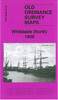


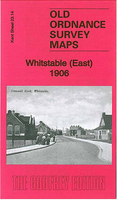
Whitstable East 1906
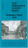
Whitstable East in 1906 in a fascinating series of reproductions of old Ordnance Survey plans in the Alan Godfrey Editions, ideal for anyone interested in the history of their neighbourhood or family. Three separate titles cover the town:- Sheet 23.10 Whitstable North covers the Harbour, Tankerton Castle, the coastal development of Tankerton, Priest & Sow Corner, Kingsdown Park, RC Church, Whitstable Branch station, etc. Sheet 23.09 covering Harbour Street and Sea Street is included as an inset.- Sheet 23.13 Whitstable West covers the High Street and Canterbury Road area, with coverage westward to Seasalter Cliff Coastguard Station; features include shipbuilding yards, Borstalhill Farm, Lower Island, Seasalter Road, Parsonage Farm etc.- Sheet 23.14 Whitstable East covers the
area from Whitstable station eastward to Rayham Farm and Ridgeway. Features include All Saints church, Church Street, Mill Strood Farm, Downshouse Farm, Gorrell Bridge, Duncan Down, Rayham Crossing etc. The maps include extensive extracts from a 1905 directory for Whitstable and Tankerton, listing many of the residents and businesses of the time.About the Alan Godfrey Editions of the 25” OS Series:Selected towns in Great Britain and Ireland are covered by maps showing the extent of urban development in the last decades of the 19th and early 20th century. The plans have been taken from the Ordnance Survey mapping and reprinted at about 15 inches to one mile (1:4, 340). On the reverse most maps have historical notes and many also include extracts from contemporary directories. Most
maps cover about one mile (1.6kms) north/south, one and a half miles (2.4kms) across; adjoining sheets can be combined to provide wider coverage.FOR MORE INFORMATION AND A COMPLETE LIST OF ALL AVAILABLE TITLES PLEASE CLICK ON THE SERIES LINK.

Product Description
Reviews/Comments
Add New
Vouchers
No voucher codes found.
Do you know a voucher code for this product or supplier? Add it to Insights for others to use.
Do you know a voucher code for this product or supplier? Add it to Insights for others to use.
 Denmark