
 United Kingdom
 France
 Germany
 Netherlands
 Sweden
 USA
USA
 Italy
Italy
 Spain
Spain
More From Contributor


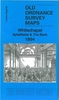


Whitefield And Besses O` Th` Barn 1907
Whitefield and Besses o` th` Barn in 1907 in a fascinating series of reproductions of old Ordnance Survey plans in the Alan Godfrey Editions, ideal for anyone interested in the history of their neighbourhood or family. The map covers much of the village of Whitefield, between Bury and Manchester. Coverage extends from Green Lane southward to Hardman`s Green, and from Stand Hall eastward to Hodge Lane. The southern part of Whitefield itself is shown, together with the hamlet of Besses o` th` Barn. Bury New Road runs north-south through the map. Features include the railway with Whitefield station, tramways, Half Acre, Kirkhams, Polefield Hall, Heaps Farm, Thatch Leach, Victoria Mill, Whitefield Brewery, Oak Bank Farm, Hillock, Albert Mill, Moss Lane Works, All Saints
church, Whitefield Park, Park Lane, The Dales, Stand Hall, etc. On the reverse are extracts from `Whitefield and Stand` by Frank Merriday written 1899.About the Alan Godfrey Editions of the 25” OS Series:Selected towns in Great Britain and Ireland are covered by maps showing the extent of urban development in the last decades of the 19th and early 20th century. The plans have been taken from the Ordnance Survey mapping and reprinted at about 15 inches to one mile (1:4, 340). On the reverse most maps have historical notes and many also include extracts from contemporary directories. Most maps cover about one mile (1.6kms) north/south, one and a half miles (2.4kms) across; adjoining sheets can be combined to provide wider coverage.FOR MORE INFORMATION AND A COMPLETE LIST OF ALL
AVAILABLE TITLES PLEASE CLICK ON THE SERIES LINK.coverage.

Product Description
Reviews/Comments
Add New
Vouchers
No voucher codes found.
Do you know a voucher code for this product or supplier? Add it to Insights for others to use.
Do you know a voucher code for this product or supplier? Add it to Insights for others to use.
 Denmark