More From Contributor
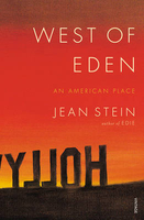
£13.95
West Midlands
- Birmingham Street Atlas from the Geographers` A-Z Map Company in a spiral-bound format slightly smaller than A4
...
Archived Product
£4.99
West Midlands at 1:400, 000 in Michelin’s tourist series covering Great Britain on waterproof & tear-resistant maps with descriptions of main sights, extensive restaurants recommendations, etc. The maps also indicate locations with entries in Michelin’s Red Guide to hotels & restaurants in Britain. Each title combines a road map with an index listing selected place names; descriptions of main places of interest with contact details; plus recommendations for eating out in pubs & restaurants accompanied by rating & an indication of the price range. Road mapping is identical to Michelin’s series covering Britain on four sheets where a full description of the cartography & road presentation is provided; special features include highlighting of scenic roads & driving distances on main routes given in both miles & kilometres. Railway lines & ferry routes are included. The maps are printed on durable, waterproof & tear-resistant plastic paper which can be written on with highlighters to mark routes, destinations, etc.* In this title:* the map

Includes::
street plans of central Birmingham, Coventry & Stratford-upon-Avon, with descriptions of main sights in these cities, in Hereford & Worcester, the Shrewsbury area & the Cotswolds, plus recommendations for over 45 restaurants rated by Michelin.

...
Archived Product
£8.00
Dave Taylor's mountain biking guide to the West Midlands has 21 circular routes
- with sketch maps
- to suit all tastes, including

...
Archived Product
£3.50
West Norwood in 1894 in a fascinating series of reproductions of old Ordnance Survey plans in the Alan Godfrey Editions, ideal for anyone interested in the history of their neighbourhood or family. Thee versions for this area have been published for this area. Coverage stretches from Wellfield Road & Angles Road eastward to Hamilton Road & Rommany Road, & from Royal Circus & Lansdown Hill southward to Crown Hill. Features include part of The Broadway, South Metropolitan Cemetery, West Norwood station, Lambeth New Schools, Convent of the Faithful Virgin, part of Streatham Common, St Anselm`s church (left hand margin), St Luke`s church, Parkhill, Wellfield House, Jews Hospital & Orphan Asylum. In the extreme south-west corner of the 1870 map is Well House, a reminder that Streatham achieved fame in the 18th century as a spa. According to author John Brown the water ”was highly regarded, one cup of which was said to be equivalent of three doses of that from Epsom” & it was claimed to be a cure for many diseases & even blindness. Other features include Spa Wells, a later chalybeate spring, whose waters were delivered with the milk until 1942 when it was bombed. Several street directory entries are on the back of each map. About the Alan Godfrey Editions of the 25” OS Series: selected towns in Great Britain & Ireland are covered by maps showing the extent of urban development in the last decades of the 19th & early 20th century. The plans have been taken from the Ordnance Survey mapping & reprinted at about 15 inches to one mile (1:4, 340). On the reverse most maps have historical notes & many also include extracts from contemporary directories. Most maps cover about one mile (1.6kms) north/south, one & a half miles (2.4kms) across; adjoining sheets can be combined to provide wider coverage.FOR MORE INFORMATION & A COMPLETE LIST OF ALL AVAILABLE TITLES PLEASE CLICK ON THE SERIES LINK. ...
Archived Product
£3.50
West Norwood in 1913 in a fascinating series of reproductions of old Ordnance Survey plans in the Alan Godfrey Editions, ideal for anyone interested in the history of their neighbourhood or family. Thee versions for this area have been published for this area. Coverage stretches from Wellfield Road & Angles Road eastward to Hamilton Road & Rommany Road, & from Royal Circus & Lansdown Hill southward to Crown Hill. Features include part of The Broadway, South Metropolitan Cemetery, West Norwood station, Lambeth New Schools, Convent of the Faithful Virgin, part of Streatham Common, St Anselm`s church (left hand margin), St Luke`s church, Parkhill, Wellfield House, Jews Hospital & Orphan Asylum. In the extreme south-west corner of the 1870 map is Well House, a reminder that Streatham achieved fame in the 18th century as a spa. According to author John Brown the water ”was highly regarded, one cup of which was said to be equivalent of three doses of that from Epsom” & it was claimed to be a cure for many diseases & even blindness. Other features include Spa Wells, a later chalybeate spring, whose waters were delivered with the milk until 1942 when it was bombed. Several street directory entries are on the back of each map. About the Alan Godfrey Editions of the 25” OS Series: selected towns in Great Britain & Ireland are covered by maps showing the extent of urban development in the last decades of the 19th & early 20th century. The plans have been taken from the Ordnance Survey mapping & reprinted at about 15 inches to one mile (1:4, 340). On the reverse most maps have historical notes & many also include extracts from contemporary directories. Most maps cover about one mile (1.6kms) north/south, one & a half miles (2.4kms) across; adjoining sheets can be combined to provide wider coverage.FOR MORE INFORMATION & A COMPLETE LIST OF ALL AVAILABLE TITLES PLEASE CLICK ON THE SERIES LINK. ...
Archived Product
£8.99
New edition of this ever-popular walking guide Explore the counties of Clare, Galway & Mayo in the company of a wildlife expert. The West of Ireland offers a huge choice of landscape to the walker
- mountain peaks, woodl&, bogs & lakes, sandy beaches & the strange limestone plateaux of the Burren. The Walks Clare: The Cliffs of Moher
- The Burren: Sliabh Eilbhe
- Blackhead
- Abbey Hill Galway/ Connemara: Inishmore, Aran Islands
- Casla Bog
- Errisbeg Mountains (Roundstone)
- Maumturk Mountains
- Kylemore Abbey
- Killary Harbour Mayo: Cong
- Lough Nadirkmore (Party Mountains)
- Tonakeera Point
- Crough Patrick.


...
Archived Product
£9.95
Sea kayaking map of the western coast of Scotland from See Kayak Oban publishers, showing best routes from the mainland to & around the islands, plus a street plan of Oban & plenty of tourist information. On one side is a map at 1:210, 000 approx showing the coast from Glasgow & the Clyde, Bute, Jura & Islay northwards to Fort William, Mull, Coll & the Ardnamurchan Peninsula. On the reverse a panel at approx. 1:60, 000 shows in greater detail the coast near Oban, from Scarba & the Garvellachs to Lismore & Sauna Isl&. Both maps indicate kayaking routes, locations where portage is required, selected pubs & distilleries, as well as ferry connections. A street plan of Oban highlights location of the Kayak Oban & the National Kayak School, hostel accommodation, etc. Notes provide information on getting to Oban, kayak rental & outfitting, etc. The map is illustrated with photos of interesting locations. ...
Archived Product
£6.39
A detailed topographic map of West Pennine Moors from the Ordnance Survey Explorer series, covering Blackburn, Darwen & Accrington. Edition A3; Publication date October 2008 About this series: These highly detailed maps show all the administrative boundaries, settlements as small as isolated farms, the road network down to unfenced roads & country tracks, & field boundaries (hedges & drystone walls) which make navigation across the countryside much easier. Steep gradients on roads are indicated. Various landmarks, e.g. powerlines, archaeological sites, windmills, churches & lighthouses are shown & additional graphics indicate natural terrain features such as cliffs, scree, mud & vegetation variations. The contour interval is 5 metres in the lower parts of the country & 10 metres in the uplands, & spot heights are marked. Each map covers an area of 30 x 20km (i.e. approx. 19 x 12 miles), with some double-sided maps covering more, as indicated in the individual descriptions. The maps are fully GPS compatible, with the National Grid shown at 1km intervals & latitude & longitude indicated by margin ticks at 1'. The Explorer series has replaced the earlier, green-cover Pathfinder maps. The Explorer series is now complete & covers all of Engl&, Wales & Scotl&. Some sheets for popular areas like the National Parks are still branded as Outdoor Leisure (OL) maps, but are now included in this series as the cartography is the same as that in the Explorer Maps. The Explorer maps offer a substantial improvement on the Pathfinder series, with greater use of colour, larger area per map, & stronger emphasis on information for ramblers & tourists. This series is ideal for walking & other outdoor pursuits & each map shows a large amount of information for ramblers & tourists. Public rights of way are shown (except in Scotland), together with other routes with public access: National Trails & Recreational Paths, permitted paths & bridleways, & selected cycle routes. Open access land created under the Countryside & Rights of Way Act 2000 is marked. Tourist information

Includes::
caravan & camp sites, Park & Ride locations, recreation/leisure/sport centres, museums, historic buildings, English Heritage & National Trust sites, rural pubs, etc. The map legend is in English only, except for the tourist information content which is also in French & German.

...
Archived Product
£14.99
West Pennine Moors, Blackburn, Darwen & Accrington area on a detailed topographic & GPS compatible map No. 287, waterproof version, from the Ordnance Survey’s 1:25, 000 Explorer series.MOBILE DOWNLOADS: this title & all the other OS Explorer maps include a code for downloading after purchase the digital version onto your smartphone or tablet for viewing on the OS smartphone app.OS EXPLORER SERIES: to see the list of all the titles in the OS Explorer series, both paper & waterproof versions, please click on the series link. The Explorer series, Ordnance Survey’s most detailed maps recommended for anyone enjoying outdoor activities, provides topographic coverage of Great Britain at 1:25, 000 on GPS compatible maps with hiking trails, cycling routes & extensive tourist information. Each printed map is available either on paper or as a waterproof & tear-resistant OS Active Map, as indicated in its title. Britain’s National Parks & other areas of particular tourist interest are presented on often double-sided OL (Outdoor Leisure) maps, whilst most standard format Explorers cover an area of 30 x 20km (approx. 19 x 12 miles). All three versions (paper, waterproof & digital) are the same & provide plenty of recreational & tourist information, indicating the traditional public right of way paths (except in Scotland where different laws apply), including bridleways & byways. National Trails & other long-distance paths are marked, as well as permissive footpaths or bridleways & on-road or traffic-free cycle routes with, where appropriate, their National/ Regional Cycle Network numbers. Boundaries of access land are clearly marked. A wide range of symbols provides additional tourist information, highlighting camping & caravanning sites, information offices & visitors’ centres, parking & picnicking places, country pubs, sport & recreational facilities including cycle hire locations & mountain biking trails, historic buildings & museums, etc. Exceptionally clear presentation of the landscape is provided by contours at 5m or in the uplands at 10m intervals, with additional spot heights plus colouring and/or graphics for different types of woodlands, orchards, heath, marshl&, scree or boulders, & other topographic features. For GPS users the maps have British National Grid lines at 1km intervals, with latitude & longitude given by margin ticks at 1`. Clearly laid out map legend

Includes::
French & German translations for the tourist information symbols.

...
Archived Product
£8.99
West Pennine Moors, Blackburn, Darwen & Accrington area on a detailed topographic & GPS compatible map No. 287, paper version, from the Ordnance Survey’s 1:25, 000 Explorer series.MOBILE DOWNLOADS: this title & all the other OS Explorer maps include a code for downloading after purchase the digital version onto your smartphone or tablet for viewing on the OS smartphone app.OS EXPLORER SERIES: to see the list of all the titles in the OS Explorer series, both paper & waterproof versions, please click on the series link. The Explorer series, Ordnance Survey’s most detailed maps recommended for anyone enjoying outdoor activities, provides topographic coverage of Great Britain at 1:25, 000 on GPS compatible maps with hiking trails, cycling routes & extensive tourist information. Each printed map is available either on paper or as a waterproof & tear-resistant OS Active Map, as indicated in its title. Britain’s National Parks & other areas of particular tourist interest are presented on often double-sided OL (Outdoor Leisure) maps, whilst most standard format Explorers cover an area of 30 x 20km (approx. 19 x 12 miles). All three versions (paper, waterproof & digital) are the same & provide plenty of recreational & tourist information, indicating the traditional public right of way paths (except in Scotland where different laws apply), including bridleways & byways. National Trails & other long-distance paths are marked, as well as permissive footpaths or bridleways & on-road or traffic-free cycle routes with, where appropriate, their National/ Regional Cycle Network numbers. Boundaries of access land are clearly marked. A wide range of symbols provides additional tourist information, highlighting camping & caravanning sites, information offices & visitors’ centres, parking & picnicking places, country pubs, sport & recreational facilities including cycle hire locations & mountain biking trails, historic buildings & museums, etc. Exceptionally clear presentation of the landscape is provided by contours at 5m or in the uplands at 10m intervals, with additional spot heights plus colouring and/or graphics for different types of woodlands, orchards, heath, marshl&, scree or boulders, & other topographic features. For GPS users the maps have British National Grid lines at 1km intervals, with latitude & longitude given by margin ticks at 1`. Clearly laid out map legend

Includes::
French & German translations for the tourist information symbols.

...
Archived Product

West Of Eden

West of Eden is the definitive story of Hollywood, told, in their own words, by the people on the inside: Lauren Bacall, Arthur Miller, Dennis Hopper, Frank Gehry, Ring Lardner, Joan Didion, Stephen Sondheim - all interviewed by Jean Stein, who grew up in the Forties in a fairytale mansion in the Hollywood Hills. The book takes us from the discovery of oil in the Twenties with the story of the tycoon Edward Doheny (There Will Be Blood) and traces the growth of corruption through the syndicates, the mob, and the movie studios - from the beginnings of the film industry to the end, with News Corp. and Rupert Murdoch (who bought the Stein mansion in 1985). West of Eden is about money, power, fame and terrible secrets: the doomed Hollywood of the late Fifties, early Sixties -
`the rotten heart of paradise`. Like her last book, the best-selling Edie, this is an oral history told through brilliantly edited interviews.As this is Hollywood, it`s a book full of sex, drugs and celebrity glamour; but because it`s built from the firsthand accounts of people who were actually there, many of them writers, actors and artists, it`s also strangely claustrophobic, seductive, and completely compelling.
RIP - This product is no longer available on our network. It was last seen on 25.09.2019

This page now acts as a permanent archive for this product. Add more information using the comments box below to ensure it can still be found by future generations.

Use our search facility to see if it is available from an alternative contributor.
  • Availability: Out Of Stock
  • Supplier: Stanfords
  • SKU: 9781784701291
Availability: In Stock
£12.99

Product Description

West of Eden is the definitive story of Hollywood, told, in their own words, by the people on the inside: Lauren Bacall, Arthur Miller, Dennis Hopper, Frank Gehry, Ring Lardner, Joan Didion, Stephen Sondheim
- all interviewed by Jean Stein, who grew up in the Forties in a fairytale mansion in the Hollywood Hills. The book takes us from the discovery of oil in the Twenties with the story of the tycoon Edward Doheny (There Will Be Blood) & traces the growth of corruption through the syndicates, the mob, & the movie studios
- from the beginnings of the film industry to the end, with News Corp. & Rupert Murdoch (who bought the Stein mansion in 1985). West of Eden is about money, power, fame & terrible secrets: the doomed Hollywood of the late Fifties, early Sixties
- `the rotten heart of paradise`. Like her last book, the best-selling Edie, this is an oral history told through brilliantly edited interviews. As this is Hollywood, it`s a book full of sex, drugs & celebrity glamour; but because it`s built from the firsthand accounts of people who were actually there, many of them writers, actors & artists, it`s also strangely claustrophobic, seductive, & completely compelling.

Reviews/Comments

Add New

Intelligent Comparison

Oooops!
We couldn't find anything!
Perhaps this product's unique.... Or perhaps we are still looking for comparisons!
Click to bump this page and we'll hurry up.

Price History

Vouchers

No voucher codes found.
Do you know a voucher code for this product or supplier? Add it to Insights for others to use.

Facebook

Jargon Buster

Oil - A hydrophobic liquid with high carbon and hydrogen content. Has many variations including; cooking oils, petrochemical oils, essential oils.
History - Anything that happens in the past. An acedemic subject.
Heart - An organ that pumps blood around the body. Usually related to love.
Blood - A red liquid that circulates around the body for all the bodies needs.
Glamour - A quality of elegance and sexually attractive sophistication

Supplier Information

Stanfords
Stanfords was established in 1853 and opened their iconic Covent Garden flagship store in 1901. They have become the top retailer of maps, travel books and accessories in the UK and arguably offer the largest selection of maps and travel books worldwide. Famous names such as Captain Robert Falcon Scott, Ranulph Fiennes and Michael Palin have purchased from Stanfords. They now have a shop in Bristol and both stores together with other venues operate a calendar of events including talks, book signings and exhibitions. As a specialist map retailer, the map selection is comprehensive and includes road maps, street maps and walking maps from worldwide destinations, as well as a selection of world atlases and wall maps. Books include travel guides and travel literature. Stanfords also stock globes, from miniatures made of blue marble to magnificent floor-standing globes. The website features a selection of interesting articles on travel topics.
Page Updated: 2023-11-12 20:15:36

Community Generated Product Tags

Oh No! The productWIKI community hasn't generated any tags for this product yet!
Menu