
 United Kingdom
 France
 Germany
 Netherlands
 Sweden
 USA
USA
 Italy
Italy
 Spain
Spain
More From Contributor


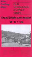
Waterfoot 1908
Waterfoot in 1908 in a fascinating series of reproductions of old Ordnance Survey plans in the Alan Godfrey Editions, ideal for anyone interested in the history of their neighbourhood or family. Selected towns in Great Britain and Ireland are covered by maps showing the extent of urban development in the last decades of the 19th and early 20th century.In this title: the map covers the Rossendale village of Waterfoot; stretching from Hurdles Quarry eastward to Rake Head and Brandwood, and from St Nicholas church (Newchurch) southward to Cowpe. Features include the LYR Bacup Branch with Waterfoot station, Hugh Mill, Lumb Holes Mill, Green Bridge Print Works, Carr Lane Mill, Bridge End Felt Works, Thrutch Plantation, Glen Top Brewery, Warth Mill, Vale Mill, Holt Holme Saw Mill,
smallpox hospital, Myrtle Grove Mill, Union Works, Hareholme, Staghills, Booth Fold, Higher Lench, Waterfoot Bridge, Siss Clough, Fearns, Waterbarn, Glen Top, Gaghills Slipper Factory, St James church etc. Directories of Waterfoot and Newchurch-in-Rossendale are included on the reverse. About the Alan Godfrey Editions of the 25
smallpox hospital, Myrtle Grove Mill, Union Works, Hareholme, Staghills, Booth Fold, Higher Lench, Waterfoot Bridge, Siss Clough, Fearns, Waterbarn, Glen Top, Gaghills Slipper Factory, St James church etc. Directories of Waterfoot and Newchurch-in-Rossendale are included on the reverse. About the Alan Godfrey Editions of the 25
Product Description
Reviews/Comments
Add New
Intelligent Comparison
Archived Product
Waterfoot 1908 Stanfords
£3.50
Vouchers
No voucher codes found.
Do you know a voucher code for this product or supplier? Add it to Insights for others to use.
Do you know a voucher code for this product or supplier? Add it to Insights for others to use.
 Denmark