
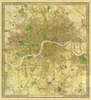
 United Kingdom
 France
 Germany
 Netherlands
 Sweden
 USA
USA
 Italy
Italy
 Spain
Spain
More From Contributor


Wall Heath 1900
Wall Heath in 1900 in a fascinating series of reproductions of old Ordnance Survey plans in the Alan Godfrey Editions, ideal for anyone interested in the history of their neighbourhood or family. Selected towns in Great Britain and Ireland are covered by maps showing the extent of urban development in the last decades of the 19th and early 20th century.In this title: the map covers the village of Wall Heath in Kingswinford parish. Coverage stretches from Holbeche House southward to Ashwood House and Dawley Brook, and from Hinksford Farm eastward to Stalling's Farm and Himley Colliery. The area is best known for Holbeche or Holbeach House, where the Gunpowder Plot particpants were arrested. Other features include mineral railway with sidings into sand pits, Wall Heath Forge,
Dawleybrook Wharf, Heathbrook arm, Himley Colliery Pits 7 and 8, Elmtree House etc. On the reverse is a directory of Kingswinford and Wall Heath.About the Alan Godfrey Editions of the 25
Dawleybrook Wharf, Heathbrook arm, Himley Colliery Pits 7 and 8, Elmtree House etc. On the reverse is a directory of Kingswinford and Wall Heath.About the Alan Godfrey Editions of the 25
Product Description
Reviews/Comments
Add New
Vouchers
No voucher codes found.
Do you know a voucher code for this product or supplier? Add it to Insights for others to use.
Do you know a voucher code for this product or supplier? Add it to Insights for others to use.
 Denmark