More From Contributor

£4.99
Walks from Grasmere by Handi Hikes is perfect for the experienced hiker as well as those new to the Lake District. This handy guide is 1 of 18 in a series of guide maps covering selected walks in the Lake District. Printed on durable compact foldaway waterproof plastic, this map

Includes::
1 easy & 3 moderate routes & is ideal for walking & outdoor pursuits. Carry a local guide in your pocket
- carry a Handi Hike! Each Map Guide in this series

Includes::
OS 1:25, 000 Explorer mapping, accurate directions, tips on navigation & recommendations for refreshments at the end of the walks. One side the map guide shows an extract from OS explorer, accurate & easy to follow directions for the walks & a few tips on navigation. The mapping from Ordnance Survey offers a large amount of information for ramblers & tourists. All types of roads, tracks, permitted & public footpaths & bridleways are shown. Graphics & colour coding represent terrain features such as cliffs, scree, marsh, mud & vegetation. Contours are shown at 10-meter vertical intervals & spots heights are marked. A wide range of symbols locates various facilities for walkers, including youth & independent hostels, camping & caravan sites & information points. Easy to follow directions describe 3 or 4 walks in the area that are clearly marked in the map with colour coded dots. Further information

Includes::
suggested viewpoints & places for refreshments, how to link together other routes in this series as well as tips on navigation. The maps indicate whether the routes are easy, moderate or difficult. This means that you can choose a walk according to ability & mood. Walk duration & distance covered are stated. The reverse of the map guide shows the legend, reference tips on reading a grid, information on how to use a compass, as well as advice on how to stay safe in the hills. GPS compatible. All text & legends are in English only. Carry a local guide in your pocket
- carry a Handi Hike!


...
Archived Product
£4.99
Walks from Great Langdale by Handi Hikes is perfect for the experienced hiker as well as those new to the Lake District. This handy guide is 1 of 18 in a series of guide maps covering selected walks in the Lake District. Printed on durable compact foldaway waterproof plastic, this map

Includes::
1 moderate & 3 difficult routes & is ideal for walking & outdoor pursuits. Carry a local guide in your pocket
- carry a Handi Hike! Each Map Guide in this series

Includes::
OS 1:25, 000 Explorer mapping, accurate directions, tips on navigation & recommendations for refreshments at the end of the walks. One side the map guide shows an extract from OS explorer, accurate & easy to follow directions for the walks & a few tips on navigation. The mapping from Ordnance Survey offers a large amount of information for ramblers & tourists. All types of roads, tracks, permitted & public footpaths & bridleways are shown. Graphics & colour coding represent terrain features such as cliffs, scree, marsh, mud & vegetation. Contours are shown at 10-meter vertical intervals & spots heights are marked. A wide range of symbols locates various facilities for walkers, including youth & independent hostels, camping & caravan sites & information points. Easy to follow directions describe 3 or 4 walks in the area that are clearly marked in the map with colour coded dots. Further information

Includes::
suggested viewpoints & places for refreshments, how to link together other routes in this series as well as tips on navigation. The maps indicate whether the routes are easy, moderate or difficult. This means that you can choose a walk according to ability & mood. Walk duration & distance covered are stated. The reverse of the map guide shows the legend, reference tips on reading a grid, information on how to use a compass, as well as advice on how to stay safe in the hills. GPS compatible. All text & legends are in English only. Carry a local guide in your pocket
- carry a Handi Hike!


...
Archived Product
£4.99
Walks from Keswick by Handi Hikes is perfect for the experienced hiker as well as those new to the Lake District. This handy guide is 1 of 18 in a series of guide maps covering selected walks in the Lake District. Printed on durable compact foldaway waterproof plastic, this map

Includes::
1 easy & 2 moderate routes & is ideal for walking & outdoor pursuits. Carry a local guide in your pocket
- carry a Handi Hike! Each Map Guide in this series

Includes::
OS 1:25, 000 Explorer mapping, accurate directions, tips on navigation & recommendations for refreshments at the end of the walks. One side the map guide shows an extract from OS explorer, accurate & easy to follow directions for the walks & a few tips on navigation. The mapping from Ordnance Survey offers a large amount of information for ramblers & tourists. All types of roads, tracks, permitted & public footpaths & bridleways are shown. Graphics & colour coding represent terrain features such as cliffs, scree, marsh, mud & vegetation. Contours are shown at 10-meter vertical intervals & spots heights are marked. A wide range of symbols locates various facilities for walkers, including youth & independent hostels, camping & caravan sites & information points. Easy to follow directions describe 3 or 4 walks in the area that are clearly marked in the map with colour coded dots. Further information

Includes::
suggested viewpoints & places for refreshments, how to link together other routes in this series as well as tips on navigation. The maps indicate whether the routes are easy, moderate or difficult. This means that you can choose a walk according to ability & mood. Walk duration & distance covered are stated. The reverse of the map guide shows the legend, reference tips on reading a grid, information on how to use a compass, as well as advice on how to stay safe in the hills. GPS compatible. All text & legends are in English only. Carry a local guide in your pocket
- carry a Handi Hike!


...
Archived Product
£4.99
Walks from Patterdale by Handi Hikes is perfect for the experienced hiker as well as those new to the Lake District. This handy guide is 1 of 18 in a series of guide maps covering selected walks in the Lake District. Printed on durable compact foldaway waterproof plastic, this map

Includes::
2 moderate & 1 difficult routes & is ideal for walking & outdoor pursuits. Carry a local guide in your pocket
- carry a Handi Hike! Each Map Guide in this series

Includes::
OS 1:25, 000 Explorer mapping, accurate directions, tips on navigation & recommendations for refreshments at the end of the walks. One side the map guide shows an extract from OS explorer, accurate & easy to follow directions for the walks & a few tips on navigation. The mapping from Ordnance Survey offers a large amount of information for ramblers & tourists. All types of roads, tracks, permitted & public footpaths & bridleways are shown. Graphics & colour coding represent terrain features such as cliffs, scree, marsh, mud & vegetation. Contours are shown at 10-meter vertical intervals & spots heights are marked. A wide range of symbols locates various facilities for walkers, including youth & independent hostels, camping & caravan sites & information points. Easy to follow directions describe 3 or 4 walks in the area that are clearly marked in the map with colour coded dots. Further information

Includes::
suggested viewpoints & places for refreshments, how to link together other routes in this series as well as tips on navigation. The maps indicate whether the routes are easy, moderate or difficult. This means that you can choose a walk according to ability & mood. Walk duration & distance covered are stated. The reverse of the map guide shows the legend, reference tips on reading a grid, information on how to use a compass, as well as advice on how to stay safe in the hills. GPS compatible. All text & legends are in English only. Carry a local guide in your pocket
- carry a Handi Hike!


...
Archived Product
£4.99
Walks from Wasdale Head by Handi Hikes is perfect for the experienced hiker as well as those new to the Lake District. This handy guide is 1 of 18 in a series of guide maps covering selected walks in the Lake District. Printed on durable compact foldaway waterproof plastic, this map

Includes::
4 difficult routes & is ideal for walking & outdoor pursuits. Carry a local guide in your pocket
- carry a Handi Hike! Each Map Guide in this series

Includes::
OS 1:25, 000 Explorer mapping, accurate directions, tips on navigation & recommendations for refreshments at the end of the walks. One side the map guide shows an extract from OS explorer, accurate & easy to follow directions for the walks & a few tips on navigation. The mapping from Ordnance Survey offers a large amount of information for ramblers & tourists. All types of roads, tracks, permitted & public footpaths & bridleways are shown. Graphics & colour coding represent terrain features such as cliffs, scree, marsh, mud & vegetation. Contours are shown at 10-meter vertical intervals & spots heights are marked. A wide range of symbols locates various facilities for walkers, including youth & independent hostels, camping & caravan sites & information points. Easy to follow directions describe 3 or 4 walks in the area that are clearly marked in the map with colour coded dots. Further information

Includes::
suggested viewpoints & places for refreshments, how to link together other routes in this series as well as tips on navigation. The maps indicate whether the routes are easy, moderate or difficult. This means that you can choose a walk according to ability & mood. Walk duration & distance covered are stated. The reverse of the map guide shows the legend, reference tips on reading a grid, information on how to use a compass, as well as advice on how to stay safe in the hills. GPS compatible. All text & legends are in English only. Carry a local guide in your pocket
- carry a Handi Hike!


...
Archived Product
£8.95
Robert Harris has compiled a selection of fascinating walks throughout Wales which not only visit the sites & monuments left by our ancestors, but pass through some of the most spectacular scenery of the Welsh countryside. He has divided Ancient Wales into three specific areas
- Anglesey, North Wales, & South Wales. Dating from the Neolithic & Bronze ages, stone circles, standing stones & burial chambers can still be found scattered throughout these beautiful areas. The majority of the walks are circular ranging in length from 4 to 10 miles. There is the opportunity not only to enjoy the peace & quiet of the valleys, the country lanes & footpaths, around modern farms & villages, but also to climb high into the still wild & remote mountains. Many of the walks link ancient paths & tracks where you can learn & understand more about the distant lives & customs of our ancient ancestors. Each walk has a unique focus, is both interesting & challenging, & invites the walker to visit both famous & less well-known sites & monuments. The author offers his own theories about the purpose & sitting of many of these ancient monuments, engaging the reader in a fascinating journey of discovery. There are sketch maps to guide you, & the author brings the text to life with his intricate h&-drawn sketches & detailed descriptions of the wonderful scenery & wildlife. A glossary of historical terms & Welsh place names completes an exceptionally comprehensive coverage of Walks in Ancient Wales.
...
Archived Product
£2.95
Walks in Dunkeld, Birnam & Little Dunkeld in Perthshire in a series of maps from Footprint covering popular hiking areas of Britain. 8 circular routes, from 3 to 7 miles long, are presented on separate panels, with half mile marking along each trail indicating the map scale. Coverage

Includes::
Birnam Wood mentioned in Shakespeare’s Macbeth. Each title in the Footprint series presents several routes within easy reach of one base. The walks include easy strolls & keep to well-used tracks & public footpaths. Each walk is presented on its own panel which can be viewed with the whole map refolded & placed in its plastic sleeve for protection. The walks are clearly highlighted on contoured maps, indicate sections where the path is indistinct on the ground, & have one or half mile markings. Symbols indicate local facilities such as pubs, youth hostels or car parks. Printed along side the map are route directions. Most titles also provide useful addresses of tourist information centres, youth hostels & other relevant organizations &, where appropriate, include a small street plan of the main town in the area covered by it.

...
Archived Product
£8.99
25 walks, all circular & about 3 to 4 miles long. They are never too steep or difficult, & can be walked at an easy pace in about one & a half to two hours, allowing time to admire the view or look at the birds or wild flowers along the way. They are all chosen for their variety of scenery, including particular places of beauty or interest. ...
Archived Product
£7.50
Walks in Elounda by Lance Chilton is a compact walking guide & map to 12 walks exploring the scenic area around Elounda, Greater Spinalonga island & Olous, in the Eastern part of Crete. Intended for the active walkers the booklet

Includes::
an introductory section describing the area, providing advice on how to prepare for the walks & stay safe in the hills, & information on local transports. For each walk you will find route times & detailed instructions referenced in hand drawn localised map extracts. The booklet is accompanied by a folded sketched map of the area measuring 30x 42cm when opened.

...
Archived Product
£6.25
Walks in Grazelama & Montejaque by Lance Chilton is a compact walking guide to 16 walks exploring the rural villages around the Grazelama & Montejaque, Gaduares & Guadiaro valleys & Ronda in Andalucia, southern Spain. Intended for the active walkers the booklet

Includes::
an introductory section describing the area, providing advice on how to prepare for the walks & stay safe in the hills. For each walk, 10 around Grazelama & 6 around Montejaque, you will find route times & detailed instructions referenced in hand drawn localised map extracts.

...
Archived Product

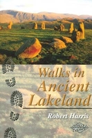
Walks In Ancient Lakeland

24 varied walks in and around the Lake District, visiting sites and monuments from the Neolithic and Bronze Ages, many following the ancient trackways which link them. Visit many largely unknown sites: explore and discover something about the lives of our ancestors who built these sites. Gain insight into the natural history of the area: birds, flowers and landsape that may have been just as familiar to our ancestors. Each walk is outlined in detail and is accompanied by graphic descriptions which help to recreate an image of the ancient landscape from remaining clues. Most of the walking is away from the most popular tourist areas of the Lake District. Excellent hand drawn sketches by the author accompany the text, making this an attractive as well as informative read.
RIP - This product is no longer available on our network. It was last seen on 25.09.2019

This page now acts as a permanent archive for this product. Add more information using the comments box below to ensure it can still be found by future generations.

Use our search facility to see if it is available from an alternative contributor.
  • External links may include paid for promotion
  • Availability: Out Of Stock
  • Supplier: Stanfords
  • SKU: 9781850587637
Availability: In Stock
£6.95

Product Description

24 varied walks in & around the Lake District, visiting sites & monuments from the Neolithic & Bronze Ages, many following the ancient trackways which link them. Visit many largely unknown sites: explore & discover something about the lives of our ancestors who built these sites. Gain insight into the natural history of the area: birds, flowers & landsape that may have been just as familiar to our ancestors. Each walk is outlined in detail & is accompanied by graphic descriptions which help to recreate an image of the ancient landscape from remaining clues. Most of the walking is away from the most popular tourist areas of the Lake District. Excellent hand drawn sketches by the author accompany the text, making this an attractive as well as informative read.

Reviews/Comments

Add New

Intelligent Comparison

Oooops!
We couldn't find anything!
Perhaps this product's unique.... Or perhaps we are still looking for comparisons!
Click to bump this page and we'll hurry up.

Price History

Vouchers

No voucher codes found.
Do you know a voucher code for this product or supplier? Add it to Insights for others to use.

Facebook

Jargon Buster

Hand - A part of the body at the end of the arm
Hand - A pointer which indicates time on a clock face
History - Anything that happens in the past. An acedemic subject.
Natural - not manmade
Popular - Something that is admired and liked by many people.

Supplier Information

Stanfords
Stanfords was established in 1853 and opened their iconic Covent Garden flagship store in 1901. They have become the top retailer of maps, travel books and accessories in the UK and arguably offer the largest selection of maps and travel books worldwide. Famous names such as Captain Robert Falcon Scott, Ranulph Fiennes and Michael Palin have purchased from Stanfords. They now have a shop in Bristol and both stores together with other venues operate a calendar of events including talks, book signings and exhibitions. As a specialist map retailer, the map selection is comprehensive and includes road maps, street maps and walking maps from worldwide destinations, as well as a selection of world atlases and wall maps. Books include travel guides and travel literature. Stanfords also stock globes, from miniatures made of blue marble to magnificent floor-standing globes. The website features a selection of interesting articles on travel topics.
Page Updated: 2023-11-12 20:15:36

Community Generated Product Tags

Oh No! The productWIKI community hasn't generated any tags for this product yet!
Menu