More From Contributor
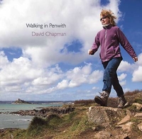
£12.99
Walking in Italy is a unique guide written for those who want to experience the delights of Italy’s finest towns cities & landscapes. The best way to appreciate Italy is undoubtedly on foot, whether you are visiting a city for the first time or venturing out into the Italian countryside. You don’t need to be an athlete to enjoy a well-informed stroll around Verona or even a two-day hike along the sparkling coastline of the Cinque Terre. This book helps you plan your journey & enjoy the best of Italy. It offers alternative walking tours in Rome, Florence, & Venice, suggests routes around such gems as Sienna & Perugia, & leads you into Italy’s most stunning landscapes & national parks. The day walks & two-day itineraries are designed with occasional walkers in mind & never take you too far from a comfortable hotel bed & a good meal. A lucid & lively text provides plenty of information & is accompanied by a collection of beautiful photographs & h&-drawn maps. ...
Archived Product
£12.95
Walking in Kent describes 40 circular day walks in the Garden of Engl&. This guidebook

Includes::
routes ranging

...
Archived Product
£12.95
This guidebook presents 25 varied walks exploring London`s green & open spaces. Covering both the city centre & the Greater London area, it takes in royal parks, heaths, forests, canals & rivers, including Epping Forest, Hampstead Heath, the World Heritage site of Kew Gardens & Wimbledon Common. Walks range from 4 to 14 miles & most can be accessed by public transport. Alongside detailed route descriptions & OS mapping, the book features practical information on parking, public transport & refreshments. Each walk showcases a particular species of wildlife that you might encounter, & there is fascinating background information the history & conservation of the capital`s wild spaces. London is a city of 8 million people & 8 million trees, & its vast open spaces are home to 13, 000 species of wildlife. This book is an ideal companion to exploring a greener, more gentle side to the city. ...
Archived Product
£12.95
This book describes 40 easy-to-moderate circular day walks, grouped by area: Northeast coast & the Broads; South Norfolk, the Yare & the Waveney; North Norfolk & coast; Central Norfolk & Breckland & West Norfolk & Fens. Each walk is described step-by-step, illustrated with 1:40K OS map extracts & packed with historical, geological & other information about the landscape the route passes through. The Fenland region of Norfolk`s far west is flat & low-lying, as are the marshes & waterways of the Broads in the east, but between these two extremes there is a great deal of topography going on. The county is far more varied than most outsiders imagine, with several distinct & unique landscapes. As well as Broads & the Fens, it has the sandy Brecks, rolling farml&, ancient woodl&, meandering rivers & the gorgeous North Norfolk coast with its beaches, shingle banks, salt marshes & tidal mud flats. ...
Archived Product
£12.95
The book comprises 36 short walking routes between 4 & 14 miles in Northumberl&, England`s most sparsely populated county. Ranging from easy ambles & gentle woodland trails to long days on the hills, there is something for all types of walker
- & all types of weather. Taking in the beautiful coast with its immense, empty beaches & dramatic crag-top castles to the remote hills of the Cheviots & Pennines, the whole county is covered. Most of the routes are circular, but there are a few linear walks that make use of local bus services. The landscapes are rich in history, featuring Hadrian`s Wall, Lindisfarne Priory, Bamburgh & Dunstanburgh castles, & much more. The walks are divided into five geographical areas: north-east Northumberl&, National Park (north), Kielder, Tyne Valley & National Park (south) & the North Pennines. Each walk description contains information on start/finish points, distance covered, total ascent, terrain, approximate walking time, grade, maps required, transport options, public toilets & refreshments, & is accompanied by 1:50k OS mapping. The book also

Includes::
a handy route summary table.


...
Archived Product
£16.95
Portugal is something of an undiscovered gem for hikers, offering beautiful, diverse landscapes & vast amounts of space. Thanks to its variety of micro-climates, it is possible to find pleasant walking conditions in all seasons, & the multitude of trails boast fantastic scenery & are rich in natural, historical & cultural interest. This guide describes 40 graded walks, ranging from gentle family strolls to strenuous mountain hikes (including Portugal`s highest peak) & multi-day routes. The walks are spread throughout Portugal, with a focus on the country`s many natural & national parks, including Peneda-Geres, Serra da Estrela & Costa Vicentina. Clear route description is illustrated with 1:50, 000 mapping & a route summary table makes it easy to choose the right walk. As well as practical travel advice, there is information on Portugal`s geology, history, plants, wildlife & agriculture & on numerous local points of interest. From the rugged mountains of the north to the UNESCO-listed Rio Douro river valley, from traditional schist villages to the unique geology of the Algarve coast, the walks have been carefully selected to showcase some of the best Portugal has to offer. They take in granite peaks, wildflower meadows, woodl&, waterfalls, castles, churches & archeological remains. With routes suitable for most ambitions & abilities, what further inspiration do you need to discover the myriad delights of this wonderful, yet frequently overlooked, destination? ...
Archived Product
£11.19
Walking in Scotland in the Walking Guide series from Lonely Planet; profiling in comprehensive detail the walking opportunities, from day walks to long distance hikes, available in a range of international destinations. Frank & informal in style, the guides introduce readers to a selection of walks in each country & are designed to be practical for use while travelling on the road. Each walk has been researched by a team of independent experts & is fully independent in its recommendations & suggestions, often offering individual takes on particular walks or treks. Widely recognised for their reliability, each Lonely Planet walking guide has the same layout, covering an extensive list of walks geographically by region. Introductory chapters provide facts about the country, including history, geography, geology & climate, as well as important facts for the walker such as suggested itineraries, when to walk, responsible walking, accommodation, food & drink, maps & weather information. There is also a dedicated clothing & equipment section, providing practical advice on what take, including relevant navigation equipment. A Health & safety section advises on pre-departure planning, staying healthy & safety on the walk or trek. Each guide is organised geographically by region, with further sub-regions also considered in each chapter. There is a selection of local stories, history & fact boxes about particular features of some of the routes throughout each guide. Each regional section gives general advice on relevant books & maps, climate, accommodation, places to eat & getting there & away. Individual walks or treks are described in extensive detail & fact boxes gives practical information on duration, distance, difficulty rating, start & finish points, the nearest town, local transport & a short summary of the route. Black & white sketch maps also provide an overview of the location of the walks in the region. A Travel Facts section at the back of each guide provides useful guidance & practical information on tourist offices, visas & documents, embassies, customs, money, post & communication, time, electricity, business hours, public holidays, getting there & away as well as getting around between each walk or trek. ...
Archived Product
£14.99
This guide

Features:
detailed descriptions of 57 great walks; precise two-colour maps for every walk; complete

...
Archived Product
£16.95
This guidebook presents 40 walks exploring the area around Briançon in France. The walks are divided into 6 sections covering the valleys of Clarée, Cerveyrette, Ayes, Durance & Guisane, as well as the area around Vallouise & Montgenèvre. The walks are circular & range in distance from 4 to 21 km. Graded easy to very hard, there is a walk to suit all abilities. Dominated on all sides by jagged peaks, & perched on a rocky spur at the nucleus of five beautiful valleys, the city of Briançon lies almost at the southernmost tip of the main Alpine range. The Briançonnais, the surrounding region to which it gives its name, is a stunning mountain wilderness packed with everything one would expect from a high alpine environment
- snow-capped peaks, green valleys & pastures filled with the sound of cow bells, sparkling alpine lakes, an abundance of wild flowers & a labyrinth of paths available to walkers. As well as maps & detailed route descriptions the guidebook provides advice on when to go, what to take & the best bases for exploring the region. There are detailed notes on wildlife & history & information on the many hill forts in the area.
...
Archived Product
£14.95
This guidebook contains over 100 routes for walking in the Scottish Cairngorms. It

Includes::
18 Munro summits

...
Archived Product

Walking In Penwith

David Chapman picks his favourite walks in his favourite area of Cornwall. These walks have been chosen to reflect the diverse nature of the district, so you will be taken to the most beautiful places as well as the most interesting ones. Plenty of information is given about the route of each walk, and the author shares his knowledge of the natural history that can be seen, as well as giving information about the history and geology along the way. The walks are varied in length; all offer suitable places to sit and relax over lunch, whether at an inn, a cafe, or simply a seat with a view! Each walk is given a rating for its beauty, level of difficulty, wildlife, historical interest and general interest. Distances, timings and parking places are detailed, so that you can make
appropriate choices. The walks are illustrated with David`s superb photographs, so not only will this book introduce you to new parts of Penwith, it will also be a souvenir of the walk.
RIP - This product is no longer available on our network. It was last seen on 25.09.2019

This page now acts as a permanent archive for this product. Add more information using the comments box below to ensure it can still be found by future generations.

Use our search facility to see if it is available from an alternative contributor.
  • External links may include paid for promotion
  • Availability: Out Of Stock
  • Supplier: Stanfords
  • SKU: 9780906720769
Availability: In Stock
£5.95

Product Description

David Chapman picks his favourite walks in his favourite area of Cornwall. These walks have been chosen to reflect the diverse nature of the district, so you will be taken to the most beautiful places as well as the most interesting ones. Plenty of information is given about the route of each walk, & the author shares his knowledge of the natural history that can be seen, as well as giving information about the history & geology along the way. The walks are varied in length; all offer suitable places to sit & relax over lunch, whether at an inn, a cafe, or simply a seat with a view! Each walk is given a rating for its beauty, level of difficulty, wildlife, historical interest & general interest. Distances, timings & parking places are detailed, so that you can make appropriate choices. The walks are illustrated with David`s superb photographs, so not only will this book introduce you to new parts of Penwith, it will also be a souvenir of the walk.

Reviews/Comments

Add New

Intelligent Comparison

Oooops!
We couldn't find anything!
Perhaps this product's unique.... Or perhaps we are still looking for comparisons!
Click to bump this page and we'll hurry up.

Price History

Vouchers

No voucher codes found.
Do you know a voucher code for this product or supplier? Add it to Insights for others to use.

Facebook

Jargon Buster

Lunch - A midday meal
History - Anything that happens in the past. An acedemic subject.
Natural - not manmade

Supplier Information

Stanfords
Stanfords was established in 1853 and opened their iconic Covent Garden flagship store in 1901. They have become the top retailer of maps, travel books and accessories in the UK and arguably offer the largest selection of maps and travel books worldwide. Famous names such as Captain Robert Falcon Scott, Ranulph Fiennes and Michael Palin have purchased from Stanfords. They now have a shop in Bristol and both stores together with other venues operate a calendar of events including talks, book signings and exhibitions. As a specialist map retailer, the map selection is comprehensive and includes road maps, street maps and walking maps from worldwide destinations, as well as a selection of world atlases and wall maps. Books include travel guides and travel literature. Stanfords also stock globes, from miniatures made of blue marble to magnificent floor-standing globes. The website features a selection of interesting articles on travel topics.
Page Updated: 2023-11-12 20:15:36

Community Generated Product Tags

Oh No! The productWIKI community hasn't generated any tags for this product yet!
Menu