More From Contributor
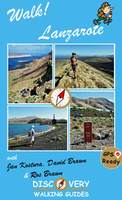
£45.00
Geoplan Postcode Sector maps provide high-detail local mapping of the UK overlaid with postcode sectors, country boundaries & larger postcode groupings. They are durable & laminated, so you can draw on them in non-permanent markers & wipe them clean. They are the market-leader postcode maps for marketing, statistical display, route-planning, strategy & many other business uses. The base map uses the latest Ordnance Survey Landranger cartography, which provides detailed geographic data including motorways, A & B roads, streets, & detailed feature types such as airports, railway stations, cities, towns, geographic names, heights (using contour lines), information centres, parking facilities & much more. The base map is light & subtle but clear, readable & now in colour. Postcode/county boundaries & labels are overlaid in a bold red. The Postcode system divides the UK into Areas, Districts & Sectors. Geoplan publish maps covering all of these levels. These Sector maps cover 37 small areas of the UK, showing postcode Sectors (like HG3 1, B10 9, WC2 9 etc), their larger Districts (HG3, B10, WC2 etc) & the even larger Areas (HG, B, WC etc) ...
Archived Product
£9.99
Originally stetching across the neck of England for over seventy miles, Hadrian`s Wall is the most important Roman monument in Britain. Set in a wild, dramatic landscape, it is now a World Heritage Site, one of the wonders of the world, & stands as a reminder of the past glories of a mighty civilisation. Hunter Davies grew up at one end of the wall & was inevitably drawn to walk its length. His charming, part history, part guidebook & part personal experience, portrays the area & its inhabitants as they are today, & gives readers a taste of what life was like in this remote part of Britain 2000 years ago. ...
Archived Product
£5.95
One of a series which offers walkers a practical tool to walking in Snowdonia
- clear directions, accurate linear measurements
...
Archived Product
£25.00
A unique illustrated guidebook to walking 40 of Britain & Ireland`s most important & impressive prehistoric monuments. Ranging from stone circles & henges to hillforts & burial chambers, Bill Bevan describes how these monuments were deliberately built & located to be seen & approached from certain directions. Processional routes led to ceremonies at stone circles, henges & tombs. Hillforts were built & designed to look imposing from specific directions to deter potential attackers. There are even ancient long-distance paths like the Ridgeway which are accessible today. The walks lead you back in time from the modern landscape to reconstruct in the mind`s eye what the prehistoric landscape would have looked like. The history & significance of each monument is discussed & generously illustrated with new colour photographs. For each walk there is a specially commisioned colour map & directions & there are also grid references, OS map recommendations & difficulty gradings, with family friendly walks highlighted. From Stonehenge to Skara Brae, from the imposing hillfort at Tre`r Ceiri to the Newgrange tomb illuminated by the midwinter sunrise, this book helps you to follow in the footsteps of the people who created Britain`s extraordinary ancient heritage. ...
Archived Product
£30.00
Following the acclaimed Walk Into Prehistory, Walk Into the Dark Ages explores Approx. 40 of Britain & Ireland`s most important & impressive Dark Ages sites & monuments, providing a beautifully illustrated guidebook for the armchair traveller. It was during the Dark Ages that the four nations of the British Isles were founded. Saints were deified, kings were buried in rich burials & kingdoms protected themselves with massive boundaries. Walk Into the Dark Ages will shine a light into the period by enabling readers to explore the important sites which are testament to times which were turbulent & sometimes enigmatic, but also the locations of learning. The types of sites featured will include the Saxon shore forts built by the Romans to try to protect Britannia from Anglo-Saxon invasions, kingly boat burials, long-distance dykes, fortified burghs, Dark Age forts, early Christian monasteries, churches & carved crosses. Presented as individual walks, the routes will lead the reader back in time from the modern landscape to reconstruct in the mind`s eye what the Dark Ages landscape would have looked like
- & how these often quite places today would have been full of activity, noises & smells in the past.
...
Archived Product
£6.00
Fifteen themed walks highlighting the best that London has to offer, from historic palaces & gardens to the pleasures of the famous River Thames & the landmarks around Docklands & the City. Original illustrated maps & essential information make this a perfect guide for visitors to the capital. This stunning guide takes in London`s famous landmarks & streets giving a description of each walk & information on historic sites & places of interest. The walks range from between 1 & 5.5 miles, & give the nearest train or Underground stations for the start & end of the walks, with a locator map indicating where stations are. ...
Archived Product
£20.99
On his seventieth birthday in 1909, a slim man with a shock of white hair, a walrus mustache, & a spring in his step faced west from Park Row in Manhattan & started walking. By the time Edward Payson Weston was finished, he was in San Francisco, having trekked 3, 895 miles in 104 days. Weston`s first epic walk across America transcended sport. He was ”everyman” in a stirring battle against the elements & exhaustion, tramping along at the pace of someone decades younger. Having long been America`s greatest pedestrian, he was attempting the most ambitious & physically taxing walk of his career. He walked most of the way alone when the car that he hired to follow him kept breaking down, & he often had to rest without adequate food or shelter. That Weston made it is one of the truly great but forgotten sports feats of all time. Thanks in large part to his daily dispatches of his travails--from blizzards to intense heat, rutted roads, bad shoes, & illness--Weston`s trek became a wonder of the ages & attracted international headlines to the sport called ”pedestrianism.” Aided by long-buried archival information, colorful biographical details, & Weston`s diary entries, Walk of Ages is more than a book about a man going for a walk. It is an epic tale of beating the odds & a penetrating look at a vanished time in America. ...
Archived Product
£5.95
Part of a series which offers walkers a practical tool to walking in Snowdonia
- clear directions, accurate linear measurements
...
Archived Product
£5.95
Snowdonia in North Wales hosts a spectacular mountain range where Everest climbers honed their skills before taking on the world's highest peaks. Described in this work is a mountain walking route over 20 Snowdonia summits, depicted by picture illustrations showing these mountains in winter snow. The works of Snowdonia's most famous bards are featured in this volume. ...
Archived Product
£8.99
A long-haired woman moves into the priest`s house & sets fire to his furniture. That Christmas, the electricity goes out. A forester mortgages his land & goes off to a seaside town looking for a wife. He finds a woman eating alone in the hotel. A farmer wakes half-naked & realises the money is almost gone. & in the title story, a priest waits on the altar for a bride & battles, all that wedding day, with his memories of a love affair. In her long-awaited second collection, Claire Keegan observes an Ireland wrestling with its past. ...
Archived Product

Walk Lanzarote

Lanzarote`s most popular walking guide book just got even better. Walk! Lanzarote 4th edition builds on the reputation of our earlier editions with more walks and comprehensive updating so that it caters for the needs of the increasing number of people who would like to combine some walking with a holiday on the Fire island. Walk Lanzarote explodes the myth that there is nowhere worth walking on the island as we range through strolling on coastal promenades, walking across alpine style meadows, striding over the lava sea, dropping into volcanoes, sitting on high mountain seats - quite simply you will be amazed at the wide variety of stunning landscapes the Fire island has to offer the adventurous leisure walker. New for the 4th edition; new extended coastal route from Arrieta to Los
Cocoteros to Costa Teguise, new Playa Blanca to Las Brenas to Yaiza on the GR131, which also updates our Yaiza to Las Brenas circular, newly revised Tabayesco circular, Montana Blanca and Montana Soo are circular adventures in new locations, revised Helechos Cirrcular now starting at Guinate, Yaiza - Uga Circular including a section of the GR131, El Golfo Circular in detail and available as a Timanfaya guided walk, Mirador del Rio, and the revised Corona`s Northern Tour. Walk Lanzarote`s forty one main walking routes provide a wide variety of adventures with routes ranging from family friendly costal promenades through a surprising range of landscapes up to some serious hiking. Every route is an adventure that will make you eager to explore further on this spectacular island. Walk
Lanzarote is produced to our highest standards with walk summary and rating, fully detailed description, frequent timings so you can check your progress, compass directions, and gps waypoints for all country routes. Each country route has full 1:40, 000 scale colour mapping and gps waypoints dedicated to that route, while our Teguise town walk uses a large scale street plan. All routes are illustrated with colour photos. Culture and agriculture are included along with a Thingy section on modern art. We`ve emphasised the Access by Bus sections for each walk along with our Access by Car information for each walking route. Map sections for each route are taken from the Lanzarote Tour & Trail Super-Durable Map 5th edition. For gps users the gps waypoint files are available as a free
downloadable zip file on the Discovery Walking Guides website. Quite simply the best book of Lanzarote that you can buy. If this is your first visit to Lanzarote then Walk! Lanzarote plus Lanzarote Tour & Trail Map will give you a series of adventures that will have you returning to the Fire island to experience more.
RIP - This product is no longer available on our network. It was last seen on 25.09.2019

This page now acts as a permanent archive for this product. Add more information using the comments box below to ensure it can still be found by future generations.

Use our search facility to see if it is available from an alternative contributor.
  • Availability: Out Of Stock
  • Supplier: Stanfords
  • SKU: 9781782750437
Availability: In Stock
£12.99

Product Description

Lanzarote`s most popular walking guide book just got even better. Walk! Lanzarote 4th edition builds on the reputation of our earlier editions with more walks & comprehensive updating so that it caters for the needs of the increasing number of people who would like to combine some walking with a holiday on the Fire isl&. Walk Lanzarote explodes the myth that there is nowhere worth walking on the island as we range through strolling on coastal promenades, walking across alpine style meadows, striding over the lava sea, dropping into volcanoes, sitting on high mountain seats
- quite simply you will be amazed at the wide variety of stunning landscapes the Fire island has to offer the adventurous leisure walker. New for the 4th edition; new extended coastal route from Arrieta to Los Cocoteros to Costa Teguise, new Playa Blanca to Las Brenas to Yaiza on the GR131, which also updates our Yaiza to Las Brenas circular, newly revised Tabayesco circular, Montana Blanca & Montana Soo are circular adventures in new locations, revised Helechos Cirrcular now starting at Guinate, Yaiza
- Uga Circular including a section of the GR131, El Golfo Circular in detail & available as a Timanfaya guided walk, Mirador del Rio, & the revised Corona`s Northern Tour. Walk Lanzarote`s forty one main walking routes provide a wide variety of adventures with routes ranging from family friendly costal promenades through a surprising range of landscapes up to some serious hiking. Every route is an adventure that will make you eager to explore further on this spectacular isl&. Walk Lanzarote is produced to our highest standards with walk summary & rating, fully detailed description, frequent timings so you can check your progress, compass directions, & gps waypoints for all country routes. Each country route has full 1:40, 000 scale colour mapping & gps waypoints dedicated to that route, while our Teguise town walk uses a large scale street plan. All routes are illustrated with colour photos. Culture & agriculture are included along with a Thingy section on modern art. We`ve emphasised the Access by Bus sections for each walk along with our Access by Car information for each walking route. Map sections for each route are taken from the Lanzarote Tour & Trail Super-Durable Map 5th edition. For gps users the gps waypoint files are available as a free downloadable zip file on the Discovery Walking Guides website. Quite simply the best book of Lanzarote that you can buy. If this is your first visit to Lanzarote then Walk! Lanzarote plus Lanzarote Tour & Trail Map will give you a series of adventures that will have you returning to the Fire island to experience more.

Reviews/Comments

Add New

Intelligent Comparison

Oooops!
We couldn't find anything!
Perhaps this product's unique.... Or perhaps we are still looking for comparisons!
Click to bump this page and we'll hurry up.

Price History

Vouchers

No voucher codes found.
Do you know a voucher code for this product or supplier? Add it to Insights for others to use.

Facebook

Jargon Buster

GPS - Global Positioning System - Global position using satellites
ZIP - A device (Usualy Metal) used for temporarily attaching two pieces of fabric together
Hiking - An outdoor activity envolving walking in nature
agriculture - The production of goods or food by farming.
Car - A machine used for transport which runs on roads
Colour - The categorised spectrum of light visable to humans
Fire - the release of energy through heat and light.
Large - something that takes up more space than normal.
Adventure - an undertaking of an exciting challenge or experience.
Zip - A Fastening which can open and close to get inside.
Spectacular - Something that catches that eye due to its eye catchingness.
Wide - Something with a large width.
Experience - To gain further knowledge by practising.
Popular - Something that is admired and liked by many people.
Family - A group of people that live together made up from parents and children.

Supplier Information

Stanfords
Stanfords was established in 1853 and opened their iconic Covent Garden flagship store in 1901. They have become the top retailer of maps, travel books and accessories in the UK and arguably offer the largest selection of maps and travel books worldwide. Famous names such as Captain Robert Falcon Scott, Ranulph Fiennes and Michael Palin have purchased from Stanfords. They now have a shop in Bristol and both stores together with other venues operate a calendar of events including talks, book signings and exhibitions. As a specialist map retailer, the map selection is comprehensive and includes road maps, street maps and walking maps from worldwide destinations, as well as a selection of world atlases and wall maps. Books include travel guides and travel literature. Stanfords also stock globes, from miniatures made of blue marble to magnificent floor-standing globes. The website features a selection of interesting articles on travel topics.
Page Updated: 2023-11-12 20:15:36

Community Generated Product Tags

Oh No! The productWIKI community hasn't generated any tags for this product yet!
Menu